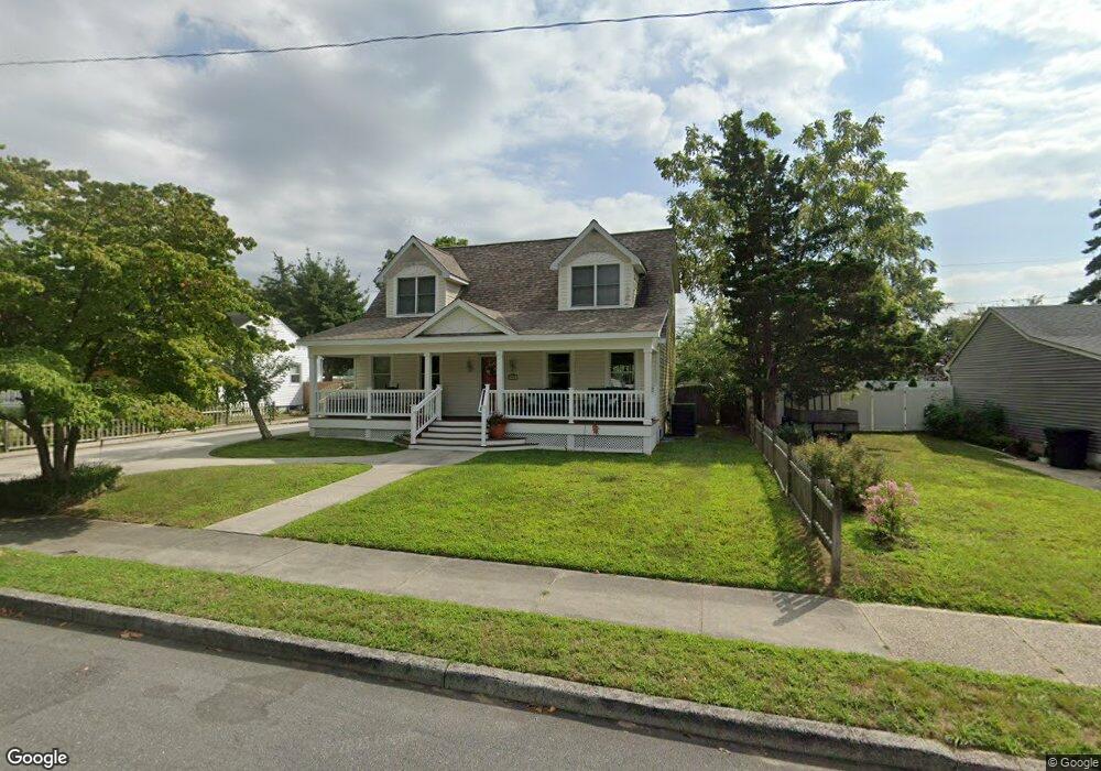
208 W Dawes Ave Somers Point, NJ 08244
Estimated Value: $408,920 - $544,000
--
Bed
--
Bath
1,728
Sq Ft
$276/Sq Ft
Est. Value
About This Home
This home is located at 208 W Dawes Ave, Somers Point, NJ 08244 and is currently estimated at $477,480, approximately $276 per square foot. 208 W Dawes Ave is a home located in Atlantic County with nearby schools including Mainland Regional High School, ChARTer TECH High School for the Performing Arts, and Gospel of Grace Christian School.
Ownership History
Date
Name
Owned For
Owner Type
Purchase Details
Closed on
Jun 20, 1998
Sold by
Shaffer Brian L and Shaffer Marilou H
Bought by
Atack Jan S
Current Estimated Value
Home Financials for this Owner
Home Financials are based on the most recent Mortgage that was taken out on this home.
Original Mortgage
$116,000
Outstanding Balance
$23,085
Interest Rate
6.99%
Estimated Equity
$454,395
Purchase Details
Closed on
Nov 9, 1992
Sold by
Faires Florence
Bought by
Shaffer Brian L and Shaffer Marilou N
Create a Home Valuation Report for This Property
The Home Valuation Report is an in-depth analysis detailing your home's value as well as a comparison with similar homes in the area
Home Values in the Area
Average Home Value in this Area
Purchase History
| Date | Buyer | Sale Price | Title Company |
|---|---|---|---|
| Atack Jan S | $145,000 | The Title Company | |
| Shaffer Brian L | $40,000 | -- |
Source: Public Records
Mortgage History
| Date | Status | Borrower | Loan Amount |
|---|---|---|---|
| Open | Atack Jan S | $116,000 |
Source: Public Records
Tax History Compared to Growth
Tax History
| Year | Tax Paid | Tax Assessment Tax Assessment Total Assessment is a certain percentage of the fair market value that is determined by local assessors to be the total taxable value of land and additions on the property. | Land | Improvement |
|---|---|---|---|---|
| 2025 | $7,474 | $209,000 | $67,600 | $141,400 |
| 2024 | $7,474 | $209,000 | $67,600 | $141,400 |
| 2023 | $6,983 | $209,000 | $67,600 | $141,400 |
| 2022 | $6,983 | $209,000 | $67,600 | $141,400 |
| 2021 | $6,878 | $209,000 | $67,600 | $141,400 |
| 2020 | $6,738 | $209,000 | $67,600 | $141,400 |
| 2019 | $6,548 | $209,000 | $67,600 | $141,400 |
| 2018 | $6,824 | $222,500 | $67,600 | $154,900 |
| 2017 | $6,579 | $222,500 | $67,600 | $154,900 |
| 2016 | $6,281 | $222,500 | $67,600 | $154,900 |
| 2015 | $6,217 | $222,500 | $67,600 | $154,900 |
| 2014 | $6,008 | $222,500 | $67,600 | $154,900 |
Source: Public Records
Map
Nearby Homes
- 226 Bethel Rd
- 1102 Jesse Dr
- 2102 Angelina Ln
- 223 W Wilmont Ave
- 116 W Ocean Ave
- 98 New Rd
- 137 W Johnson Ave
- 33 W Meyran Ave
- 301 Bliss Ave
- 206 Philadelphia Ave
- 6 Abbey Rd
- 25 W Pierson Ave
- 25 Shore Rd
- 11 Shore Rd Unit 7D
- 29 E Pierson Ave
- 421 Shore Rd
- 2 Shore Rd
- 14 Edgewood Dr
- 112 E Pierson Ave
- 101 E Johnson Ave
- 202 W Dawes Ave
- 212 W Dawes Ave
- 215 Doran Ave
- 502 Montgomery Ave
- 217 Doran Ave
- 216 W Dawes Ave
- 215 W Dawes Ave
- 201 W Dawes Ave
- 156 W Dawes Ave
- 217 W Dawes Ave
- 221 Doran Ave
- 503 Montgomery Ave
- 230 Bethel Rd
- 219 W Dawes Ave
- 157 W Dawes Ave
- 150 W Dawes Ave
- 204 W Meyran Ave
- 212 W Meyran Ave
- 137 Doran Ave
- 221 W Dawes Ave