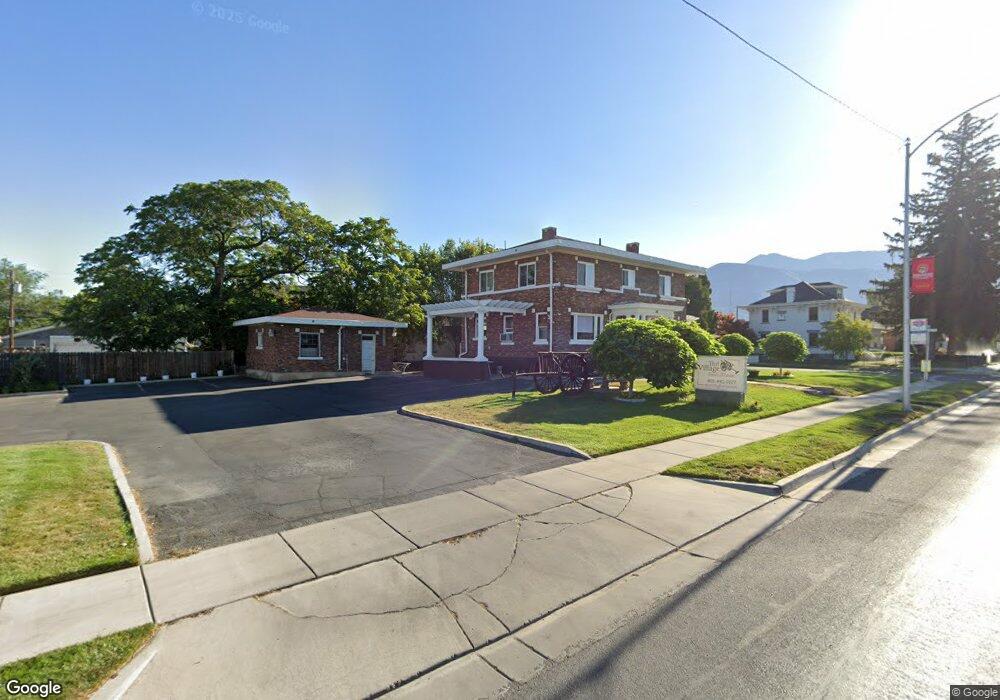
208 W Main St American Fork, UT 84003
7
Beds
2
Baths
3,333
Sq Ft
0.35
Acres
About This Home
This home is located at 208 W Main St, American Fork, UT 84003. 208 W Main St is a home located in Utah County with nearby schools including American Fork Junior High School, American Fork High School, and Athenian eAcademy.
Ownership History
Date
Name
Owned For
Owner Type
Purchase Details
Closed on
Nov 25, 2015
Sold by
Vannarath Dao
Bought by
Access Title Co
Purchase Details
Closed on
Dec 17, 2003
Sold by
Doty Daniel Edward
Bought by
Vannarath Dao
Home Financials for this Owner
Home Financials are based on the most recent Mortgage that was taken out on this home.
Original Mortgage
$170,000
Interest Rate
6.03%
Mortgage Type
Seller Take Back
Create a Home Valuation Report for This Property
The Home Valuation Report is an in-depth analysis detailing your home's value as well as a comparison with similar homes in the area
Home Values in the Area
Average Home Value in this Area
Purchase History
| Date | Buyer | Sale Price | Title Company |
|---|---|---|---|
| Access Title Co | -- | Access Title Co | |
| Vannarath Dao | -- | Timp Title Insurance Agency |
Source: Public Records
Mortgage History
| Date | Status | Borrower | Loan Amount |
|---|---|---|---|
| Previous Owner | Vannarath Dao | $170,000 |
Source: Public Records
Tax History Compared to Growth
Tax History
| Year | Tax Paid | Tax Assessment Tax Assessment Total Assessment is a certain percentage of the fair market value that is determined by local assessors to be the total taxable value of land and additions on the property. | Land | Improvement |
|---|---|---|---|---|
| 2025 | $5,471 | $693,900 | $466,800 | $227,100 |
| 2024 | $5,471 | $607,900 | $0 | $0 |
| 2023 | $5,058 | $587,700 | $0 | $0 |
| 2022 | $5,058 | $588,000 | $352,900 | $235,100 |
| 2021 | $3,826 | $409,900 | $240,300 | $169,600 |
| 2020 | $3,945 | $409,900 | $240,300 | $169,600 |
| 2019 | $3,626 | $388,500 | $218,000 | $170,500 |
| 2018 | $3,285 | $354,600 | $207,600 | $147,000 |
| 2017 | $3,168 | $297,800 | $0 | $0 |
| 2016 | $3,410 | $297,800 | $0 | $0 |
| 2015 | $3,501 | $290,135 | $0 | $0 |
| 2014 | $3,457 | $282,580 | $0 | $0 |
Source: Public Records
Map
Nearby Homes
- 55 S 200 W
- 129 W Pacific Dr
- 105 N 100 W
- 351 Washington Ave
- 120 N 350 W Unit 127
- 120 N 350 W Unit 133
- 120 N 350 W Unit 130
- 82 S Lincoln Ave
- 217 W Main St
- 55 Roosevelt Ave
- 370 W Pacific Dr Unit 1
- 271 S Barratt Cir
- 399 W Pacific Dr
- 195 S Center St
- 148 N 100 E
- 382 W 330 S
- 365 N 100 W
- 368 S Storrs Ct Unit 107
- 161 N Grant Ave
- 146 N Grant Ave