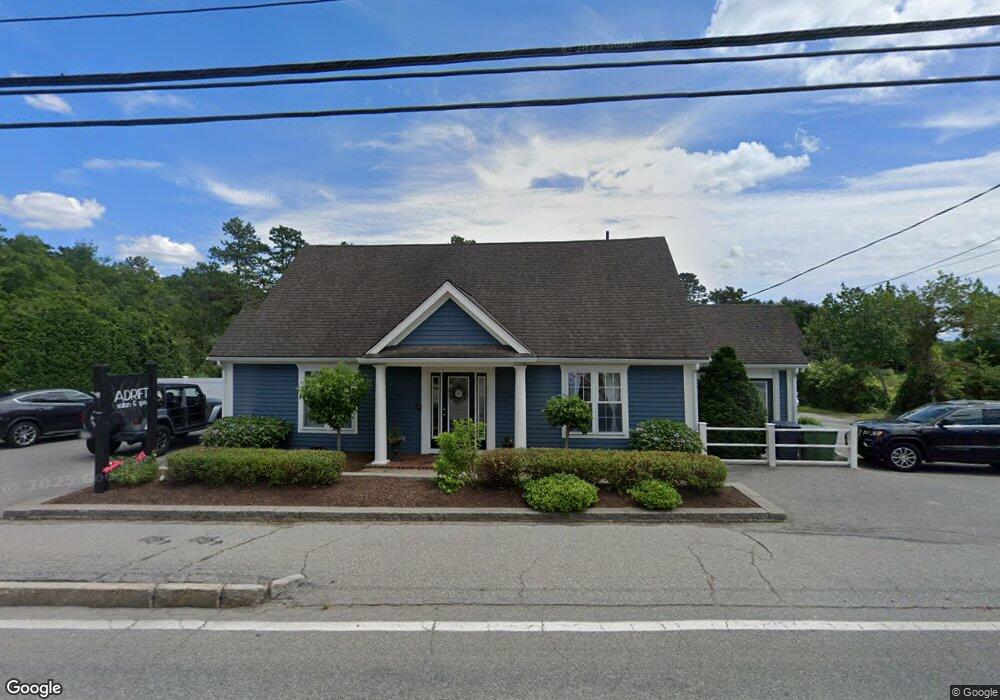
208 Wareham Rd Marion, MA 02738
Estimated Value: $578,342
2
Beds
1
Bath
2,776
Sq Ft
$208/Sq Ft
Est. Value
About This Home
This home is located at 208 Wareham Rd, Marion, MA 02738 and is currently estimated at $578,342, approximately $208 per square foot. 208 Wareham Rd is a home located in Plymouth County with nearby schools including Old Rochester Regional High School and Tabor Academy.
Ownership History
Date
Name
Owned For
Owner Type
Purchase Details
Closed on
Jun 2, 2011
Sold by
Real Investments Llc
Bought by
Quinlan Group Llc
Current Estimated Value
Home Financials for this Owner
Home Financials are based on the most recent Mortgage that was taken out on this home.
Original Mortgage
$192,000
Outstanding Balance
$132,772
Interest Rate
4.85%
Mortgage Type
Commercial
Estimated Equity
$445,570
Purchase Details
Closed on
Feb 26, 2010
Sold by
Dawson Christopher W and Andresen James K
Bought by
Rl Investment Llc
Purchase Details
Closed on
Jun 15, 2006
Sold by
Sylvia Daniel
Bought by
Dawson Christopher W and Andresen James K
Purchase Details
Closed on
Apr 10, 1998
Sold by
Beacon Hill Mtg Corp
Bought by
Sylvia Daniel
Create a Home Valuation Report for This Property
The Home Valuation Report is an in-depth analysis detailing your home's value as well as a comparison with similar homes in the area
Purchase History
| Date | Buyer | Sale Price | Title Company |
|---|---|---|---|
| Quinlan Group Llc | $240,000 | -- | |
| Quinlan Group Llc | $240,000 | -- | |
| Rl Investment Llc | $170,000 | -- | |
| Rl Investment Llc | $170,000 | -- | |
| Dawson Christopher W | $440,000 | -- | |
| Dawson Christopher W | $440,000 | -- | |
| Sylvia Daniel | $75,000 | -- | |
| Sylvia Daniel | $75,000 | -- |
Source: Public Records
Mortgage History
| Date | Status | Borrower | Loan Amount |
|---|---|---|---|
| Open | Quinlan Group Llc | $192,000 | |
| Closed | Sylvia Daniel | $192,000 | |
| Previous Owner | Sylvia Daniel | $170,000 |
Source: Public Records
Tax History
| Year | Tax Paid | Tax Assessment Tax Assessment Total Assessment is a certain percentage of the fair market value that is determined by local assessors to be the total taxable value of land and additions on the property. | Land | Improvement |
|---|---|---|---|---|
| 2025 | $3,487 | $374,100 | $127,600 | $246,500 |
| 2024 | $3,464 | $374,100 | $127,600 | $246,500 |
| 2023 | $2,877 | $304,800 | $103,500 | $201,300 |
| 2022 | $2,966 | $273,400 | $57,200 | $216,200 |
| 2021 | $3,155 | $278,700 | $57,200 | $221,500 |
| 2020 | $3,261 | $278,700 | $57,200 | $221,500 |
| 2019 | $3,085 | $279,700 | $57,200 | $222,500 |
| 2018 | $2,996 | $261,700 | $56,100 | $205,600 |
| 2017 | $2,986 | $261,700 | $56,100 | $205,600 |
| 2016 | $2,703 | $239,000 | $56,100 | $182,900 |
| 2015 | $2,655 | $239,000 | $56,100 | $182,900 |
Source: Public Records
Map
Nearby Homes
- 245 Wareham Rd
- 4 Blackhall Ct
- 929 Point Rd
- 5 Hermitage Rd
- 119 County Rd
- 143 Cross Neck Rd
- 127 County Rd
- 13 Fieldstone Ln
- 17 Fieldstone Ln
- 2 Quelle Ln
- 12 Taft St
- 4 Roosevelt St
- 14 Briarwood Dr
- 0 Cross Neck Rd Unit 73420524
- 0 Cross Neck Rd Unit 73466177
- 0 Cross Neck Rd Unit 73420525
- 0 Cromesett Rd (Off) Unit 73385395
- 13 Cottage St
- 25 Main St Unit 3
- 16 Vine St
- 207 Wareham Rd
- 211 Wareham Rd
- 203 Wareham Rd
- 201 Wareham Rd
- 209 Wareham Rd
- 230 Wareham Rd
- 221 Wareham Rd
- 221 Wareham Rd
- 229 Wareham Rd
- 186 Wareham Rd
- 185 Wareham Rd
- 184 Wareham Rd
- 238 Wareham Rd
- 238 Wareham Rd Unit 4C
- 238 Wareham Rd Unit c4
- 238 Wareham Rd Unit 4
- 182 Wareham Rd
- 239 Wareham Rd
- 180 Wareham Rd
- 240 Wareham Rd
Your Personal Tour Guide
Ask me questions while you tour the home.