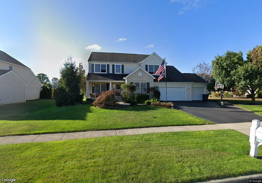
2080 Ashcreek Ave Lewis Center, OH 43035
Orange NeighborhoodEstimated Value: $538,000 - $589,000
4
Beds
3
Baths
2,664
Sq Ft
$212/Sq Ft
Est. Value
About This Home
This home is located at 2080 Ashcreek Ave, Lewis Center, OH 43035 and is currently estimated at $564,874, approximately $212 per square foot. 2080 Ashcreek Ave is a home located in Delaware County with nearby schools including Glen Oak Elementary School, Olentangy Shanahan Middle School, and Olentangy High School.
Ownership History
Date
Name
Owned For
Owner Type
Purchase Details
Closed on
Apr 30, 2021
Sold by
Pasco Kelly M and Pasco Anthony
Bought by
Pasco Kelly M and Pasco Anthony
Current Estimated Value
Home Financials for this Owner
Home Financials are based on the most recent Mortgage that was taken out on this home.
Original Mortgage
$329,500
Interest Rate
3%
Mortgage Type
New Conventional
Purchase Details
Closed on
Aug 19, 2011
Sold by
Funk Rober W
Bought by
Funk Kelly M
Purchase Details
Closed on
Nov 7, 2003
Sold by
Dominion Homes Inc
Bought by
Funk Robert W and Funk Kelly M
Home Financials for this Owner
Home Financials are based on the most recent Mortgage that was taken out on this home.
Original Mortgage
$278,800
Interest Rate
6.01%
Mortgage Type
Purchase Money Mortgage
Create a Home Valuation Report for This Property
The Home Valuation Report is an in-depth analysis detailing your home's value as well as a comparison with similar homes in the area
Home Values in the Area
Average Home Value in this Area
Purchase History
| Date | Buyer | Sale Price | Title Company |
|---|---|---|---|
| Pasco Kelly M | -- | None Available | |
| Funk Kelly M | -- | None Available | |
| Funk Robert W | $293,600 | Multiple |
Source: Public Records
Mortgage History
| Date | Status | Borrower | Loan Amount |
|---|---|---|---|
| Closed | Pasco Kelly M | $329,500 | |
| Closed | Funk Robert W | $278,800 |
Source: Public Records
Tax History Compared to Growth
Tax History
| Year | Tax Paid | Tax Assessment Tax Assessment Total Assessment is a certain percentage of the fair market value that is determined by local assessors to be the total taxable value of land and additions on the property. | Land | Improvement |
|---|---|---|---|---|
| 2024 | $8,425 | $152,110 | $31,150 | $120,960 |
| 2023 | $8,456 | $152,110 | $31,150 | $120,960 |
| 2022 | $7,571 | $110,710 | $21,000 | $89,710 |
| 2021 | $7,772 | $110,710 | $21,000 | $89,710 |
| 2020 | $7,810 | $110,710 | $21,000 | $89,710 |
| 2019 | $6,802 | $99,680 | $21,000 | $78,680 |
| 2018 | $6,833 | $99,680 | $21,000 | $78,680 |
| 2017 | $6,765 | $97,480 | $16,980 | $80,500 |
| 2016 | $7,118 | $97,480 | $16,980 | $80,500 |
| 2015 | $6,516 | $97,480 | $16,980 | $80,500 |
| 2014 | $6,608 | $97,480 | $20,510 | $76,970 |
| 2013 | $6,760 | $97,480 | $20,510 | $76,970 |
Source: Public Records
Map
Nearby Homes
- 1915 Myrtle St
- 1811 Ivy St
- 6566 Morningside Dr
- 1929 Rocklake Ct
- 1654 Sunflower St
- 2515 Coltsbridge Dr
- 6440 Morningside Dr
- 2567 Carmel Dr
- 0 E Orange Rd
- 2840 Waukeegan Ave
- 2771 Abbey Knoll Dr
- 2070 Alum Village Dr
- 7787 Holderman St
- 3177 Shoreline Dr
- 7698 Gladshire Blvd
- 2868 Lewis Center Rd
- 8101 Orange Station Loop
- 1258 Ashlar Ln Unit LOT 30007
- 2946 Lewis Center Rd
- 1229 Fairstone Dr Unit LOT 30030
- 2098 Ashcreek Ave
- 6824 Snapdragon Way
- 6841 Snapdragon Way
- 6706 Blue Holly Dr
- 2118 Ashcreek Ave
- 6690 Blue Holly Dr
- 6859 Snapdragon Way
- 2059 Ashcreek Ave
- 2079 Ashcreek Ave
- 6672 Blue Holly Dr
- 2101 Ashcreek Ave
- 2138 Ashcreek Ave
- 2121 Ashcreek Ave
- 6751 Snapdragon Way
- 6656 Blue Holly Dr
- 2139 Ashcreek Ave
- 2156 Ashcreek Ave
- 6709 Blue Holly Dr
- 6788 Greenspire Dr
- 6691 Blue Holly Dr