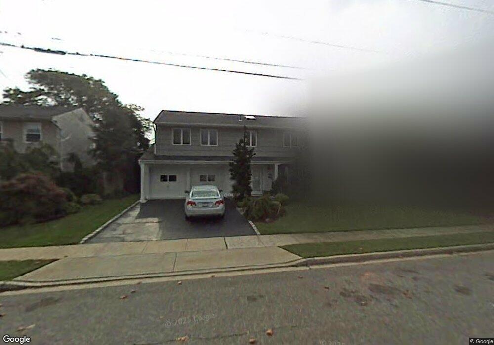
2080 Berkley Ln Merrick, NY 11566
Estimated Value: $1,154,163 - $1,229,000
4
Beds
3
Baths
2,746
Sq Ft
$434/Sq Ft
Est. Value
About This Home
This home is located at 2080 Berkley Ln, Merrick, NY 11566 and is currently estimated at $1,191,582, approximately $433 per square foot. 2080 Berkley Ln is a home located in Nassau County with nearby schools including Burcham Elementary School, Merrick Avenue Middle School, and John F. Kennedy High School.
Ownership History
Date
Name
Owned For
Owner Type
Purchase Details
Closed on
Sep 30, 2014
Sold by
Cohen Frida
Bought by
Prussack Andrew and Prussack Haley
Current Estimated Value
Home Financials for this Owner
Home Financials are based on the most recent Mortgage that was taken out on this home.
Original Mortgage
$536,000
Outstanding Balance
$410,771
Interest Rate
4.09%
Mortgage Type
New Conventional
Estimated Equity
$780,811
Purchase Details
Closed on
Jan 15, 1996
Sold by
Cohen Jacob and Cohen Frida
Bought by
Cohen Frida
Create a Home Valuation Report for This Property
The Home Valuation Report is an in-depth analysis detailing your home's value as well as a comparison with similar homes in the area
Home Values in the Area
Average Home Value in this Area
Purchase History
| Date | Buyer | Sale Price | Title Company |
|---|---|---|---|
| Prussack Andrew | $670,000 | None Available | |
| Cohen Frida | -- | -- |
Source: Public Records
Mortgage History
| Date | Status | Borrower | Loan Amount |
|---|---|---|---|
| Open | Prussack Andrew | $536,000 |
Source: Public Records
Tax History Compared to Growth
Tax History
| Year | Tax Paid | Tax Assessment Tax Assessment Total Assessment is a certain percentage of the fair market value that is determined by local assessors to be the total taxable value of land and additions on the property. | Land | Improvement |
|---|---|---|---|---|
| 2025 | $21,733 | $752 | $263 | $489 |
| 2024 | $5,239 | $763 | $266 | $497 |
| 2023 | $19,277 | $772 | $270 | $502 |
| 2022 | $19,277 | $816 | $285 | $531 |
| 2021 | $27,611 | $784 | $274 | $510 |
| 2020 | $18,741 | $955 | $585 | $370 |
| 2019 | $16,682 | $955 | $585 | $370 |
| 2018 | $15,578 | $955 | $0 | $0 |
| 2017 | $9,056 | $911 | $446 | $465 |
| 2016 | $12,955 | $911 | $421 | $490 |
| 2015 | $4,441 | $1,195 | $553 | $642 |
| 2014 | $4,441 | $1,195 | $553 | $642 |
| 2013 | $4,450 | $1,265 | $585 | $680 |
Source: Public Records
Map
Nearby Homes