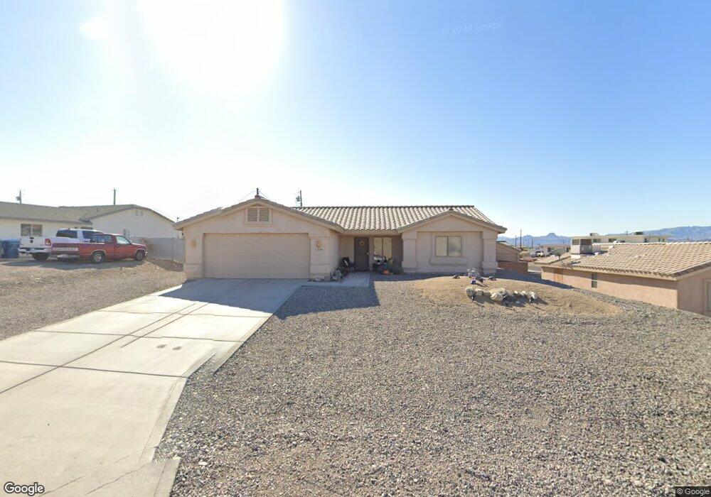
2080 Chaparral Dr Lake Havasu City, AZ 86403
Estimated Value: $522,000 - $590,000
--
Bed
1
Bath
2,119
Sq Ft
$260/Sq Ft
Est. Value
About This Home
This home is located at 2080 Chaparral Dr, Lake Havasu City, AZ 86403 and is currently estimated at $550,518, approximately $259 per square foot. 2080 Chaparral Dr is a home located in Mohave County with nearby schools including Havasupai Elementary School, Thunderbolt Middle School, and Lake Havasu High School.
Ownership History
Date
Name
Owned For
Owner Type
Purchase Details
Closed on
Nov 15, 2022
Sold by
Ling William A and Ling Ann Marie
Bought by
Smith Alfred and Smith Judith A
Current Estimated Value
Home Financials for this Owner
Home Financials are based on the most recent Mortgage that was taken out on this home.
Original Mortgage
$535,000
Outstanding Balance
$518,319
Interest Rate
6.92%
Mortgage Type
Seller Take Back
Estimated Equity
$32,199
Purchase Details
Closed on
Sep 21, 2000
Sold by
Kalmich Sol I and Kalmich Helen S
Bought by
Ling William A and Garcia Ling Ann Marie
Create a Home Valuation Report for This Property
The Home Valuation Report is an in-depth analysis detailing your home's value as well as a comparison with similar homes in the area
Home Values in the Area
Average Home Value in this Area
Purchase History
| Date | Buyer | Sale Price | Title Company |
|---|---|---|---|
| Smith Alfred | $550,000 | Pioneer Title | |
| Ling William A | $3,800 | First American Title |
Source: Public Records
Mortgage History
| Date | Status | Borrower | Loan Amount |
|---|---|---|---|
| Open | Smith Alfred | $535,000 |
Source: Public Records
Tax History Compared to Growth
Tax History
| Year | Tax Paid | Tax Assessment Tax Assessment Total Assessment is a certain percentage of the fair market value that is determined by local assessors to be the total taxable value of land and additions on the property. | Land | Improvement |
|---|---|---|---|---|
| 2026 | -- | -- | -- | -- |
| 2025 | $1,575 | $43,398 | $0 | $0 |
| 2024 | $1,575 | $48,412 | $0 | $0 |
| 2023 | $1,575 | $42,357 | $0 | $0 |
| 2022 | $1,860 | $30,209 | $0 | $0 |
| 2021 | $2,037 | $27,450 | $0 | $0 |
| 2019 | $1,934 | $24,093 | $0 | $0 |
| 2018 | $1,868 | $22,113 | $0 | $0 |
| 2017 | $1,850 | $21,053 | $0 | $0 |
| 2016 | $1,674 | $19,641 | $0 | $0 |
| 2015 | $1,603 | $17,037 | $0 | $0 |
Source: Public Records
Map
Nearby Homes
- 2100 Chaparral Dr
- 2090 San Juan Dr
- 2030 Commander Dr
- 1911 Holly Ave
- 1901 Holly Ave
- 1541 Holly Ave
- 2021 Industrial
- 1986 Bahama Ave
- 2091 Holly Ave
- 2257 Barranca Dr
- 2301 Sahara Dr
- 2162 Runabout Dr
- 1960 Pirate Ln
- 2200 Clarke Dr
- 640 Acoma Blvd N
- 2183 Runabout Dr
- 2285 Pennant Ln
- 2264 Barranca Dr
- 2272 Barranca Dr
- 2050 Kiowa Blvd N
- 2091 Sahara Dr
- 2091 Sahara Dr
- 2090 Chaparral Dr
- 2111 Sahara Dr
- 2070 Chaparral Dr
- 2089 Chaparral Dr
- 2097 Chaparral Ct
- 2097 Chaparral Dr
- 2097 Chaparral Dr
- 2040 Sahara
- 2121 Sahara Dr
- 2110 Chaparral Dr
- 2105 Chaparral Dr
- 2073 Chaparral Ct
- 2131 Sahara Dr
- 2070 Sahara Dr
- 2070 Sahara Dr Unit 1
- 2070 Sahara Dr Unit 3
- 2070 Sahara Dr Unit 4
- 2113 Chaparral Dr