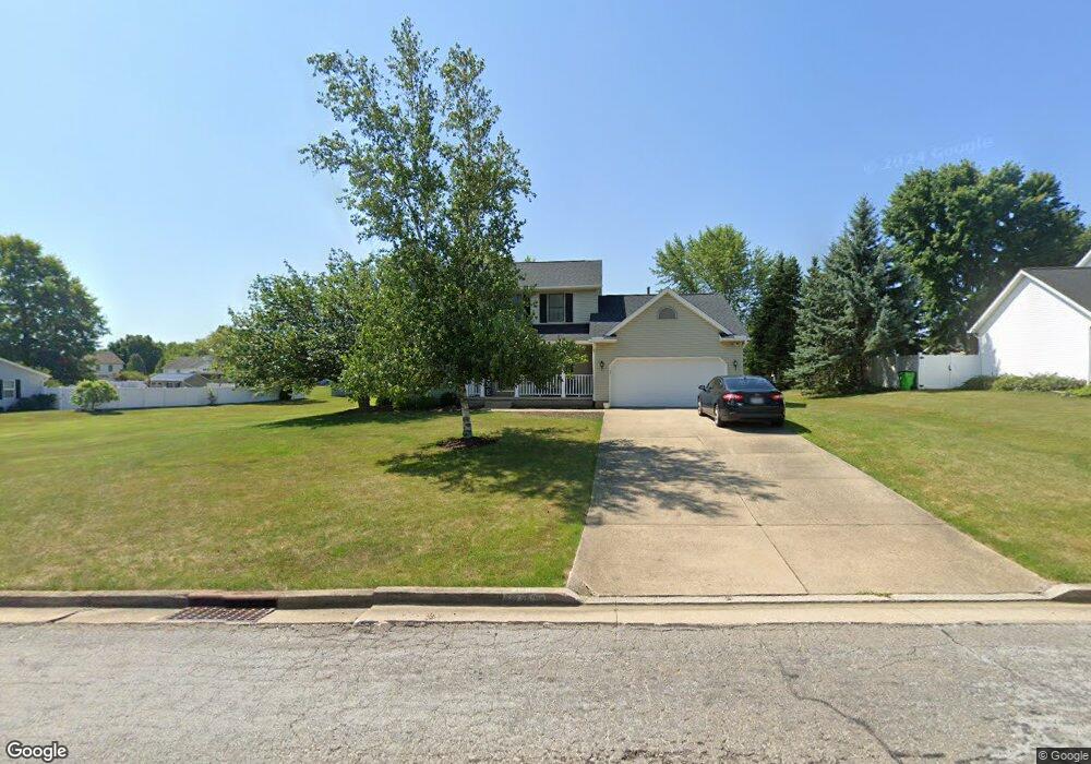
2080 Crestwood St Alliance, OH 44601
Estimated Value: $295,663 - $340,000
3
Beds
3
Baths
1,752
Sq Ft
$183/Sq Ft
Est. Value
About This Home
This home is located at 2080 Crestwood St, Alliance, OH 44601 and is currently estimated at $320,166, approximately $182 per square foot. 2080 Crestwood St is a home located in Stark County with nearby schools including Marlington High School and Regina Coeli/St Joseph School.
Ownership History
Date
Name
Owned For
Owner Type
Purchase Details
Closed on
Jun 6, 2017
Sold by
Redd Thomas J and Redd Melissa M
Bought by
Miller Kyle L and Miller Chelsea D
Current Estimated Value
Home Financials for this Owner
Home Financials are based on the most recent Mortgage that was taken out on this home.
Original Mortgage
$170,000
Outstanding Balance
$137,277
Interest Rate
3%
Mortgage Type
Adjustable Rate Mortgage/ARM
Estimated Equity
$182,889
Purchase Details
Closed on
May 28, 2004
Sold by
Johnson James E and Johnson Nanette L
Bought by
Redd Thomas J and Redd Melissa M
Home Financials for this Owner
Home Financials are based on the most recent Mortgage that was taken out on this home.
Original Mortgage
$145,000
Interest Rate
5.99%
Mortgage Type
Credit Line Revolving
Purchase Details
Closed on
Mar 25, 1996
Sold by
Westwood Properties
Bought by
Johnson James E and Johnson Nanette
Home Financials for this Owner
Home Financials are based on the most recent Mortgage that was taken out on this home.
Original Mortgage
$106,384
Interest Rate
7.06%
Mortgage Type
New Conventional
Create a Home Valuation Report for This Property
The Home Valuation Report is an in-depth analysis detailing your home's value as well as a comparison with similar homes in the area
Home Values in the Area
Average Home Value in this Area
Purchase History
| Date | Buyer | Sale Price | Title Company |
|---|---|---|---|
| Miller Kyle L | $182,000 | None Available | |
| Redd Thomas J | $165,000 | -- | |
| Johnson James E | $19,500 | -- |
Source: Public Records
Mortgage History
| Date | Status | Borrower | Loan Amount |
|---|---|---|---|
| Open | Miller Kyle L | $170,000 | |
| Previous Owner | Redd Thomas J | $145,000 | |
| Previous Owner | Johnson James E | $106,384 |
Source: Public Records
Tax History Compared to Growth
Tax History
| Year | Tax Paid | Tax Assessment Tax Assessment Total Assessment is a certain percentage of the fair market value that is determined by local assessors to be the total taxable value of land and additions on the property. | Land | Improvement |
|---|---|---|---|---|
| 2025 | -- | $92,050 | $21,490 | $70,560 |
| 2024 | -- | $92,050 | $21,490 | $70,560 |
| 2023 | $2,254 | $72,840 | $16,380 | $56,460 |
| 2022 | $2,262 | $72,840 | $16,380 | $56,460 |
| 2021 | $2,270 | $72,840 | $16,380 | $56,460 |
| 2020 | $2,180 | $64,090 | $14,210 | $49,880 |
| 2019 | $2,215 | $64,090 | $14,210 | $49,880 |
| 2018 | $2,218 | $64,090 | $14,210 | $49,880 |
| 2017 | $1,911 | $55,620 | $11,410 | $44,210 |
| 2016 | $1,700 | $49,460 | $11,410 | $38,050 |
| 2015 | $1,704 | $49,460 | $11,410 | $38,050 |
| 2014 | $1,782 | $47,390 | $10,920 | $36,470 |
| 2013 | $892 | $47,390 | $10,920 | $36,470 |
Source: Public Records
Map
Nearby Homes
- 2081 Marwood Cir
- 1430 Westwood Ave
- 0 S Sawburg Ave Unit 5113457
- 2371 Ansley St Unit 2371
- 2377 Ansley St Unit 2377
- 8630 Schubert Ave NE
- 2050 Federal Ave
- 1201 Overlook Dr
- 0 W Main St Unit 5090123
- 2220 Western Ave
- 2112 Blenheim Ave
- 0 Easton St NE
- 2851 Patriots Path Unit 3D
- 2435 Queensbury Rd
- 970 Kingsway St
- 1321 Parkway Blvd
- 13061 Beeson St NE
- 884 W College Rd
- 1059 Oakwood Dr
- 896 Parkway Blvd
- 2090 Crestwood St
- 2116 Crestwood St
- 2060 Crestwood St
- 2091 Marwood Cir
- 2071 Marwood Cir
- 2081 Crestwood St
- 2105 Marwood Cir
- 2071 Crestwood St
- 2061 Marwood Cir
- 2050 Crestwood St
- 2132 Crestwood St
- 2061 Crestwood St
- 2117 Crestwood St
- 2051 Marwood Cir
- 2051 Crestwood St
- 2148 Crestwood St
- 2115 Marwood Cir
- 2133 Crestwood St
- 2040 Crestwood St
- 1511 Northwood Ave