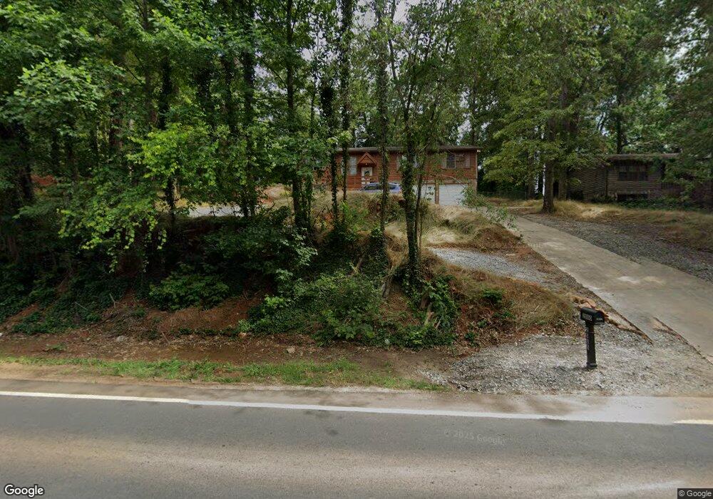
2080 E Cherokee Dr Woodstock, GA 30188
Union Hill NeighborhoodEstimated Value: $359,000 - $362,331
3
Beds
2
Baths
1,624
Sq Ft
$222/Sq Ft
Est. Value
About This Home
This home is located at 2080 E Cherokee Dr, Woodstock, GA 30188 and is currently estimated at $360,666, approximately $222 per square foot. 2080 E Cherokee Dr is a home located in Cherokee County with nearby schools including Johnston Elementary School, Mill Creek Middle School, and River Ridge High School.
Ownership History
Date
Name
Owned For
Owner Type
Purchase Details
Closed on
Jun 11, 2007
Sold by
2080 East Cherokee Drive Ward
Bought by
Li Jian
Current Estimated Value
Purchase Details
Closed on
Nov 28, 2006
Sold by
Ward Fred F
Bought by
2080 East Cherokee Drive Ward
Purchase Details
Closed on
Sep 29, 2006
Sold by
Ward Daphna A
Bought by
2080 East Cherokee Drive Ward
Create a Home Valuation Report for This Property
The Home Valuation Report is an in-depth analysis detailing your home's value as well as a comparison with similar homes in the area
Home Values in the Area
Average Home Value in this Area
Purchase History
| Date | Buyer | Sale Price | Title Company |
|---|---|---|---|
| Li Jian | -- | -- | |
| 2080 East Cherokee Drive Ward | -- | -- | |
| 2080 East Cherokee Drive Ward | -- | -- |
Source: Public Records
Tax History Compared to Growth
Tax History
| Year | Tax Paid | Tax Assessment Tax Assessment Total Assessment is a certain percentage of the fair market value that is determined by local assessors to be the total taxable value of land and additions on the property. | Land | Improvement |
|---|---|---|---|---|
| 2025 | $3,063 | $116,624 | $26,800 | $89,824 |
| 2024 | $3,023 | $116,344 | $26,800 | $89,544 |
| 2023 | $2,855 | $109,864 | $23,600 | $86,264 |
| 2022 | $2,370 | $90,184 | $12,800 | $77,384 |
| 2021 | $2,174 | $76,584 | $12,800 | $63,784 |
| 2020 | $2,015 | $70,904 | $12,800 | $58,104 |
| 2019 | $1,781 | $62,680 | $12,800 | $49,880 |
| 2018 | $1,655 | $57,880 | $12,800 | $45,080 |
| 2017 | $1,574 | $136,600 | $12,800 | $41,840 |
| 2016 | $1,457 | $125,100 | $10,800 | $39,240 |
| 2015 | $1,344 | $114,300 | $10,800 | $34,920 |
| 2014 | $1,161 | $98,500 | $10,800 | $28,600 |
Source: Public Records
Map
Nearby Homes
- 707 Evans St
- 711 Evans St
- 5830 Mill Creek Ln
- 160 Highlands Dr
- 126 Highlands Dr Unit 1
- 161 Stoney Creek Pkwy
- 414 New Park Dr
- 157 Springwater Trace
- 614 Springharbor Dr
- 106 Thornwood Dr
- 505 Lost Creek Dr
- 151 Springwater Trace
- 221 Stone Park Dr
- 524 S Holly Springs Rd
- 2875 Trickum Rd
- 224 Stone Park Dr
- 133 Madison Bend
- 2076 E Cherokee Dr
- 2084 E Cherokee Dr
- 703 Navaho Ct
- 2072 E Cherokee Dr
- 516 Tomahawk Trail
- 222 Allison Dr Unit 1
- 514 Tomahawk Trail
- 220 Allison Dr
- 518 Tomahawk Trail
- 520 Tomahawk Trail
- 2068 E Cherokee Dr
- 2086 E Cherokee Dr
- 218 Allison Dr
- 706 Navaho Ct
- 0 Navaho Ct
- 224 Allison Dr
- 522 Tomahawk Trail
- 704 Navaho Ct
- 216 Allison Dr Unit 1
- 702 Navaho Ct