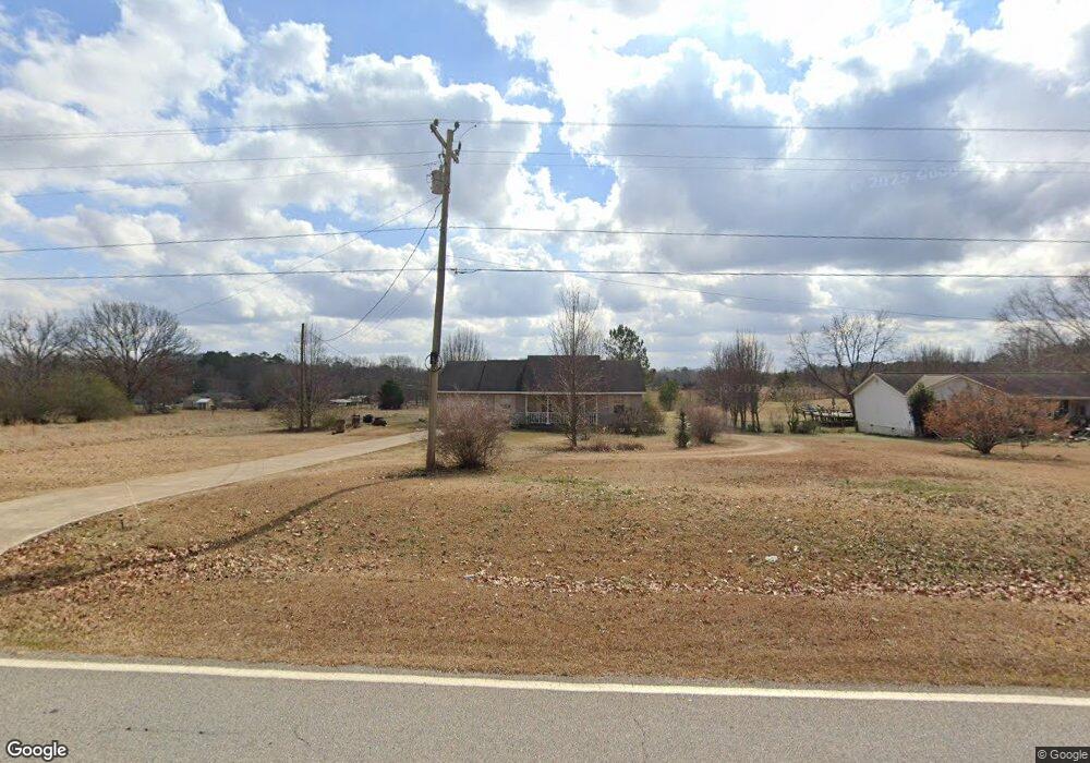
2080 Swint Rd Griffin, GA 30224
Spalding County NeighborhoodEstimated Value: $192,000 - $226,000
3
Beds
2
Baths
1,204
Sq Ft
$169/Sq Ft
Est. Value
About This Home
This home is located at 2080 Swint Rd, Griffin, GA 30224 and is currently estimated at $203,816, approximately $169 per square foot. 2080 Swint Rd is a home located in Spalding County with nearby schools including Futral Road Elementary School, Rehoboth Road Middle School, and Spalding High School.
Ownership History
Date
Name
Owned For
Owner Type
Purchase Details
Closed on
Jan 23, 2006
Sold by
Murray G Niles
Bought by
Neal Rommy
Current Estimated Value
Home Financials for this Owner
Home Financials are based on the most recent Mortgage that was taken out on this home.
Original Mortgage
$102,127
Outstanding Balance
$57,199
Interest Rate
6.21%
Mortgage Type
FHA
Estimated Equity
$146,617
Create a Home Valuation Report for This Property
The Home Valuation Report is an in-depth analysis detailing your home's value as well as a comparison with similar homes in the area
Home Values in the Area
Average Home Value in this Area
Purchase History
| Date | Buyer | Sale Price | Title Company |
|---|---|---|---|
| Neal Rommy | $103,000 | -- |
Source: Public Records
Mortgage History
| Date | Status | Borrower | Loan Amount |
|---|---|---|---|
| Open | Neal Rommy | $102,127 |
Source: Public Records
Tax History Compared to Growth
Tax History
| Year | Tax Paid | Tax Assessment Tax Assessment Total Assessment is a certain percentage of the fair market value that is determined by local assessors to be the total taxable value of land and additions on the property. | Land | Improvement |
|---|---|---|---|---|
| 2024 | $1,591 | $46,292 | $6,600 | $39,692 |
| 2023 | $1,591 | $46,292 | $6,600 | $39,692 |
| 2022 | $1,331 | $38,410 | $6,000 | $32,410 |
| 2021 | $1,143 | $33,232 | $6,000 | $27,232 |
| 2020 | $1,147 | $33,232 | $6,000 | $27,232 |
| 2019 | $1,170 | $33,232 | $6,000 | $27,232 |
| 2018 | $1,103 | $30,683 | $6,000 | $24,683 |
| 2017 | $1,073 | $30,683 | $6,000 | $24,683 |
| 2016 | $1,093 | $30,683 | $6,000 | $24,683 |
| 2015 | $1,126 | $30,683 | $6,000 | $24,683 |
| 2014 | $1,148 | $30,683 | $6,000 | $24,683 |
Source: Public Records
Map
Nearby Homes
- 2495 Barnesville Rd
- 245 Kennelsman Dr
- 87 Hounds Way
- 270 Kennelsman Dr
- Flora Plan at Fox Crossing
- Cali Plan at Fox Crossing
- Galen Plan at Fox Crossing
- Aisle Plan at Fox Crossing
- Aria Plan at Fox Crossing
- 145 Hounds Way Unit LOT 94
- 250 Kennelsman Dr
- 258 Kennelsman Dr
- 264 Kennelsman Dr
- 171 Kennelsman Dr
- 269 Kennelsman Dr
- 261 Kennelsman Dr
- 271 Kennelsman Dr
- 111 Hatmaker Ct
- 113 Hatmaker Ct
- 112 Hatmaker Ct
- 2076 Swint Rd
- 2072 Swint Rd
- 2092 Swint Rd
- 1910 Barnesville Rd
- 2068 Swint Rd
- 1916 Barnesville Rd
- 1924 Barnesville Rd
- 1865 Barnesville Rd
- 2060 Swint Rd
- 1932 Barnesville Rd
- 1877 Barnesville Rd
- 1853 Barnesville Rd
- 1889 Barnesville Rd
- 1901 Barnesville Rd
- 1824 Barnesville Rd
- 2056 Swint Rd
- 1841 Barnesville Rd
- 1911 Barnesville Rd
- 1923 Barnesville Rd
- 1795 Barnesville Rd