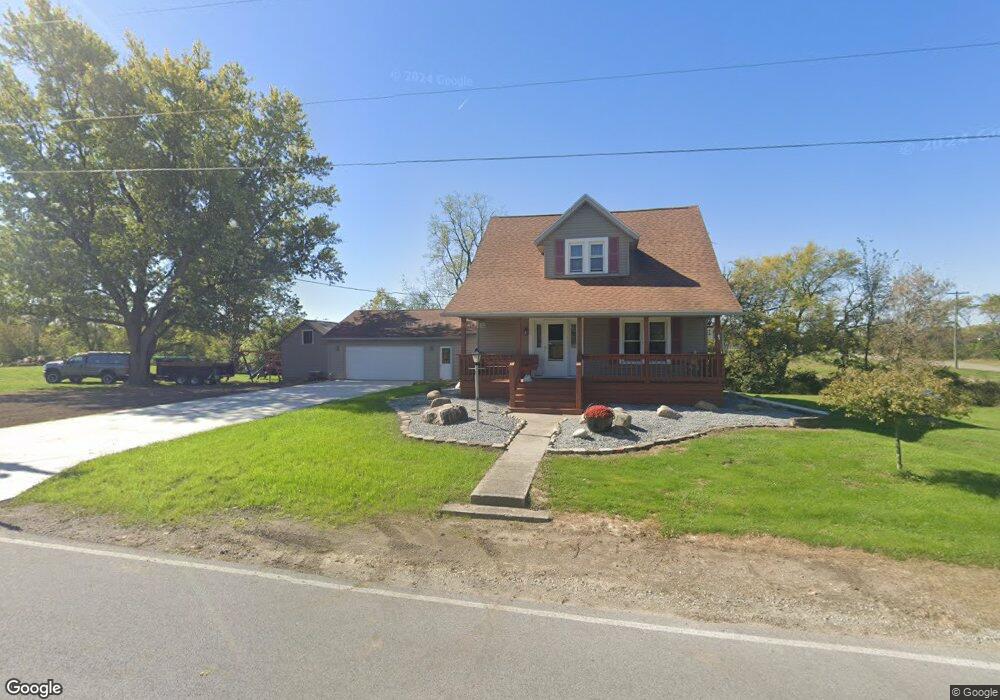
20801 Mudsock Rd Wapakoneta, OH 45895
Estimated Value: $106,000 - $282,000
3
Beds
2
Baths
1,648
Sq Ft
$116/Sq Ft
Est. Value
About This Home
This home is located at 20801 Mudsock Rd, Wapakoneta, OH 45895 and is currently estimated at $190,816, approximately $115 per square foot. 20801 Mudsock Rd is a home located in Auglaize County with nearby schools including Cridersville Elementary School, Wapakoneta High School, and Wapakoneta Middle School.
Ownership History
Date
Name
Owned For
Owner Type
Purchase Details
Closed on
Sep 22, 1994
Sold by
Muleski Bernard S
Bought by
Muleski Edward S
Current Estimated Value
Create a Home Valuation Report for This Property
The Home Valuation Report is an in-depth analysis detailing your home's value as well as a comparison with similar homes in the area
Purchase History
| Date | Buyer | Sale Price | Title Company |
|---|---|---|---|
| Muleski Edward S | $30,000 | -- |
Source: Public Records
Tax History
| Year | Tax Paid | Tax Assessment Tax Assessment Total Assessment is a certain percentage of the fair market value that is determined by local assessors to be the total taxable value of land and additions on the property. | Land | Improvement |
|---|---|---|---|---|
| 2025 | $2,542 | $51,090 | $10,150 | $40,940 |
| 2024 | $2,542 | $51,090 | $10,150 | $40,940 |
| 2023 | $1,708 | $51,090 | $10,150 | $40,940 |
| 2022 | $1,265 | $34,410 | $8,460 | $25,950 |
| 2021 | $1,245 | $34,410 | $8,460 | $25,950 |
| 2020 | $1,249 | $34,409 | $8,456 | $25,953 |
| 2019 | $1,063 | $28,203 | $6,930 | $21,273 |
| 2018 | $1,068 | $28,203 | $6,930 | $21,273 |
| 2017 | $1,063 | $28,203 | $6,930 | $21,273 |
| 2016 | $1,045 | $27,874 | $6,580 | $21,294 |
| 2015 | $1,044 | $27,874 | $6,580 | $21,294 |
| 2014 | $1,038 | $27,874 | $6,580 | $21,294 |
| 2013 | $1,062 | $27,829 | $6,535 | $21,294 |
Source: Public Records
Map
Nearby Homes
- 17138 National Rd
- 312 S Dixie Hwy
- 20863 Town Line-Lima Rd
- 117 E Main St
- 322 Lavina Ave
- 18934 Mudsock Rd
- 4 Harwood Ln
- 2638 Summer Rambo Ct
- 2648 Summer Rambo Ct
- 2613 Jonathon Dr
- 2691 Jonathan Dr
- 2667 Jonathan Dr
- 8 Harwood Ln
- 2644 Jonathon Dr
- 2675 Jonathan Dr
- 1725 Jo Jean Rd
- 31 Greentree Cir
- 1643 W Breese Rd Unit 73
- St Johns Rd
- 4040 Shawnee Rd
- 20720 Mudsock Rd
- 17277 National Rd
- 20723 Mudsock Rd
- 17149 National Rd
- 20706 Mudsock Rd
- 17340 National Rd
- 20918 Mudsock Rd
- 17070 National Rd
- 17386 National Rd
- 17069 National Rd
- 20591 Mudsock Rd
- 17412 National Rd
- 17417 National Rd
- 17020 National Rd
- 17434 National Rd
- 20987 Mudsock Rd
- 20976 Mudsock Rd
- 17001 National Rd
- 17442 National Rd
- 20572 Mudsock Rd
Your Personal Tour Guide
Ask me questions while you tour the home.