Estimated Value: $191,000 - $208,415
3
Beds
2
Baths
1,401
Sq Ft
$145/Sq Ft
Est. Value
About This Home
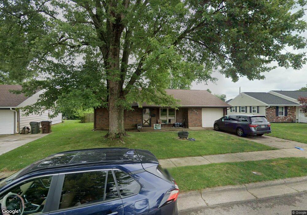
This home is located at 2081 Drummond Dr, Xenia, OH 45385 and is currently estimated at $202,604, approximately $144 per square foot. 2081 Drummond Dr is a home located in Greene County with nearby schools including Xenia High School, Summit Academy Community School for Alternative Learners - Xenia, and Legacy Christian Academy.
Ownership History
Date
Name
Owned For
Owner Type
Purchase Details
Closed on
Aug 25, 2005
Sold by
Owens Danielle L
Bought by
Bruce Robert E and Bruce Michelle L
Current Estimated Value
Home Financials for this Owner
Home Financials are based on the most recent Mortgage that was taken out on this home.
Original Mortgage
$94,400
Outstanding Balance
$50,409
Interest Rate
5.82%
Mortgage Type
Fannie Mae Freddie Mac
Estimated Equity
$152,195
Purchase Details
Closed on
Nov 6, 2002
Sold by
Licklider Trent E and Licklider Darla A
Bought by
Owens Danielle L
Home Financials for this Owner
Home Financials are based on the most recent Mortgage that was taken out on this home.
Original Mortgage
$81,700
Interest Rate
5.5%
Purchase Details
Closed on
Mar 23, 2001
Sold by
Kennedy Darla A and Kennedy Darla A
Bought by
Licklider Trent E and Licklider Darla A
Home Financials for this Owner
Home Financials are based on the most recent Mortgage that was taken out on this home.
Original Mortgage
$50,000
Interest Rate
7.02%
Create a Home Valuation Report for This Property
The Home Valuation Report is an in-depth analysis detailing your home's value as well as a comparison with similar homes in the area
Home Values in the Area
Average Home Value in this Area
Purchase History
| Date | Buyer | Sale Price | Title Company |
|---|---|---|---|
| Bruce Robert E | $94,400 | -- | |
| Owens Danielle L | $86,000 | -- | |
| Licklider Trent E | -- | -- |
Source: Public Records
Mortgage History
| Date | Status | Borrower | Loan Amount |
|---|---|---|---|
| Open | Bruce Robert E | $94,400 | |
| Previous Owner | Owens Danielle L | $81,700 | |
| Previous Owner | Licklider Trent E | $50,000 |
Source: Public Records
Tax History Compared to Growth
Tax History
| Year | Tax Paid | Tax Assessment Tax Assessment Total Assessment is a certain percentage of the fair market value that is determined by local assessors to be the total taxable value of land and additions on the property. | Land | Improvement |
|---|---|---|---|---|
| 2024 | $2,316 | $55,540 | $11,570 | $43,970 |
| 2023 | $2,316 | $55,540 | $11,570 | $43,970 |
| 2022 | $1,938 | $39,620 | $6,810 | $32,810 |
| 2021 | $1,964 | $39,620 | $6,810 | $32,810 |
| 2020 | $1,879 | $39,620 | $6,810 | $32,810 |
| 2019 | $1,708 | $33,890 | $6,550 | $27,340 |
| 2018 | $1,715 | $33,890 | $6,550 | $27,340 |
| 2017 | $1,572 | $33,890 | $6,550 | $27,340 |
| 2016 | $1,573 | $30,520 | $6,550 | $23,970 |
| 2015 | $1,577 | $30,520 | $6,550 | $23,970 |
| 2014 | $1,509 | $30,520 | $6,550 | $23,970 |
Source: Public Records
Map
Nearby Homes
- 1866 Roxbury Dr
- 1255 Colorado Dr
- 1908 Whitt St
- 1107 Arkansas Dr
- 2499 Jenny Marie Dr
- 2540 Jenny Marie Dr
- 2540 Cornwall Dr
- 2421 Louisiana Dr
- 1403 Texas Dr
- 1829 Gayhart Dr
- 1769 Gayhart Dr
- 0 Berkshire Dr Unit 942854
- 910 Wright Ave
- 2144 Tandem Dr
- 1778 Arapaho Dr
- 2345 Tennessee Dr
- 2257 Maryland Dr
- 2102 High Wheel Dr
- 920 Wright Cycle Blvd
- 926 Wright Cycle Blvd
- 2067 Drummond Dr
- 2095 Drummond Dr
- 2055 Drummond Dr
- 2082 Bellbrook Ave
- 2068 Bellbrook Ave
- 2107 Drummond Dr
- 2096 Bellbrook Ave
- 2086 Drummond Dr
- 2072 Drummond Dr
- 2054 Bellbrook Ave
- 2041 Drummond Dr
- 2104 Drummond Dr
- 2056 Drummond Dr
- 2110 Bellbrook Ave
- 2066 Oxward Ct
- 2038 Bellbrook Ave
- 2042 Drummond Dr
- 2029 Drummond Dr
- 2052 Oxward Ct
- 2126 Bellbrook Ave