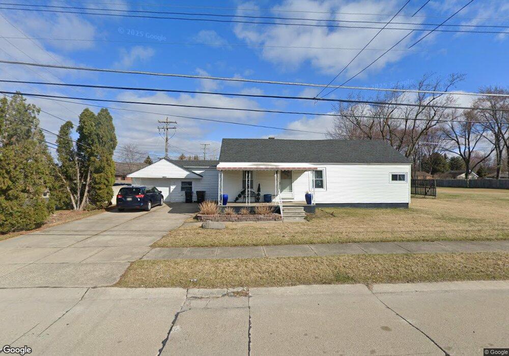
2081 Lindell Rd Unit Bldg-Unit Sterling Heights, MI 48310
Estimated Value: $231,000 - $258,866
--
Bed
3
Baths
1,128
Sq Ft
$215/Sq Ft
Est. Value
About This Home
This home is located at 2081 Lindell Rd Unit Bldg-Unit, Sterling Heights, MI 48310 and is currently estimated at $242,217, approximately $214 per square foot. 2081 Lindell Rd Unit Bldg-Unit is a home located in Macomb County with nearby schools including Susick Elementary School, Grissom Middle School, and Sterling Heights Senior H.S..
Ownership History
Date
Name
Owned For
Owner Type
Purchase Details
Closed on
Aug 26, 2020
Sold by
Norris Marshall G
Bought by
Webb Patricia
Current Estimated Value
Purchase Details
Closed on
Mar 6, 2019
Sold by
Hamilton Cailey L
Bought by
Norris Marshall G
Purchase Details
Closed on
Jan 11, 2018
Sold by
Chowdhury Ezaz
Bought by
Norris Marshall and Hamilton Cailey
Home Financials for this Owner
Home Financials are based on the most recent Mortgage that was taken out on this home.
Original Mortgage
$128,250
Interest Rate
3.9%
Mortgage Type
New Conventional
Purchase Details
Closed on
Jul 3, 2013
Sold by
Haynes Joyce A
Bought by
Chowdhury Ezaz
Create a Home Valuation Report for This Property
The Home Valuation Report is an in-depth analysis detailing your home's value as well as a comparison with similar homes in the area
Home Values in the Area
Average Home Value in this Area
Purchase History
| Date | Buyer | Sale Price | Title Company |
|---|---|---|---|
| Webb Patricia | $160,000 | None Available | |
| Norris Marshall G | -- | None Available | |
| Norris Marshall | $135,000 | None Available | |
| Chowdhury Ezaz | $45,450 | Lighthouse Title Inc |
Source: Public Records
Mortgage History
| Date | Status | Borrower | Loan Amount |
|---|---|---|---|
| Previous Owner | Norris Marshall | $128,250 |
Source: Public Records
Tax History Compared to Growth
Tax History
| Year | Tax Paid | Tax Assessment Tax Assessment Total Assessment is a certain percentage of the fair market value that is determined by local assessors to be the total taxable value of land and additions on the property. | Land | Improvement |
|---|---|---|---|---|
| 2025 | $4,609 | $95,000 | $0 | $0 |
| 2024 | $4,448 | $89,600 | $0 | $0 |
| 2023 | $4,221 | $80,800 | $0 | $0 |
| 2022 | $4,131 | $72,700 | $0 | $0 |
| 2021 | $4,045 | $69,900 | $0 | $0 |
| 2020 | $2,593 | $62,000 | $0 | $0 |
| 2019 | $1,886 | $58,700 | $0 | $0 |
| 2018 | $1,997 | $51,300 | $0 | $0 |
| 2017 | $1,927 | $47,800 | $19,000 | $28,800 |
| 2016 | $1,886 | $47,800 | $0 | $0 |
| 2015 | -- | $44,600 | $0 | $0 |
| 2014 | -- | $39,100 | $0 | $0 |
Source: Public Records
Map
Nearby Homes
- 2109 Chesley Dr
- 2121 Chesley Dr
- 2987 Chesterfield Dr
- 2846 Teasdale Dr
- 2448 Oakcrest Rd
- 2950 Iowa Dr
- 1714 Castleton Dr
- 2735 E Maple Rd
- 2595 Elmcrest Rd
- 2936 Wisconsin Rd
- 2021 Castleton Dr
- 000 Wisconsin Rd
- 2528 Koper Dr
- 2269 Serra Dr
- 1436 Minnesota Rd
- 2268 Serra Dr
- 2693 Wisconsin Rd
- 3148 Marc Dr
- 34150 Dequindre Rd
- 3131 Elmcrest Rd
- 2081 Lindell Rd
- 2121 Lindell Rd
- 2100 Chesley Dr
- 2153 Lindell Rd
- 2020 Chesley Dr Unit A
- 2090 Lindell Rd
- 2078 Lindell Rd
- 35200 Dequindre Rd Unit 400, 100
- 35200 Dequindre Rd Unit 400
- 2118 Lindell Rd
- 2132 Chesley Dr
- 2130 Lindell Rd Unit Bldg-Unit
- 2130 Lindell Rd
- 2154 Chesley Dr
- 2211 Lindell Rd
- 1999 15 Mile Rd
- 2123 15 Mile Rd
- 2200 Lindell Rd
- 2150 Chesley Dr
- 2156 Lindell Rd Unit Bldg-Unit