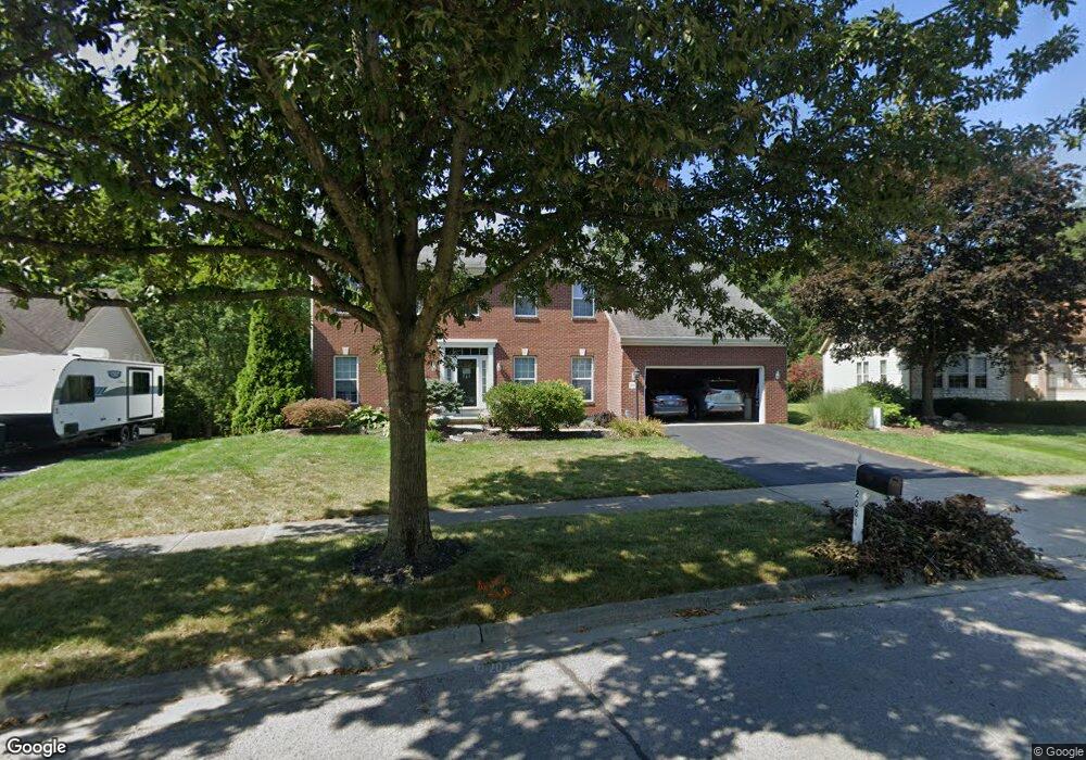
2081 Mayflower Cir Grove City, OH 43123
Estimated Value: $460,488 - $491,000
4
Beds
3
Baths
2,722
Sq Ft
$174/Sq Ft
Est. Value
About This Home
This home is located at 2081 Mayflower Cir, Grove City, OH 43123 and is currently estimated at $473,122, approximately $173 per square foot. 2081 Mayflower Cir is a home located in Franklin County with nearby schools including Buckeye Woods Elementary School, Hayes Intermediate School, and Jackson Middle School.
Ownership History
Date
Name
Owned For
Owner Type
Purchase Details
Closed on
Nov 17, 2000
Sold by
Rockford Homes Inc
Bought by
Wolfram Anthony G and Wolfram Karen E
Current Estimated Value
Home Financials for this Owner
Home Financials are based on the most recent Mortgage that was taken out on this home.
Original Mortgage
$172,154
Interest Rate
7.87%
Mortgage Type
Balloon
Create a Home Valuation Report for This Property
The Home Valuation Report is an in-depth analysis detailing your home's value as well as a comparison with similar homes in the area
Home Values in the Area
Average Home Value in this Area
Purchase History
| Date | Buyer | Sale Price | Title Company |
|---|---|---|---|
| Wolfram Anthony G | $215,300 | Title First Agency Inc |
Source: Public Records
Mortgage History
| Date | Status | Borrower | Loan Amount |
|---|---|---|---|
| Open | Wolfram Anthony G | $127,100 | |
| Closed | Wolfram Anthony G | $176,500 | |
| Closed | Wolfram Anthony G | $174,300 | |
| Closed | Wolfram Anthony G | $172,154 |
Source: Public Records
Tax History Compared to Growth
Tax History
| Year | Tax Paid | Tax Assessment Tax Assessment Total Assessment is a certain percentage of the fair market value that is determined by local assessors to be the total taxable value of land and additions on the property. | Land | Improvement |
|---|---|---|---|---|
| 2024 | $6,303 | $138,610 | $34,760 | $103,850 |
| 2023 | $6,214 | $138,610 | $34,760 | $103,850 |
| 2022 | $6,438 | $105,570 | $20,410 | $85,160 |
| 2021 | $6,562 | $105,570 | $20,410 | $85,160 |
| 2020 | $6,541 | $105,570 | $20,410 | $85,160 |
| 2019 | $5,918 | $88,620 | $17,010 | $71,610 |
| 2018 | $5,632 | $88,620 | $17,010 | $71,610 |
| 2017 | $5,620 | $88,620 | $17,010 | $71,610 |
| 2016 | $5,366 | $74,030 | $15,930 | $58,100 |
| 2015 | $5,367 | $74,030 | $15,930 | $58,100 |
| 2014 | $5,371 | $74,030 | $15,930 | $58,100 |
| 2013 | $2,328 | $67,970 | $15,155 | $52,815 |
Source: Public Records
Map
Nearby Homes
- 5796 Ravine Creek Dr
- 5870 Crooked Creek Blvd Unit 5870
- 2310 Ravine Woods Dr Unit 22
- 5655 Lotus Ct
- 2051 Borror Rd
- 2336 Willowside Ln Unit 2336
- 2383 Birch Bark Trail
- 2384 Birch Bark Trail
- 2504 Landings Way Unit 52504
- 5793 Daffodil Ct
- 2382 Clover Blossom Ct
- 5933 Landings Pond Place Unit 21
- 5712 Buckeye Pkwy
- 5941 Landings Pond Place
- 2609 Landings Way Unit 29-D
- 2305 Spring Cress Ave
- 1907 Timber Haven Ct
- 5455 Lilac Ave
- Cedar Plan at The Enclave at Meadow Grove Estates
- Charleston Plan at The Enclave at Meadow Grove Estates
- 2071 Mayflower Cir
- 2091 Mayflower Cir
- 2061 Mayflower Cir
- 2101 Mayflower Cir
- 2098 Mayflower Cir
- 2068 Mayflower Cir
- 2051 Mayflower Cir
- 2048 Mayflower Cir
- 2111 Mayflower Cir
- 5810 Lookout Blvd
- 5806 Lookout Blvd Unit 5806
- 2126 Mayflower Cir
- 5818 Lookout Blvd Unit 5818
- 5802 Lookout Blvd Unit 5802
- 5822 Lookout Blvd
- 5798 Lookout Blvd Unit 5798
- 2121 Mayflower Cir
- 2041 Mayflower Cir
- 2038 Mayflower Cir
- 5826 Lookout Blvd Unit 5826