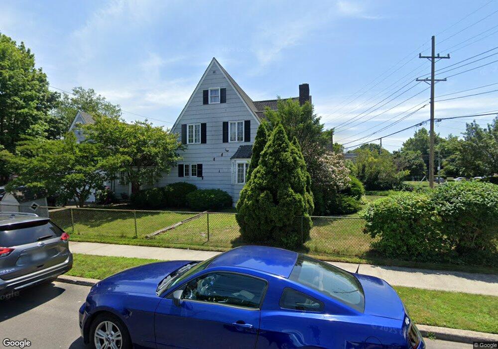
2081 Milburn Ave North Baldwin, NY 11510
Estimated Value: $678,106 - $791,000
--
Bed
1
Bath
2,434
Sq Ft
$302/Sq Ft
Est. Value
About This Home
This home is located at 2081 Milburn Ave, North Baldwin, NY 11510 and is currently estimated at $734,553, approximately $301 per square foot. 2081 Milburn Ave is a home located in Nassau County with nearby schools including Baldwin Senior High School.
Ownership History
Date
Name
Owned For
Owner Type
Purchase Details
Closed on
Mar 26, 1998
Sold by
Uhlig Evenlyn
Bought by
Holt Francino
Current Estimated Value
Purchase Details
Closed on
Jul 14, 1995
Sold by
Deleonardis John Ref
Bought by
Uhlig Evelyn
Home Financials for this Owner
Home Financials are based on the most recent Mortgage that was taken out on this home.
Original Mortgage
$110,000
Interest Rate
7.56%
Create a Home Valuation Report for This Property
The Home Valuation Report is an in-depth analysis detailing your home's value as well as a comparison with similar homes in the area
Home Values in the Area
Average Home Value in this Area
Purchase History
| Date | Buyer | Sale Price | Title Company |
|---|---|---|---|
| Holt Francino | $238,500 | -- | |
| Uhlig Evelyn | $201,000 | -- |
Source: Public Records
Mortgage History
| Date | Status | Borrower | Loan Amount |
|---|---|---|---|
| Previous Owner | Uhlig Evelyn | $110,000 |
Source: Public Records
Tax History Compared to Growth
Tax History
| Year | Tax Paid | Tax Assessment Tax Assessment Total Assessment is a certain percentage of the fair market value that is determined by local assessors to be the total taxable value of land and additions on the property. | Land | Improvement |
|---|---|---|---|---|
| 2025 | $11,172 | $494 | $189 | $305 |
| 2024 | $3,137 | $494 | $189 | $305 |
| 2023 | $9,592 | $494 | $189 | $305 |
| 2022 | $9,592 | $494 | $189 | $305 |
| 2021 | $12,069 | $479 | $183 | $296 |
| 2020 | $11,691 | $674 | $510 | $164 |
| 2019 | $12,105 | $674 | $421 | $253 |
| 2018 | $11,480 | $816 | $0 | $0 |
| 2017 | $9,220 | $816 | $510 | $306 |
| 2016 | $12,805 | $816 | $510 | $306 |
| 2015 | $3,389 | $816 | $510 | $306 |
| 2014 | $3,389 | $816 | $510 | $306 |
| 2013 | $3,173 | $816 | $510 | $306 |
Source: Public Records
Map
Nearby Homes
- 2100 Ambrose Ct
- 15 Mckenna Ave
- 2 Florence St
- 345 W Seaman Ave
- 669 Seaman Ave
- 215 N Brookside Ave
- 2 Twain St
- 55 S Brookside Ave
- 86 N Bayview Ave
- 1850 Voshage St
- 0 Edna Ct
- 578 Seaman Ave
- 254 Lena Ave
- 1900 Carleton Place
- 569 Seaman Ave
- 1905 Bryant Place
- 715 Prospect St Unit 4
- 1887 Bryant Place
- 2355 Pershing Blvd Unit 303
- 2355 Pershing Blvd Unit 707
- 2091 Milburn Ave
- 2095 Milburn Ave
- 862 Brookwold Ave
- 849 Brookwold Ave
- 2069 Milburn Ave
- 855 Brookwold Ave
- 2092 Milburn Ave
- 2086 Milburn Ave
- 2080 Milburn Ave
- 2100 Milburn Ave
- 2090 Brookwold Ct
- 861 Brookwold Ave
- 2070 Milburn Ave
- 2096 Brookwold Ct
- 2105 Milburn Ave
- 836 Miller Place
- 9 Brookwold Ave
- 1 Miller Place
- 848 Mckenna Ave
- 872 Brookwold Ave