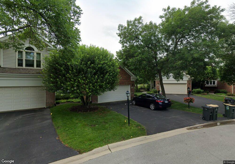
2081 N Charter Point Dr Unit 11 Arlington Heights, IL 60004
Estimated Value: $404,000 - $485,000
2
Beds
--
Bath
8,750
Sq Ft
$51/Sq Ft
Est. Value
About This Home
This home is located at 2081 N Charter Point Dr Unit 11, Arlington Heights, IL 60004 and is currently estimated at $442,870, approximately $50 per square foot. 2081 N Charter Point Dr Unit 11 is a home located in Cook County with nearby schools including Dwight D Eisenhower Elementary School, Anne Sullivan Elementary School, and Betsy Ross Elementary School.
Ownership History
Date
Name
Owned For
Owner Type
Purchase Details
Closed on
Jan 16, 2019
Sold by
Quiery Daniel and Quiery Patricia
Bought by
Quiery Daniel J and Quiery Patricia P
Current Estimated Value
Purchase Details
Closed on
Dec 23, 2004
Sold by
Saltzberg Bernard G
Bought by
Quiery Daniel and Quiery Patricia
Purchase Details
Closed on
Aug 12, 1996
Sold by
Saltzberg Bernard G and Saltzberg Alta
Bought by
Saltzberg Alta
Create a Home Valuation Report for This Property
The Home Valuation Report is an in-depth analysis detailing your home's value as well as a comparison with similar homes in the area
Home Values in the Area
Average Home Value in this Area
Purchase History
| Date | Buyer | Sale Price | Title Company |
|---|---|---|---|
| Quiery Daniel J | -- | None Available | |
| Quiery Daniel | $392,000 | Cti | |
| Saltzberg Alta | -- | -- |
Source: Public Records
Tax History Compared to Growth
Tax History
| Year | Tax Paid | Tax Assessment Tax Assessment Total Assessment is a certain percentage of the fair market value that is determined by local assessors to be the total taxable value of land and additions on the property. | Land | Improvement |
|---|---|---|---|---|
| 2024 | $6,513 | $29,798 | $10,079 | $19,719 |
| 2023 | $6,170 | $29,798 | $10,079 | $19,719 |
| 2022 | $6,170 | $29,798 | $10,079 | $19,719 |
| 2021 | $5,847 | $25,231 | $1,048 | $24,183 |
| 2020 | $5,813 | $25,231 | $1,048 | $24,183 |
| 2019 | $5,831 | $28,220 | $1,048 | $27,172 |
| 2018 | $4,999 | $23,350 | $838 | $22,512 |
| 2017 | $4,977 | $23,350 | $838 | $22,512 |
| 2016 | $5,118 | $23,350 | $838 | $22,512 |
| 2015 | $5,066 | $21,543 | $5,248 | $16,295 |
| 2014 | $5,040 | $21,543 | $5,248 | $16,295 |
| 2013 | $4,897 | $21,543 | $5,248 | $16,295 |
Source: Public Records
Map
Nearby Homes
- 2026 N Stillwater Rd Unit 24
- 1956 N Silver Lake Rd
- 307 Anne Ct
- 1912 N Coldspring Rd Unit 96
- 1949 N Charter Point Dr Unit 1949
- 1044 Creekside Ct Unit 2B
- 11 W Palatine Rd
- 802 Andover Ct
- 412 Cherry Creek Ln
- 21 E Stonegate Dr
- 1500 Harbour Dr Unit 2K
- 1500 Harbour Dr Unit 1D
- 105 W Ridge Ave
- 2143 E Peachtree Ln
- 13 W Kenilworth Ave
- 1014 N Elmhurst Rd
- 2611 E Radford Ct
- 9 Kenneth Ave
- 1201 Pleasant Run Dr Unit 312
- 962 Twilight Ln
- 2083 N Charter Point Dr Unit 11
- 2085 N Charter Point Dr Unit 11
- 2079 N Charter Point Dr Unit 12
- 2087 N Charter Point Dr Unit 11
- 2077 N Charter Point Dr Unit 12
- 2075 N Charter Point Dr Unit 12
- 2089 N Charter Point Dr Unit 11
- 2080 N Charter Point Dr Unit 16
- 2073 N Charter Point Dr Unit 12
- 2052 N Coldspring Rd Unit 52
- 2054 N Coldspring Rd Unit 53
- 2050 N Coldspring Rd Unit 51
- 2071 N Charter Point Dr Unit 12
- 2082 N Charter Point Dr Unit 16
- 2109 N Charter Point Dr Unit 10
- 2060 N Coldspring Rd Unit 61
- 2086 N Charter Point Dr Unit 16
- 2111 N Charter Point Dr Unit 10
- 2062 N Coldspring Rd Unit 62
- 2069 N Charter Point Dr Unit 13