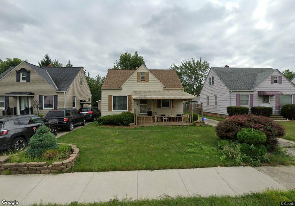
20812 Franklin Rd Maple Heights, OH 44137
Estimated Value: $89,000 - $108,681
3
Beds
1
Bath
1,092
Sq Ft
$87/Sq Ft
Est. Value
About This Home
This home is located at 20812 Franklin Rd, Maple Heights, OH 44137 and is currently estimated at $95,420, approximately $87 per square foot. 20812 Franklin Rd is a home located in Cuyahoga County with nearby schools including Abraham Lincoln Elementary School, Rockside/ J.F. Kennedy School, and Italy High School.
Ownership History
Date
Name
Owned For
Owner Type
Purchase Details
Closed on
May 15, 2025
Sold by
Smith Cynthia and Smith Cory B
Bought by
Eb Enterprises Llc
Current Estimated Value
Home Financials for this Owner
Home Financials are based on the most recent Mortgage that was taken out on this home.
Original Mortgage
$107,730
Outstanding Balance
$72,610
Interest Rate
6.64%
Mortgage Type
Construction
Estimated Equity
$22,810
Purchase Details
Closed on
Aug 5, 2006
Sold by
Smith Cory B and Smith Cynthia
Bought by
Smith Cynthia
Purchase Details
Closed on
Apr 21, 2000
Sold by
Michael Parks Roderick and Kay Parks Deana
Bought by
Smith Cory B and Smith Cynthia
Home Financials for this Owner
Home Financials are based on the most recent Mortgage that was taken out on this home.
Original Mortgage
$89,990
Interest Rate
8.24%
Purchase Details
Closed on
Jan 23, 1989
Sold by
Farmer Richard
Bought by
Parks Roderick Michael
Purchase Details
Closed on
Jan 1, 1975
Bought by
Farmer Richard
Create a Home Valuation Report for This Property
The Home Valuation Report is an in-depth analysis detailing your home's value as well as a comparison with similar homes in the area
Home Values in the Area
Average Home Value in this Area
Purchase History
| Date | Buyer | Sale Price | Title Company |
|---|---|---|---|
| Eb Enterprises Llc | $90,000 | Titleco Title | |
| Smith Cynthia | -- | Third Capital | |
| Smith Cory B | $100,000 | Brooklyn Title Agency Inc | |
| Parks Roderick Michael | $56,000 | -- | |
| Farmer Richard | -- | -- |
Source: Public Records
Mortgage History
| Date | Status | Borrower | Loan Amount |
|---|---|---|---|
| Open | Eb Enterprises Llc | $107,730 | |
| Previous Owner | Smith Cory B | $89,990 |
Source: Public Records
Tax History Compared to Growth
Tax History
| Year | Tax Paid | Tax Assessment Tax Assessment Total Assessment is a certain percentage of the fair market value that is determined by local assessors to be the total taxable value of land and additions on the property. | Land | Improvement |
|---|---|---|---|---|
| 2024 | $2,917 | $31,675 | $7,420 | $24,255 |
| 2023 | $2,197 | $20,090 | $4,480 | $15,610 |
| 2022 | $2,189 | $20,090 | $4,480 | $15,610 |
| 2021 | $2,330 | $20,090 | $4,480 | $15,610 |
| 2020 | $1,999 | $15,230 | $3,400 | $11,830 |
| 2019 | $1,987 | $43,500 | $9,700 | $33,800 |
| 2018 | $1,865 | $15,230 | $3,400 | $11,830 |
| 2017 | $1,899 | $14,180 | $3,150 | $11,030 |
| 2016 | $1,836 | $14,180 | $3,150 | $11,030 |
| 2015 | $1,830 | $14,180 | $3,150 | $11,030 |
| 2014 | $1,830 | $15,580 | $3,470 | $12,110 |
Source: Public Records
Map
Nearby Homes
- 20814 Watson Rd
- 20715 Watson Rd
- 21102 Raymond St
- 20907 Watson Rd
- 21207 Franklin Rd
- 20814 Kenyon Dr
- 20701 Kenyon Dr
- 20510 Mountville Dr
- 20120 Mccracken Rd
- 20107 Libby Rd
- 21416 Gardenview Dr
- 19807 Gardenview Dr
- 19806 Mountville Dr
- 19812 Stockton Ave
- 19520 Maple Heights Blvd
- 19309 Nitra Ave
- 5165 Camden Rd
- 19289 Stafford Ave
- 20625 Centuryway Rd
- 20750 Bowling Green Rd
- 20816 Franklin Rd
- 20808 Franklin Rd
- 20804 Franklin Rd
- 20904 Franklin Rd
- 20813 Hillgrove Ave
- 20817 Hillgrove Ave
- 20809 Hillgrove Ave
- 20800 Franklin Rd
- 20901 Hillgrove Ave
- 20805 Hillgrove Ave
- 20908 Franklin Rd
- 20905 Hillgrove Ave
- 20817 Franklin Rd
- 20801 Hillgrove Ave
- 20813 Franklin Rd
- 20716 Franklin Rd
- 20912 Franklin Rd
- 20809 Franklin Rd
- 20901 Franklin Rd
- 20909 Hillgrove Ave