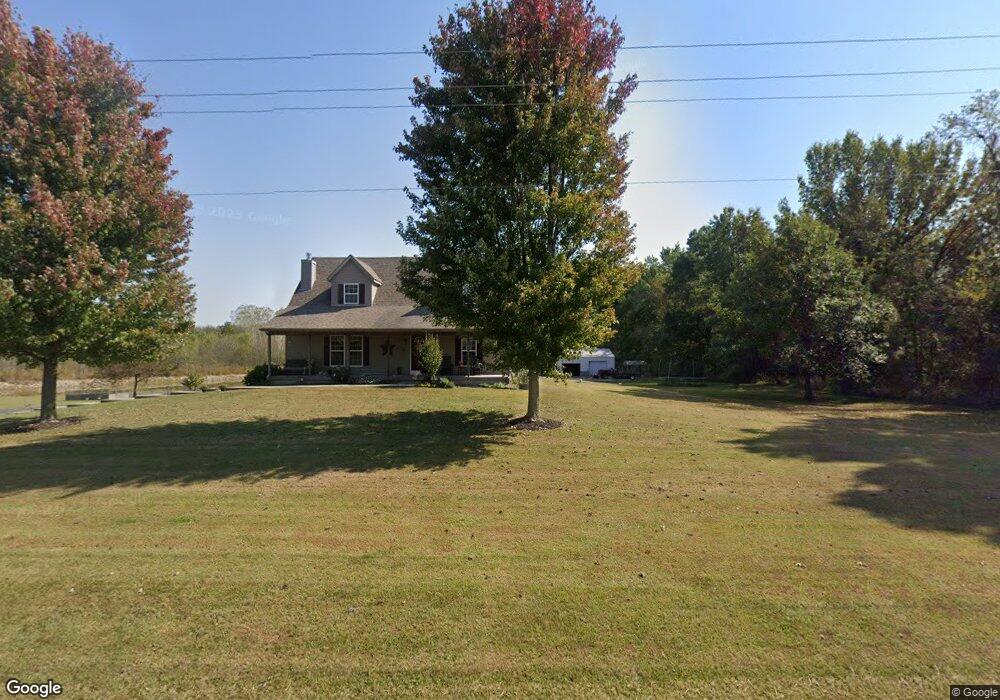
20817 S State Route Cc Pleasant Hill, MO 64080
Estimated Value: $434,000 - $497,000
3
Beds
1
Bath
1,542
Sq Ft
$303/Sq Ft
Est. Value
About This Home
This home is located at 20817 S State Route Cc, Pleasant Hill, MO 64080 and is currently estimated at $467,073, approximately $302 per square foot. 20817 S State Route Cc is a home located in Cass County.
Ownership History
Date
Name
Owned For
Owner Type
Purchase Details
Closed on
May 4, 2023
Sold by
Bagby Michelle A and Bagby Gary D
Bought by
Michelle A Bagby Intervivos Trust and Gary D Bagby Intervivos Trust
Current Estimated Value
Purchase Details
Closed on
Dec 2, 2011
Sold by
Bagby Michelle A and Bagby Gary D
Bought by
Bagby Michelle A and Bagby Gary D
Home Financials for this Owner
Home Financials are based on the most recent Mortgage that was taken out on this home.
Original Mortgage
$65,000
Interest Rate
4.14%
Mortgage Type
New Conventional
Create a Home Valuation Report for This Property
The Home Valuation Report is an in-depth analysis detailing your home's value as well as a comparison with similar homes in the area
Home Values in the Area
Average Home Value in this Area
Purchase History
| Date | Buyer | Sale Price | Title Company |
|---|---|---|---|
| Michelle A Bagby Intervivos Trust | -- | None Listed On Document | |
| Bagby Michelle A | -- | None Available |
Source: Public Records
Mortgage History
| Date | Status | Borrower | Loan Amount |
|---|---|---|---|
| Previous Owner | Bagby Michelle A | $65,000 |
Source: Public Records
Tax History Compared to Growth
Tax History
| Year | Tax Paid | Tax Assessment Tax Assessment Total Assessment is a certain percentage of the fair market value that is determined by local assessors to be the total taxable value of land and additions on the property. | Land | Improvement |
|---|---|---|---|---|
| 2024 | $2,386 | $34,470 | $4,760 | $29,710 |
| 2023 | $2,379 | $34,470 | $4,760 | $29,710 |
| 2022 | $2,117 | $30,300 | $4,760 | $25,540 |
| 2021 | $2,088 | $30,300 | $4,760 | $25,540 |
| 2020 | $1,854 | $27,600 | $4,760 | $22,840 |
| 2019 | $1,827 | $27,600 | $4,760 | $22,840 |
| 2018 | $1,622 | $24,260 | $3,810 | $20,450 |
| 2017 | $1,552 | $24,260 | $3,810 | $20,450 |
| 2016 | $1,552 | $23,190 | $3,810 | $19,380 |
| 2015 | $1,573 | $23,190 | $3,810 | $19,380 |
| 2014 | $1,560 | $22,890 | $3,810 | $19,080 |
| 2013 | -- | $22,890 | $3,810 | $19,080 |
Source: Public Records
Map
Nearby Homes
- 0 E 215th St
- 0000 E 219th St
- 312 N East Hwy
- 227th St
- 000 227th St -124 Acres
- 115 SW 1991st Rd
- 33701 E State Route 58
- 1936 SW 200th Rd
- 22920 S Staley Mound Rd
- 0 S Staley Mound Rd
- S Staley Mound Rd
- 30909 E 219th St
- 21 Acres Staley Mound Rd
- 0000 S Pryor Rd
- TBD S Pryor Rd
- Tbd South Pryor Rd
- Lot 4 State Rt K Hwy
- Lot 2 State Rt K Hwy
- Lot 3 State Rt K Hwy
- 23700 S State Rt K Hwy
- 20900 S State Route Cc
- 20915 S State Route Cc
- 20803 S State Route Cc
- 20914 S State Route Cc
- 20719 S State Route Cc
- 20719 S State Route Cc
- 20718 S State Route Cc
- 21017 S State Route Cc
- 20606 S State Route Cc
- 20603 S State Route Cc
- 37608 E 209th St
- 20501 S State Route Cc
- 37809 E 209th St
- 36400 E 213th St
- 20405 S State Route Cc
- 36703 E 213th St
- 20324 S State Route Cc
- 21322 S Dillon Rd
- 36805 E 203rd St
- 20400 S State Route Cc