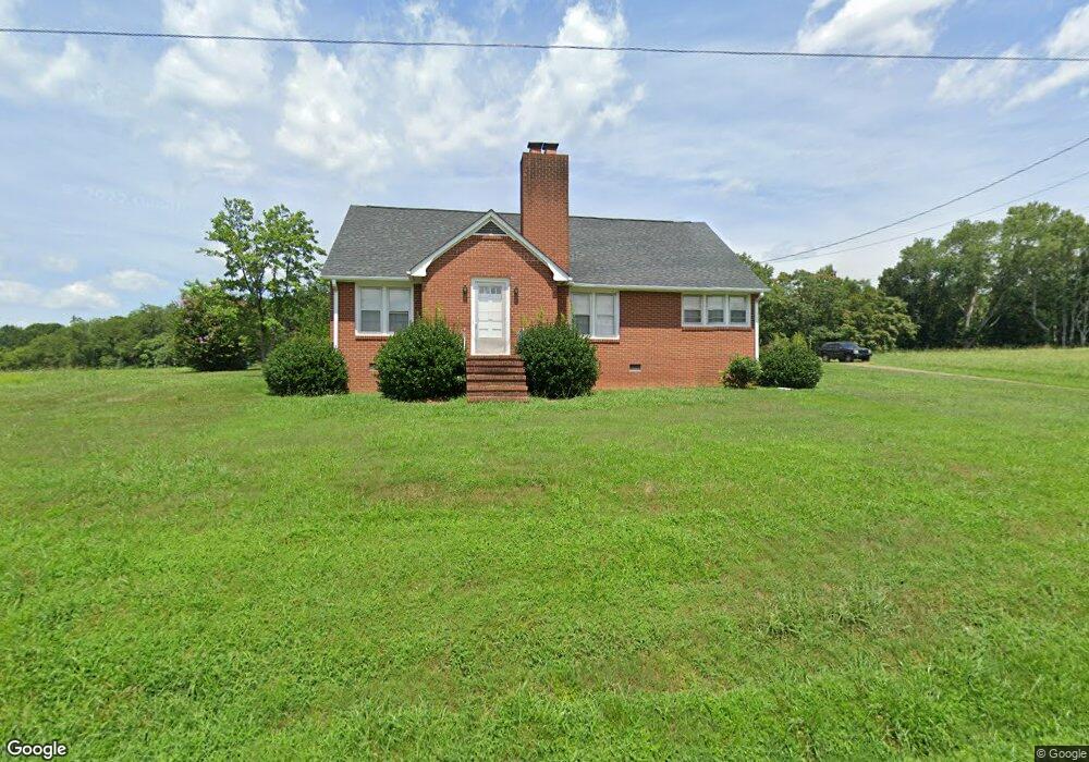
2082 Nc 268 Pilot Mountain, NC 27041
Estimated Value: $363,000 - $505,528
3
Beds
1
Bath
1,792
Sq Ft
$239/Sq Ft
Est. Value
About This Home
This home is located at 2082 Nc 268, Pilot Mountain, NC 27041 and is currently estimated at $428,882, approximately $239 per square foot. 2082 Nc 268 is a home located in Surry County with nearby schools including Pilot Mountain Elementary School, Pilot Mountain Middle School, and East Surry High School.
Ownership History
Date
Name
Owned For
Owner Type
Purchase Details
Closed on
Oct 3, 2023
Sold by
Pope Reid Teresa
Bought by
Reid Jan Lee
Current Estimated Value
Purchase Details
Closed on
Mar 24, 2022
Sold by
Lee Reid Jan and Pope Teresa
Bought by
Windes Connie Marie
Home Financials for this Owner
Home Financials are based on the most recent Mortgage that was taken out on this home.
Original Mortgage
$285,000
Interest Rate
4.42%
Mortgage Type
New Conventional
Create a Home Valuation Report for This Property
The Home Valuation Report is an in-depth analysis detailing your home's value as well as a comparison with similar homes in the area
Home Values in the Area
Average Home Value in this Area
Purchase History
| Date | Buyer | Sale Price | Title Company |
|---|---|---|---|
| Reid Jan Lee | -- | None Listed On Document | |
| Reid Jan Lee | -- | None Listed On Document | |
| Windes Connie Marie | $335,000 | Royster And Royster Pllc | |
| Reid Jan Lee | -- | Royster Mark S |
Source: Public Records
Mortgage History
| Date | Status | Borrower | Loan Amount |
|---|---|---|---|
| Previous Owner | Windes Connie Marie | $285,000 |
Source: Public Records
Tax History Compared to Growth
Tax History
| Year | Tax Paid | Tax Assessment Tax Assessment Total Assessment is a certain percentage of the fair market value that is determined by local assessors to be the total taxable value of land and additions on the property. | Land | Improvement |
|---|---|---|---|---|
| 2024 | $729 | $115,350 | $0 | $0 |
| 2023 | $1,707 | $114,520 | $0 | $0 |
| 2022 | $1,707 | $114,520 | $0 | $0 |
| 2021 | $1,313 | $274,200 | $0 | $0 |
| 2020 | $1,291 | $254,870 | $0 | $0 |
| 2019 | $1,465 | $283,230 | $0 | $0 |
| 2018 | $1,821 | $283,230 | $0 | $0 |
| 2017 | $1,848 | $283,230 | $0 | $0 |
| 2016 | $1,848 | $283,230 | $0 | $0 |
Source: Public Records
Map
Nearby Homes
- 0 Pine Ridge Trail
- 104 Windover Dr
- 267 Pine Ridge Trail
- 2952 N Carolina 268
- 1222 Bryant Mill Rd
- 106 Grants Home Trail
- 00 Whitaker Chapel Rd Unit 2
- 00 Whitaker Chapel Rd Unit 1
- 226 Lola Ln Unit 102
- 153 Chilton Rd
- TBD Golf Course Rd
- 0 S Key St
- TBD S Key St
- 3605 Nc 268
- 906 Long Hill Rd
- 402 Lynchburg Rd
- x Green Meadow Ln Unit 5 Ac S
- 267 S Boyles St
- 522 Butler St
- o N Carolina 268
- 2140 Nc 268
- 2151 Nc 268
- 140 Pilot Power Dam Rd
- 1990 Nc 268
- 135 Pilot Power Dam Rd
- 2184 Nc 268
- 248 Pilot Power Dam Rd
- 231 Sandy Creek Ln
- 2226 N Carolina 268
- 1924 Nc 268
- 273 Pilot Power Dam Rd
- 206 Sandy Creek Ln
- 2234 Nc 268
- 2234 Nc 268
- 164 Sandy Creek Ln
- 109 Sandy Creek Ln
- 142 Sandy Creek Ln
- 104 Sandy Creek Ln
- 1876 Nc 268
- 2264 Nc 268