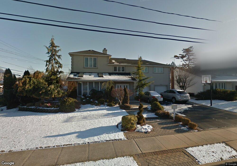
2082 Oliver Way Merrick, NY 11566
Estimated Value: $1,284,803 - $1,484,000
--
Bed
4
Baths
2,238
Sq Ft
$619/Sq Ft
Est. Value
About This Home
This home is located at 2082 Oliver Way, Merrick, NY 11566 and is currently estimated at $1,384,402, approximately $618 per square foot. 2082 Oliver Way is a home located in Nassau County with nearby schools including Burcham Elementary School, Merrick Avenue Middle School, and John F. Kennedy High School.
Ownership History
Date
Name
Owned For
Owner Type
Purchase Details
Closed on
Aug 18, 2009
Sold by
Popper Joseph
Bought by
Popper Joseph and Popper Cheryl Rauch
Current Estimated Value
Purchase Details
Closed on
Nov 19, 2007
Sold by
Didonna Scott
Bought by
Popper Joseph
Purchase Details
Closed on
May 16, 2002
Purchase Details
Closed on
Jul 15, 1997
Sold by
Newman Daniel M
Bought by
Didonna Scott and Didonna Esther
Create a Home Valuation Report for This Property
The Home Valuation Report is an in-depth analysis detailing your home's value as well as a comparison with similar homes in the area
Home Values in the Area
Average Home Value in this Area
Purchase History
| Date | Buyer | Sale Price | Title Company |
|---|---|---|---|
| Popper Joseph | -- | -- | |
| Popper Joseph | $895,000 | -- | |
| -- | -- | -- | |
| Didonna Scott | $260,000 | -- |
Source: Public Records
Tax History Compared to Growth
Tax History
| Year | Tax Paid | Tax Assessment Tax Assessment Total Assessment is a certain percentage of the fair market value that is determined by local assessors to be the total taxable value of land and additions on the property. | Land | Improvement |
|---|---|---|---|---|
| 2025 | $20,884 | $688 | $284 | $404 |
| 2024 | $4,718 | $715 | $295 | $420 |
| 2023 | $18,858 | $754 | $311 | $443 |
| 2022 | $16,347 | $732 | $302 | $430 |
| 2021 | $16,067 | $765 | $292 | $473 |
| 2020 | $16,067 | $814 | $580 | $234 |
| 2019 | $15,484 | $873 | $583 | $290 |
| 2018 | $15,597 | $931 | $0 | $0 |
| 2017 | $11,380 | $989 | $588 | $401 |
| 2016 | $15,612 | $1,047 | $542 | $505 |
| 2015 | $4,385 | $1,105 | $510 | $595 |
| 2014 | $4,385 | $1,105 | $510 | $595 |
| 2013 | $4,510 | $1,201 | $554 | $647 |
Source: Public Records
Map
Nearby Homes
- 2072 Brighton Way
- 2956 Judith Dr
- 2810 Wynsum Ave
- 110 Hampton Way
- 2884 Bay Dr
- 2819 Harbor Rd
- 2863 Harbor Rd
- 2074 Ellen Dr
- 72 Lake End Rd
- 2858 Shore Rd
- 2729 Shore Dr
- 2466 Army Place
- 1952 Julian Ln
- 23 Bay St
- 1945 Byron Rd
- 217 Bayview Ave
- 2903 Preston Ln
- 1944 Lowell Ln
- 1360-1370 Merrick Rd
- 2476 Florin Ct
- 2072 Oliver Way
- 2081 Holland Way
- 2071 Holland Way
- 2854 Hewlett Ave
- 2064 Oliver Way
- 2065 Holland Way
- 2080 Oliver Way
- 2089 Holland Way
- 2071 Oliver Way
- 2059 Holland Way
- 2058 Oliver Way
- 2065 Oliver Way
- 2099 Holland Way
- 2098 Oliver Way
- 2847 Hewlett Ave
- 2080 Holland Way
- 2072 Holland Way
- 98 Beverly Way
- 2053 Holland Way
- 2059 Oliver Way