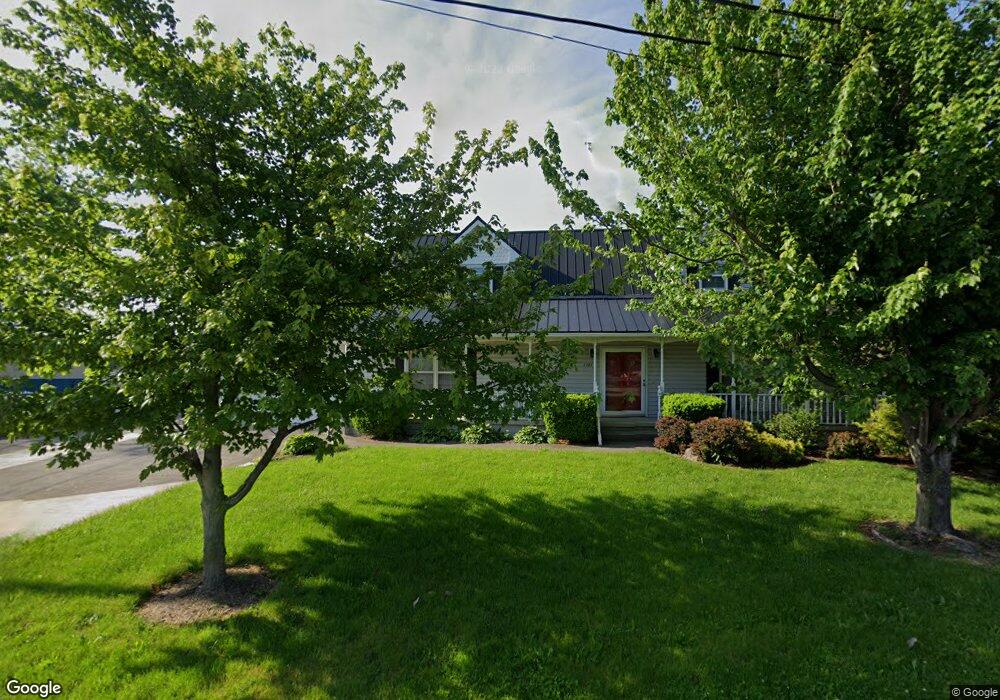
2083 E Sand Rd Port Clinton, OH 43452
Estimated Value: $459,750 - $549,000
3
Beds
3
Baths
2,093
Sq Ft
$247/Sq Ft
Est. Value
About This Home
This home is located at 2083 E Sand Rd, Port Clinton, OH 43452 and is currently estimated at $516,938, approximately $246 per square foot. 2083 E Sand Rd is a home located in Ottawa County with nearby schools including Bataan Memorial Primary School, Bataan Memorial Intermediate School, and Port Clinton Middle School.
Ownership History
Date
Name
Owned For
Owner Type
Purchase Details
Closed on
Feb 21, 2019
Sold by
Klubnik Donetta and Doneta R Klubnik Living Trust
Bought by
Sand Rose Llc
Current Estimated Value
Purchase Details
Closed on
Sep 21, 2016
Sold by
Sand Rose Llc and Klubnik Donetta
Bought by
Donetta R Klubnik Living Trust and Klubnik Donetta
Purchase Details
Closed on
Mar 18, 2015
Sold by
Klubnik Donetta R and Albright Michelle A
Bought by
Sand Rose Llc
Purchase Details
Closed on
Dec 30, 2002
Sold by
Klubnik Raymond and Klubnik Donetta
Bought by
Klubnik Donetta R and Klubnik Raymond M
Purchase Details
Closed on
Dec 19, 2000
Sold by
Ronald E Company Sr Trst
Bought by
Klubnik Raymond and Klubnik Donetta
Home Financials for this Owner
Home Financials are based on the most recent Mortgage that was taken out on this home.
Original Mortgage
$100,000
Interest Rate
7.8%
Mortgage Type
New Conventional
Create a Home Valuation Report for This Property
The Home Valuation Report is an in-depth analysis detailing your home's value as well as a comparison with similar homes in the area
Home Values in the Area
Average Home Value in this Area
Purchase History
| Date | Buyer | Sale Price | Title Company |
|---|---|---|---|
| Sand Rose Llc | -- | None Available | |
| Donetta R Klubnik Living Trust | -- | None Available | |
| Sand Rose Llc | -- | A S K Services Inc | |
| Klubnik Donetta R | -- | None Available | |
| Klubnik Raymond | $215,000 | -- |
Source: Public Records
Mortgage History
| Date | Status | Borrower | Loan Amount |
|---|---|---|---|
| Previous Owner | Klubnik Raymond | $100,000 |
Source: Public Records
Tax History Compared to Growth
Tax History
| Year | Tax Paid | Tax Assessment Tax Assessment Total Assessment is a certain percentage of the fair market value that is determined by local assessors to be the total taxable value of land and additions on the property. | Land | Improvement |
|---|---|---|---|---|
| 2024 | $5,011 | $141,107 | $74,127 | $66,980 |
| 2023 | $5,011 | $87,039 | $30,881 | $56,158 |
| 2022 | $3,419 | $87,038 | $30,880 | $56,158 |
| 2021 | $3,415 | $87,040 | $30,880 | $56,160 |
| 2020 | $3,550 | $87,040 | $30,880 | $56,160 |
| 2019 | $3,498 | $87,040 | $30,880 | $56,160 |
| 2018 | $3,391 | $87,040 | $30,880 | $56,160 |
| 2017 | $3,348 | $84,540 | $30,880 | $53,660 |
| 2016 | $3,356 | $84,540 | $30,880 | $53,660 |
| 2015 | $3,376 | $84,540 | $30,880 | $53,660 |
| 2014 | $3,405 | $84,540 | $30,880 | $53,660 |
| 2013 | $3,415 | $84,540 | $30,880 | $53,660 |
Source: Public Records
Map
Nearby Homes
- 2130 E Sand Rd
- 19 N Beach St
- 12 N Beach St
- 2650 E Harbor Rd
- 0 E Harbor Rd
- 2006 E Harbor Rd
- 34 Grande Lake Dr Unit C
- 1807 E Perry St Unit 69
- 1803 E Perry St Unit 36
- 1801 E Perry St Unit 22
- 2321 E State Rd
- 2348 E Sand Rd
- 635 S Liz Ln
- 2350 E Sand Rd
- 115 Driftwood Dr
- 168 Morningside Dr
- 680 S Plasterbed Rd Unit 4-7
- 2322 E State Rd Unit 12
- 188 Driftwood Dr
- 1805 Briarcrest Dr
- 349 N Y Place
- 344 N Miami Place
- 350 N Miami Place
- 355 N Y Place
- 354 N Miami Place
- 2026 E Harbor Rd Unit D
- 2026 E Harbor Rd Unit B-C
- 2026 E Harbor Rd Unit B
- 2026 E Harbor Rd Unit G
- 2026 E Harbor Rd Unit E
- 2026 E Harbor Rd Unit C
- 359 N Y Place
- 322 N Miami Beach
- 360 N Miami Place
- 322 N Miami Place
- 2039 E Harbor Rd
- 328 N Miami Place
- 363 N Y Place
- 2096 E Sand Rd
- 364 N Miami Place