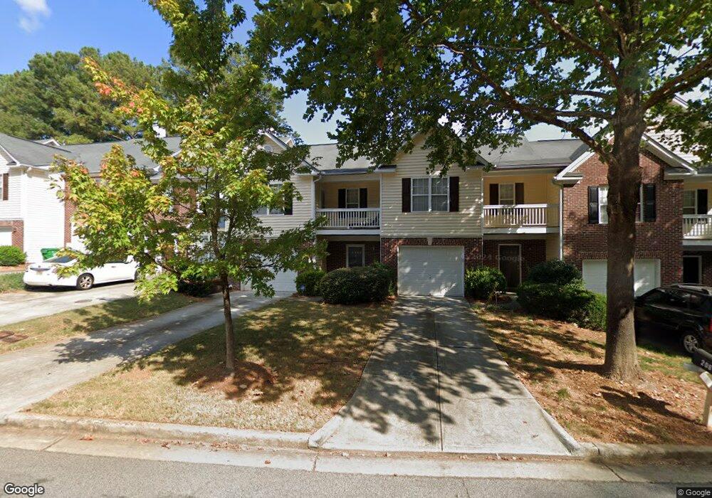
2083 Manhattan Pkwy Unit 2083 Decatur, GA 30035
Estimated Value: $232,220 - $247,000
3
Beds
3
Baths
1,620
Sq Ft
$148/Sq Ft
Est. Value
About This Home
This home is located at 2083 Manhattan Pkwy Unit 2083, Decatur, GA 30035 and is currently estimated at $240,055, approximately $148 per square foot. 2083 Manhattan Pkwy Unit 2083 is a home located in DeKalb County with nearby schools including Rowland Elementary School, Mary McLeod Bethune Middle School, and Towers High School.
Ownership History
Date
Name
Owned For
Owner Type
Purchase Details
Closed on
Apr 24, 2009
Sold by
Bank Of America Na
Bought by
Condoll Bethany
Current Estimated Value
Home Financials for this Owner
Home Financials are based on the most recent Mortgage that was taken out on this home.
Original Mortgage
$68,240
Interest Rate
4.79%
Mortgage Type
FHA
Purchase Details
Closed on
May 6, 2008
Sold by
Gardner Tamika D
Bought by
Bank Of America Na
Create a Home Valuation Report for This Property
The Home Valuation Report is an in-depth analysis detailing your home's value as well as a comparison with similar homes in the area
Home Values in the Area
Average Home Value in this Area
Purchase History
| Date | Buyer | Sale Price | Title Company |
|---|---|---|---|
| Condoll Bethany | $69,500 | -- | |
| Bank Of America Na | $26,400 | -- |
Source: Public Records
Mortgage History
| Date | Status | Borrower | Loan Amount |
|---|---|---|---|
| Previous Owner | Condoll Bethany | $68,240 |
Source: Public Records
Tax History Compared to Growth
Tax History
| Year | Tax Paid | Tax Assessment Tax Assessment Total Assessment is a certain percentage of the fair market value that is determined by local assessors to be the total taxable value of land and additions on the property. | Land | Improvement |
|---|---|---|---|---|
| 2024 | $2,832 | $100,160 | $20,000 | $80,160 |
| 2023 | $2,832 | $96,920 | $20,000 | $76,920 |
| 2022 | $2,116 | $72,240 | $10,000 | $62,240 |
| 2021 | $1,798 | $58,480 | $10,000 | $48,480 |
| 2020 | $1,691 | $53,640 | $10,000 | $43,640 |
| 2019 | $1,594 | $50,120 | $10,000 | $40,120 |
| 2018 | $1,194 | $46,120 | $8,000 | $38,120 |
| 2017 | $1,271 | $38,440 | $8,000 | $30,440 |
| 2016 | $947 | $29,920 | $3,880 | $26,040 |
| 2014 | $615 | $20,120 | $3,880 | $16,240 |
Source: Public Records
Map
Nearby Homes
- 4643 Grand Central Pkwy
- 2109 Manhattan Pkwy
- 4617 Grand Central Pkwy
- 4616 Grand Central Pkwy
- 2127 Manhattan Pkwy
- 4612 Grand Central Pkwy
- 1830 Broadway St
- 1923 Manhattan Pkwy Unit 183
- 2065 Resting Creek Dr
- 5148 Covington Hwy
- 5181 Covington Hwy
- 5169 Covington Hwy
- 5160 Covington Hwy
- 5160 Covington Hwy Unit 18
- 5159 Covington Hwy
- 1764 Big Valley Way Unit 3
- 4664 Seagull Cove
- 1984 Wedgewood Dr Unit 17C
- 2083 Manhattan Pkwy
- 2085 Manhattan Pkwy
- 2081 Manhattan Pkwy
- 2081 Manhattan Pkwy Unit 2081
- 2089 Manhattan Pkwy
- 2079 Manhattan Pkwy Unit 2079
- 2079 Manhattan Pkwy
- 2079 Manhattan Pkwy
- 2091 Manhattan Pkwy
- 2091 Manhattan Pkwy Unit 81
- 0 Lenox Ave Unit 7059203
- 0 Lenox Ave Unit 8427519
- 2093 Manhattan Pkwy
- 2067 Manhattan Pkwy
- 4649 Grand Central Pkwy
- 4651 Grand Central Pkwy
- 4647 Grand Central Pkwy
- 4653 Grand Central Pkwy
- 4645 Grand Central Pkwy
- 2065 Manhattan Pkwy Unit 88