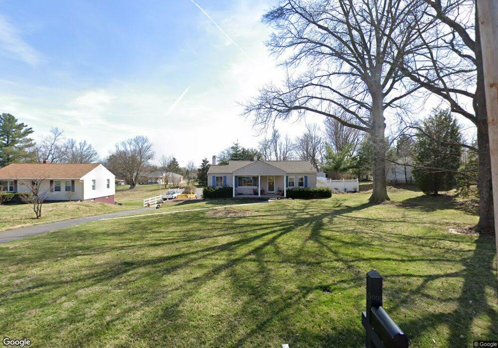
2083 Miles Rd Cincinnati, OH 45231
New Burlington NeighborhoodEstimated Value: $239,000 - $264,000
3
Beds
3
Baths
1,514
Sq Ft
$165/Sq Ft
Est. Value
About This Home
This home is located at 2083 Miles Rd, Cincinnati, OH 45231 and is currently estimated at $249,667, approximately $164 per square foot. 2083 Miles Rd is a home located in Hamilton County with nearby schools including Mt Healthy High School, Hamilton County Mathematics and Science Academy, and Central Montessori Academy.
Ownership History
Date
Name
Owned For
Owner Type
Purchase Details
Closed on
May 18, 2009
Sold by
Rouse Kenneth Randall and Rouse Deborah L
Bought by
Rouse Kenneth Randall and Rouse Deborah L
Current Estimated Value
Home Financials for this Owner
Home Financials are based on the most recent Mortgage that was taken out on this home.
Original Mortgage
$139,397
Interest Rate
4.84%
Mortgage Type
FHA
Create a Home Valuation Report for This Property
The Home Valuation Report is an in-depth analysis detailing your home's value as well as a comparison with similar homes in the area
Home Values in the Area
Average Home Value in this Area
Purchase History
| Date | Buyer | Sale Price | Title Company |
|---|---|---|---|
| Rouse Kenneth Randall | -- | Concord Title Agency Inc |
Source: Public Records
Mortgage History
| Date | Status | Borrower | Loan Amount |
|---|---|---|---|
| Closed | Rouse Kenneth Randall | $139,397 |
Source: Public Records
Tax History
| Year | Tax Paid | Tax Assessment Tax Assessment Total Assessment is a certain percentage of the fair market value that is determined by local assessors to be the total taxable value of land and additions on the property. | Land | Improvement |
|---|---|---|---|---|
| 2025 | $4,079 | $69,850 | $12,121 | $57,729 |
| 2024 | $4,053 | $69,850 | $12,121 | $57,729 |
| 2023 | $3,844 | $69,850 | $12,121 | $57,729 |
| 2022 | $3,739 | $48,920 | $11,823 | $37,097 |
| 2021 | $3,648 | $48,920 | $11,823 | $37,097 |
| 2020 | $3,692 | $48,920 | $11,823 | $37,097 |
| 2019 | $3,117 | $38,521 | $9,310 | $29,211 |
| 2018 | $3,134 | $38,521 | $9,310 | $29,211 |
| 2017 | $2,981 | $38,521 | $9,310 | $29,211 |
| 2016 | $2,709 | $34,535 | $8,624 | $25,911 |
| 2015 | $2,726 | $34,535 | $8,624 | $25,911 |
| 2014 | $2,713 | $34,535 | $8,624 | $25,911 |
| 2013 | $3,017 | $39,246 | $9,800 | $29,446 |
Source: Public Records
Map
Nearby Homes
- 2005 Miles Rd
- 9846 Pinedale Dr
- 9925 Grasscreek Ct
- 2317 Magdalena Dr
- 2528 Mariposa St
- 9978 Greenriver Dr
- 2473 Schon Dr
- 10228 Springbeauty Ln
- 1805 Miles Rd
- 624 Brightview Dr
- 626 Brightview Dr
- 606 Brightview Dr
- 610 Brightview Dr
- 622 Brightview Dr
- 614 Brightview Dr
- 616 Brightview Dr
- 620 Brightview Dr
- 612 Brightview Dr
- 604 Brightview Dr
- 2547 Adams Rd
- 2093 Miles Rd
- 2073 Miles Rd
- 2101 Miles Rd
- 2065 Miles Rd
- 2103 Miles Rd
- 2052 Arrowood Place
- 2058 Arrowood Place
- 2046 Arrowood Place
- 2088 Miles Rd
- 2100 Miles Rd
- 2066 Miles Rd
- 2040 Arrowood Place
- 2064 Arrowood Place
- 2105 Miles Rd
- 2094 Miles Rd
- 2055 Miles Rd
- 2074 Miles Rd
- 0 Arrowood Place Unit 785758
- 0 Arrowood Place Unit 744023
- 0 Arrowood Place Unit 619079
Your Personal Tour Guide
Ask me questions while you tour the home.