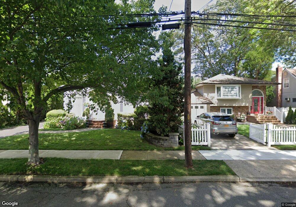
2083 Washington St Merrick, NY 11566
Estimated Value: $488,000 - $874,487
--
Bed
2
Baths
1,129
Sq Ft
$603/Sq Ft
Est. Value
About This Home
This home is located at 2083 Washington St, Merrick, NY 11566 and is currently estimated at $681,244, approximately $603 per square foot. 2083 Washington St is a home with nearby schools including Merrick Avenue Middle School, Sanford H Calhoun High School, and Grace Christian Academy.
Ownership History
Date
Name
Owned For
Owner Type
Purchase Details
Closed on
Sep 27, 2018
Sold by
Rush Mary
Bought by
Brulinski Marek and Brulinski Iwona
Current Estimated Value
Home Financials for this Owner
Home Financials are based on the most recent Mortgage that was taken out on this home.
Original Mortgage
$260,000
Outstanding Balance
$226,735
Interest Rate
4.5%
Mortgage Type
New Conventional
Estimated Equity
$454,509
Purchase Details
Closed on
Jul 18, 2003
Sold by
Pagano Eileen
Create a Home Valuation Report for This Property
The Home Valuation Report is an in-depth analysis detailing your home's value as well as a comparison with similar homes in the area
Home Values in the Area
Average Home Value in this Area
Purchase History
| Date | Buyer | Sale Price | Title Company |
|---|---|---|---|
| Brulinski Marek | $505,000 | Westcor Land Title Ins Co | |
| -- | $400,000 | -- |
Source: Public Records
Mortgage History
| Date | Status | Borrower | Loan Amount |
|---|---|---|---|
| Open | Brulinski Marek | $260,000 |
Source: Public Records
Tax History Compared to Growth
Tax History
| Year | Tax Paid | Tax Assessment Tax Assessment Total Assessment is a certain percentage of the fair market value that is determined by local assessors to be the total taxable value of land and additions on the property. | Land | Improvement |
|---|---|---|---|---|
| 2025 | $15,876 | $523 | $194 | $329 |
| 2024 | $3,598 | $531 | $197 | $334 |
| 2023 | $13,829 | $531 | $197 | $334 |
| 2022 | $13,829 | $545 | $202 | $343 |
| 2021 | $18,624 | $524 | $194 | $330 |
| 2020 | $12,083 | $536 | $407 | $129 |
| 2019 | $2,669 | $574 | $408 | $166 |
| 2018 | $6,102 | $613 | $0 | $0 |
| 2017 | $6,065 | $651 | $411 | $240 |
| 2016 | $8,851 | $690 | $394 | $296 |
| 2015 | $2,889 | $728 | $370 | $358 |
| 2014 | $2,889 | $728 | $370 | $358 |
| 2013 | $2,869 | $764 | $389 | $375 |
Source: Public Records
Map
Nearby Homes
- 1931 Miller Place
- 96 Thelma Ave
- 179 Commonwealth Ave
- 1818 Gormley Ave
- 25 Babylon Turnpike
- 2291 Girard Place
- 2991 Girard Place
- 1729 Gormley Ave
- 1922 Horatio Ave
- 138 Hewlett Ave
- 1707 Carroll Ave
- 1938 Meadowbrook Rd
- 1690 Argyle Rd
- 131 Gregory Ave
- 10 Central Pkwy
- 49 Princeton Place
- 1824 Gildersleeve St
- 1674 Birch Dr
- 1741 Pettit Ave
- 5 Oak Brook Ln
- 2089 Washington St
- 2079 Washington St
- 2079 Washington St
- 1 Washington
- 2073 Washington St
- 29 Sherman St
- 2095 Washington St
- 33 Sherman St
- 37 Sherman St
- 20 Sherman St
- 2090 Sherman St
- 2084 Washington St
- 2067 Washington St
- 2101 Washington St
- 15 Sherman St
- 2074 Washington St
- 2070 Sherman St
- 122 Washington St
- 2105 Washington St
- 2098 Washington St