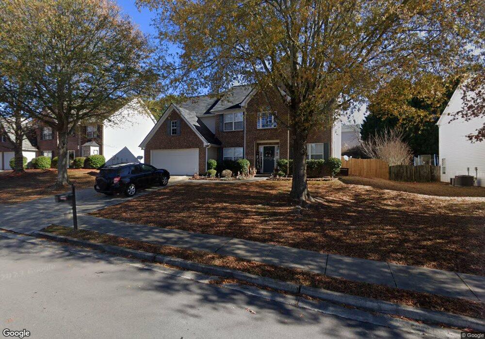
2084 Pierce Way Buford, GA 30519
Estimated Value: $426,691 - $448,000
4
Beds
3
Baths
2,678
Sq Ft
$162/Sq Ft
Est. Value
About This Home
This home is located at 2084 Pierce Way, Buford, GA 30519 and is currently estimated at $432,673, approximately $161 per square foot. 2084 Pierce Way is a home located in Gwinnett County with nearby schools including Freeman's Mill Elementary School, Twin Rivers Middle School, and Mountain View High School.
Ownership History
Date
Name
Owned For
Owner Type
Purchase Details
Closed on
Jun 4, 2004
Sold by
Winmark Homes Inc
Bought by
Phun Patricia
Current Estimated Value
Home Financials for this Owner
Home Financials are based on the most recent Mortgage that was taken out on this home.
Original Mortgage
$37,000
Interest Rate
5.72%
Mortgage Type
New Conventional
Create a Home Valuation Report for This Property
The Home Valuation Report is an in-depth analysis detailing your home's value as well as a comparison with similar homes in the area
Home Values in the Area
Average Home Value in this Area
Purchase History
| Date | Buyer | Sale Price | Title Company |
|---|---|---|---|
| Phun Patricia | $185,200 | -- |
Source: Public Records
Mortgage History
| Date | Status | Borrower | Loan Amount |
|---|---|---|---|
| Closed | Phun Patricia | $37,000 | |
| Open | Phun Patricia | $148,150 |
Source: Public Records
Tax History
| Year | Tax Paid | Tax Assessment Tax Assessment Total Assessment is a certain percentage of the fair market value that is determined by local assessors to be the total taxable value of land and additions on the property. | Land | Improvement |
|---|---|---|---|---|
| 2025 | $4,814 | $179,200 | $26,000 | $153,200 |
| 2024 | $4,693 | $166,400 | $30,000 | $136,400 |
| 2023 | $4,693 | $166,400 | $30,000 | $136,400 |
| 2022 | $4,248 | $146,440 | $28,000 | $118,440 |
| 2021 | $3,614 | $113,120 | $20,000 | $93,120 |
| 2020 | $3,379 | $101,040 | $20,000 | $81,040 |
| 2019 | $3,283 | $101,040 | $20,000 | $81,040 |
| 2018 | $3,122 | $93,480 | $16,800 | $76,680 |
| 2016 | $2,757 | $75,720 | $12,800 | $62,920 |
| 2015 | $2,622 | $70,480 | $11,200 | $59,280 |
| 2014 | -- | $70,480 | $11,200 | $59,280 |
Source: Public Records
Map
Nearby Homes
- 2461 Lance Ridge Way
- 1987 Pierce Way
- 1825 Ashton Brooke Ln
- 2159 Shin Ct
- 2373 Hampton Park Dr
- 2305 Braselton Hwy
- 2755 Fort Daniels Dr
- 0 Hog Mountain Church Road and Auburn Rd
- 2116 Baltic Ln
- 3973 Tridens Place
- 2727 Captain Ct
- 2415 Matlin Way
- 2228 Lakeview Bend Way
- 1909 Lakeview Bend Way
- 2170 Peachford Ln
- 1728 Scouts Walk NE
- 2152 Paces Vale Place
- 1515 Brisbane Dr
- 1965 Holland Park Dr NE
- 1722 Laurel Song Trail Unit 1
- 2074 Pierce Way
- 2094 Pierce Way
- 2536 Betty Sue Dr
- 2064 Pierce Way
- 2064 Pierce Way Unit 2064
- 2104 Pierce Way
- 2546 Betty Sue Dr Unit 2
- 2526 Betty Sue Dr
- 2087 Pierce Way
- 2097 Pierce Way
- 2077 Pierce Way
- 2516 Betty Sue Dr
- 2107 Pierce Way
- 2054 Pierce Way
- 2054 Pierce Way
- 2114 Pierce Way
- 2067 Pierce Way
- 2556 Betty Sue Dr
- 2082 Binnies Way
- 2117 Pierce Way Unit 1
Your Personal Tour Guide
Ask me questions while you tour the home.