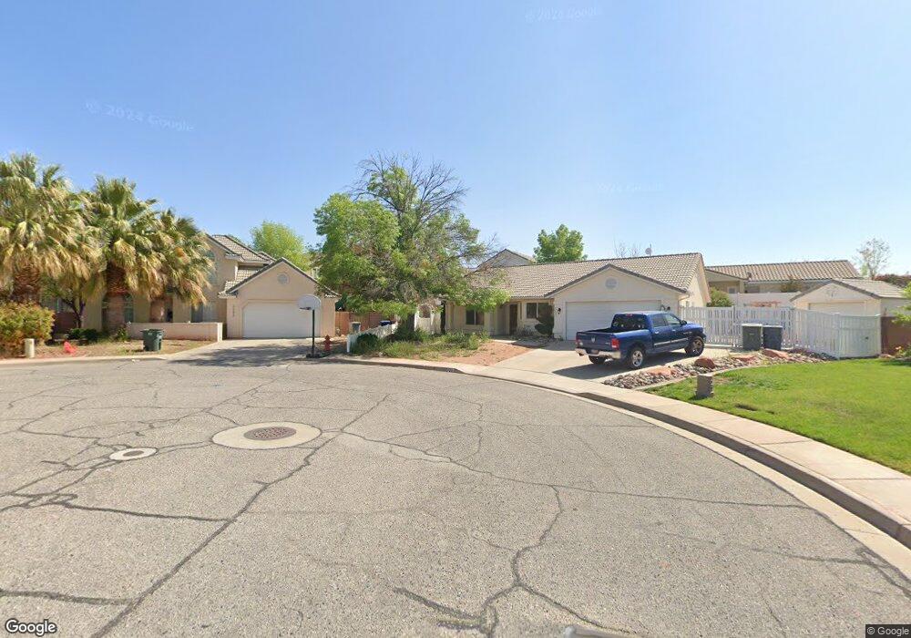
2085 E 70 S St. George, UT 84790
Estimated Value: $482,000 - $582,000
4
Beds
3
Baths
2,040
Sq Ft
$256/Sq Ft
Est. Value
About This Home
This home is located at 2085 E 70 S, St. George, UT 84790 and is currently estimated at $521,422, approximately $255 per square foot. 2085 E 70 S is a home located in Washington County with nearby schools including Panorama School, Fossil Ridge Intermediate School, and Pine View Middle School.
Ownership History
Date
Name
Owned For
Owner Type
Purchase Details
Closed on
Nov 28, 2011
Sold by
Staples Kevin R and Staples Alyce M
Bought by
Ramos David J and Ramos Trisha L
Current Estimated Value
Home Financials for this Owner
Home Financials are based on the most recent Mortgage that was taken out on this home.
Original Mortgage
$164,900
Outstanding Balance
$111,423
Interest Rate
4.06%
Mortgage Type
New Conventional
Estimated Equity
$409,999
Purchase Details
Closed on
May 23, 2005
Sold by
Costanza John J and Costanza Kelli A
Bought by
Staples Kevin R and Staples Alyce M
Home Financials for this Owner
Home Financials are based on the most recent Mortgage that was taken out on this home.
Original Mortgage
$234,000
Interest Rate
7.77%
Mortgage Type
Adjustable Rate Mortgage/ARM
Create a Home Valuation Report for This Property
The Home Valuation Report is an in-depth analysis detailing your home's value as well as a comparison with similar homes in the area
Purchase History
| Date | Buyer | Sale Price | Title Company |
|---|---|---|---|
| Ramos David J | -- | American Secure Title St Geo | |
| Staples Kevin R | -- | Southern Utah Title Co |
Source: Public Records
Mortgage History
| Date | Status | Borrower | Loan Amount |
|---|---|---|---|
| Open | Ramos David J | $164,900 | |
| Previous Owner | Staples Kevin R | $234,000 |
Source: Public Records
Tax History
| Year | Tax Paid | Tax Assessment Tax Assessment Total Assessment is a certain percentage of the fair market value that is determined by local assessors to be the total taxable value of land and additions on the property. | Land | Improvement |
|---|---|---|---|---|
| 2025 | $1,841 | $270,105 | $59,400 | $210,705 |
| 2023 | $1,905 | $284,625 | $52,800 | $231,825 |
| 2022 | $2,025 | $284,515 | $52,250 | $232,265 |
| 2021 | $1,802 | $377,600 | $80,000 | $297,600 |
| 2020 | $1,657 | $327,000 | $60,000 | $267,000 |
| 2019 | $1,623 | $312,800 | $60,000 | $252,800 |
| 2018 | $1,591 | $153,725 | $0 | $0 |
| 2017 | $1,551 | $149,930 | $0 | $0 |
| 2016 | $1,618 | $144,650 | $0 | $0 |
| 2015 | $1,549 | $132,825 | $0 | $0 |
| 2014 | $1,451 | $125,235 | $0 | $0 |
Source: Public Records
Map
Nearby Homes
- 4204 S Crimson Cir Unit 10
- 4186 S Crimson Cir Unit 13
- 78 N 2000 E
- 236 S 2020 Cir E
- 210 N Mall Dr Unit 115
- 210 N Mall Dr Unit 64
- 210 N Mall Dr Unit 27
- 145 N Mall Dr Unit 35
- 145 N Mall Dr Unit 57
- 232 S Acantilado Cir
- 5664 S Carnelian Pkwy
- 756 W Owen Dr
- 86 S Acantilado Dr
- 2294 E 170 N
- 230 N 2230 E
- 0 S Mall Dr
- 345 N 2450 E Unit 120
- 345 N 2450 E Unit 220
- 0 Null Unit 26-269072
- 345 N 2450 E Unit 120
- 2085 E 70 South Cir
- 2077 E 70 S
- 2077 E 70 South Cir
- 54 S 2110 East Cir
- 54 S 2110 E
- 2082 E 70 S
- 2082 E 70 South Cir
- 66 S 2110 East Cir
- 66 S 2110 E
- 2078 E 10 S
- 2084 E 10 S
- 78 S 2110 East Cir
- 78 S 2110 E
- 2074 E 70 S
- 2074 E 70 South Cir
- 47 S 2060 E
- 2069 E 70 South Cir
- 40 S 2110 East Cir
- 40 S 2110 E
- 2070 E 10 South St
Your Personal Tour Guide
Ask me questions while you tour the home.