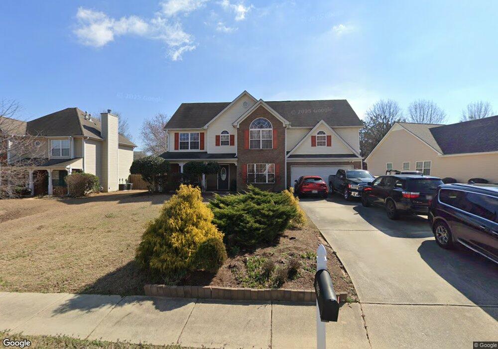
2085 Grant Ave McDonough, GA 30252
Estimated Value: $358,330 - $363,000
5
Beds
4
Baths
2,778
Sq Ft
$130/Sq Ft
Est. Value
About This Home
This home is located at 2085 Grant Ave, McDonough, GA 30252 and is currently estimated at $360,583, approximately $129 per square foot. 2085 Grant Ave is a home located in Henry County with nearby schools including Tussahaw Elementary School, Locust Grove Middle School, and Locust Grove High School.
Ownership History
Date
Name
Owned For
Owner Type
Purchase Details
Closed on
May 17, 2013
Sold by
Crossley Maurice
Bought by
Crossley Maurice and Crossley Anna Jean
Current Estimated Value
Home Financials for this Owner
Home Financials are based on the most recent Mortgage that was taken out on this home.
Original Mortgage
$154,000
Outstanding Balance
$108,831
Interest Rate
3.42%
Mortgage Type
New Conventional
Estimated Equity
$251,752
Purchase Details
Closed on
Jun 9, 2005
Sold by
Mhm Holdings Llc
Bought by
Peachtree Homes Inc
Home Financials for this Owner
Home Financials are based on the most recent Mortgage that was taken out on this home.
Original Mortgage
$599,625
Interest Rate
5.7%
Create a Home Valuation Report for This Property
The Home Valuation Report is an in-depth analysis detailing your home's value as well as a comparison with similar homes in the area
Home Values in the Area
Average Home Value in this Area
Purchase History
| Date | Buyer | Sale Price | Title Company |
|---|---|---|---|
| Crossley Maurice | -- | -- | |
| Peachtree Homes Inc | $195,000 | -- |
Source: Public Records
Mortgage History
| Date | Status | Borrower | Loan Amount |
|---|---|---|---|
| Open | Crossley Maurice | $154,000 | |
| Previous Owner | Peachtree Homes Inc | $599,625 |
Source: Public Records
Tax History Compared to Growth
Tax History
| Year | Tax Paid | Tax Assessment Tax Assessment Total Assessment is a certain percentage of the fair market value that is determined by local assessors to be the total taxable value of land and additions on the property. | Land | Improvement |
|---|---|---|---|---|
| 2025 | $575 | $144,560 | $18,000 | $126,560 |
| 2024 | $575 | $141,880 | $18,000 | $123,880 |
| 2023 | $3,629 | $133,600 | $16,000 | $117,600 |
| 2022 | $3,704 | $115,440 | $16,000 | $99,440 |
| 2021 | $3,121 | $90,760 | $16,000 | $74,760 |
| 2020 | $3,026 | $86,720 | $12,000 | $74,720 |
| 2019 | $2,792 | $77,800 | $12,000 | $65,800 |
| 2018 | $2,659 | $74,320 | $12,000 | $62,320 |
| 2016 | $2,488 | $69,880 | $8,800 | $61,080 |
| 2015 | $2,369 | $65,200 | $8,800 | $56,400 |
| 2014 | $2,389 | $65,080 | $10,000 | $55,080 |
Source: Public Records
Map
Nearby Homes
- 5120 Redcoat Ln
- 167 Classica Dr
- 5009 Yankee Doodle Dr
- 3227 Puritan Way
- 3305 Hancock Point
- 8008 Revere Dr Unit 1
- 9054 Dawes Crossing
- 0 King Mill Rd Unit 10647914
- 0 King Mill Rd Unit 7684355
- 435 Rabbit Run
- 308 Jade Laurel Ln
- 390 Coan Dr
- 1579 S Bethany Rd
- 75 Price Dr W
- 170 Fresh Laurel Ln
- 153 Fresh Laurel Ln
- 560 Coan Dr
- 0 Nail Mill Rd
- 201 Nina Cir
- 2087 Grant Ave Unit 1
- 2083 Grant Ave
- 7020 Van Buren Ct
- 2089 Grant Ave
- 2081 Grant Ave
- 2084 Grant Ave
- 2082 Grant Ave Unit 65
- 2082 Grant Ave
- 7025 Van Buren Ct
- 2086 Grant Ave
- 7010 Van Buren Ct
- 2091 Grant Ave Unit 101
- 2091 Grant Ave
- 2080 Grant Ave
- 2088 Grant Ave
- 0 Lincoln Log Way Unit 8708369
- 0 Lincoln Log Way Unit 8582708
- 0 Lincoln Log Way Unit 3254646
- 0 Lincoln Log Way Unit 2837053
- 0 Lincoln Log Way Unit 7263552