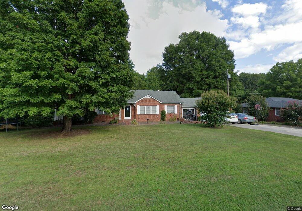
2085 Lower Palmer Rd Salisbury, NC 28146
Estimated Value: $278,000 - $328,000
Studio
2
Baths
1,798
Sq Ft
$167/Sq Ft
Est. Value
About This Home
This home is located at 2085 Lower Palmer Rd, Salisbury, NC 28146 and is currently estimated at $300,986, approximately $167 per square foot. 2085 Lower Palmer Rd is a home located in Rowan County with nearby schools including Rockwell Elementary School, Charles C Erwin Middle School, and East Rowan High School.
Ownership History
Date
Name
Owned For
Owner Type
Purchase Details
Closed on
Jul 9, 2021
Sold by
Cruse Susan Morgan and Cruse Steve A
Bought by
Cruse Patrick R
Current Estimated Value
Home Financials for this Owner
Home Financials are based on the most recent Mortgage that was taken out on this home.
Original Mortgage
$144,000
Outstanding Balance
$130,658
Interest Rate
2.9%
Mortgage Type
New Conventional
Estimated Equity
$170,328
Purchase Details
Closed on
Jan 29, 2021
Sold by
Morgan Hayes Alexander and Morgan Bonnie
Bought by
Cruse Susan Morgan and Cruse Steve A
Purchase Details
Closed on
May 24, 2012
Sold by
Morgan Rucky W and Morgan Hayes Alexander
Bought by
Cruse Steven A and Cruse Suzanne Morgan
Create a Home Valuation Report for This Property
The Home Valuation Report is an in-depth analysis detailing your home's value as well as a comparison with similar homes in the area
Purchase History
| Date | Buyer | Sale Price | Title Company |
|---|---|---|---|
| Cruse Patrick R | $180,000 | None Available | |
| Cruse Susan Morgan | -- | None Available | |
| Cruse Steven A | -- | None Available |
Source: Public Records
Mortgage History
| Date | Status | Borrower | Loan Amount |
|---|---|---|---|
| Open | Cruse Patrick R | $144,000 |
Source: Public Records
Tax History
| Year | Tax Paid | Tax Assessment Tax Assessment Total Assessment is a certain percentage of the fair market value that is determined by local assessors to be the total taxable value of land and additions on the property. | Land | Improvement |
|---|---|---|---|---|
| 2025 | $1,725 | $257,428 | $46,056 | $211,372 |
| 2024 | $1,725 | $257,428 | $46,056 | $211,372 |
| 2023 | $1,725 | $257,428 | $46,056 | $211,372 |
| 2022 | $1,308 | $174,922 | $34,018 | $140,904 |
| 2021 | $1,308 | $174,922 | $34,018 | $140,904 |
| 2020 | $1,308 | $174,922 | $34,018 | $140,904 |
| 2019 | $1,308 | $174,922 | $34,018 | $140,904 |
| 2018 | $1,142 | $154,016 | $34,018 | $119,998 |
| 2017 | $1,142 | $154,016 | $34,018 | $119,998 |
| 2016 | $1,142 | $154,016 | $34,018 | $119,998 |
| 2015 | $1,159 | $154,016 | $34,018 | $119,998 |
| 2014 | $1,132 | $157,212 | $34,018 | $123,194 |
Source: Public Records
Map
Nearby Homes
- 2120 Gold Knob Rd
- 602 Rothrock Rd
- 1545 Sides Rd
- 3920 Saint Peters Church Rd
- 1315 King Rd
- 206 N Trexler Ave
- 512 Gold Hill Ave
- 206 Trexler Ave
- 1266 Oak Grove Ln
- 310 Palmer Cir
- 1044 Oak Grove Ln Unit Lot 2
- 509 E Main St
- 13 Emanuel Church Rd Unit 13
- 408 Sides St
- 218 Ferris Ave
- 116 Gold Hill Ave
- 208 Pine St
- 1090 Sides St
- 8710 Stokes Ferry Rd
- 660 Sides Rd
- 2075 Lower Palmer Rd
- 0 Lower Palmer Rd Unit 23668415
- 0 Lower Palmer Rd Unit NULL R57309
- 0 Lower Palmer Rd
- 64 Lower Palmer Rd
- 980 Varnadore Rd
- 2065 Lower Palmer Rd
- 2060 Lower Palmer Rd
- 910 Varnadore Rd
- 130 Baywood Dr
- 2217 Lower Palmer Rd
- 150 Baywood Dr
- 120 Baywood Dr
- 2070 Lower Palmer Rd
- 318 Varnadore Rd
- 825 Varnadore Rd
- 2275 Lower Palmer Rd
- Lot 0 Lower Palmer Rd
- 129 Fairhaven Dr
- 735 Varnadore Rd
Your Personal Tour Guide
Ask me questions while you tour the home.