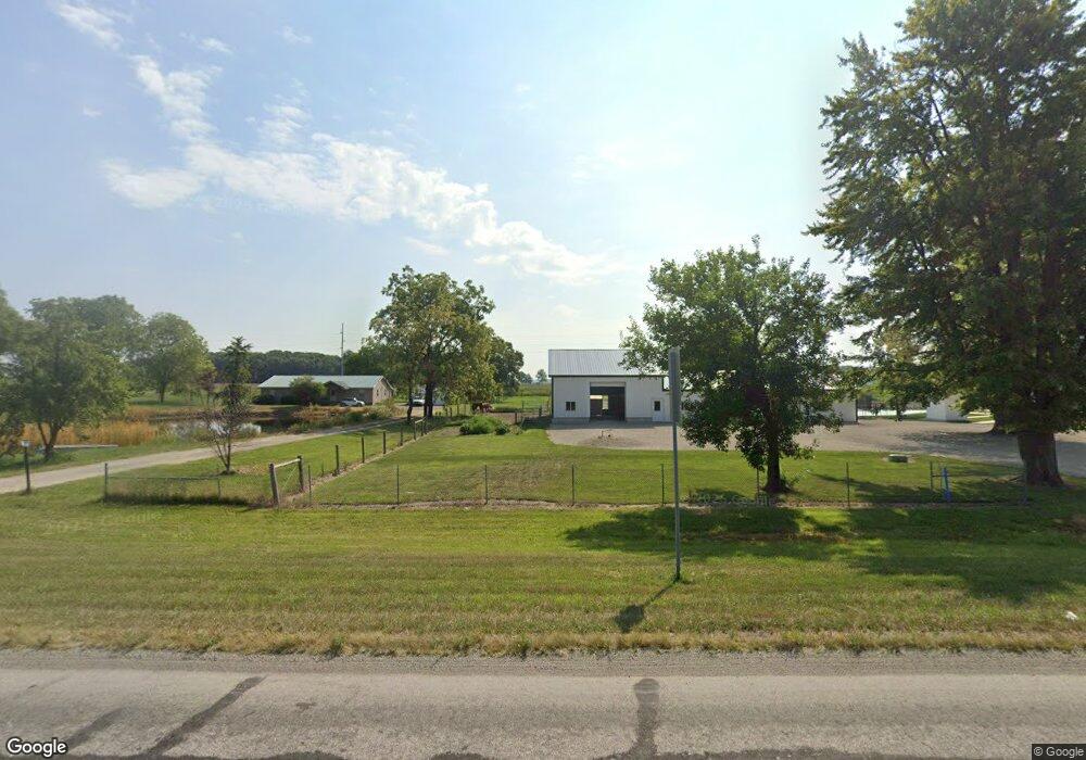
2085 N Us Highway 27 Decatur, IN 46733
Estimated Value: $355,000 - $463,415
3
Beds
1
Bath
3,152
Sq Ft
$130/Sq Ft
Est. Value
About This Home
This home is located at 2085 N Us Highway 27, Decatur, IN 46733 and is currently estimated at $410,138, approximately $130 per square foot. 2085 N Us Highway 27 is a home located in Adams County with nearby schools including Adams Central Elementary School, Adams Central Middle School, and Adams Central High School.
Ownership History
Date
Name
Owned For
Owner Type
Purchase Details
Closed on
Oct 11, 2019
Sold by
Shoaf Robert W
Bought by
Eicher Samuel
Current Estimated Value
Home Financials for this Owner
Home Financials are based on the most recent Mortgage that was taken out on this home.
Original Mortgage
$90,950
Outstanding Balance
$79,677
Interest Rate
3.5%
Mortgage Type
New Conventional
Estimated Equity
$330,461
Purchase Details
Closed on
Jun 28, 2019
Sold by
Mckean Sean D and Mckean Rhonda J
Bought by
Shoaf Robert W
Home Financials for this Owner
Home Financials are based on the most recent Mortgage that was taken out on this home.
Original Mortgage
$68,000
Interest Rate
3.9%
Mortgage Type
New Conventional
Purchase Details
Closed on
Nov 7, 2012
Sold by
Shoaf Lorna Jean
Bought by
Mckean Sean D and Mckean Rhonda J
Home Financials for this Owner
Home Financials are based on the most recent Mortgage that was taken out on this home.
Original Mortgage
$60,000
Interest Rate
4.55%
Mortgage Type
Adjustable Rate Mortgage/ARM
Create a Home Valuation Report for This Property
The Home Valuation Report is an in-depth analysis detailing your home's value as well as a comparison with similar homes in the area
Home Values in the Area
Average Home Value in this Area
Purchase History
| Date | Buyer | Sale Price | Title Company |
|---|---|---|---|
| Eicher Samuel | -- | -- | |
| Shoaf Robert W | -- | -- | |
| Mckean Sean D | -- | None Available |
Source: Public Records
Mortgage History
| Date | Status | Borrower | Loan Amount |
|---|---|---|---|
| Open | Eicher Samuel | $90,950 | |
| Previous Owner | Shoaf Robert W | $68,000 | |
| Previous Owner | Mckean Sean D | $60,000 |
Source: Public Records
Tax History Compared to Growth
Tax History
| Year | Tax Paid | Tax Assessment Tax Assessment Total Assessment is a certain percentage of the fair market value that is determined by local assessors to be the total taxable value of land and additions on the property. | Land | Improvement |
|---|---|---|---|---|
| 2024 | $3,019 | $358,700 | $33,000 | $325,700 |
| 2023 | $3,005 | $332,800 | $31,600 | $301,200 |
| 2022 | $876 | $54,900 | $7,100 | $47,800 |
| 2021 | $734 | $44,400 | $6,100 | $38,300 |
| 2020 | $158 | $11,300 | $6,000 | $5,300 |
| 2019 | $742 | $117,600 | $35,700 | $81,900 |
| 2018 | $754 | $115,200 | $35,700 | $79,500 |
| 2017 | $728 | $111,000 | $32,900 | $78,100 |
| 2016 | $569 | $108,100 | $33,000 | $75,100 |
| 2014 | $545 | $104,000 | $33,000 | $71,000 |
| 2013 | $603 | $102,500 | $32,800 | $69,700 |
Source: Public Records
Map
Nearby Homes
- 3959 U S 27
- 0 E Woodstone Ln
- 101 S Van Buren St
- 102 S Van Buren St
- 222 W Andrews St
- 210 W Walnut St
- 3260 N 200 W
- 1528 High St
- 38 Homestead
- 1115 Adams St
- 428 Mercer Ave
- 347 S 3rd St
- 1024 Adams St
- 618 Adams St
- 1705 W Monroe St
- 115 N 11th St
- 109 N 10th St
- 110 S 4th St
- 922 W Monroe St
- 0 W US Hwy 224 Unit 202544637
- 2129 N Us Highway 27
- 112 E 200 N
- 2175 N Us Highway 27
- 2215 N Us Highway 27
- 111 W 200 N
- 2231 N Us Highway 27
- 2399 N Us Highway 27
- 304 E 200 N
- 1755 N Us Highway 27
- 368 E 200 N
- 393 E 200 N
- 425 E 200 N
- 420 E 200 N
- 555 E 200 N
- 464 E 200 N
- 520 W 200 N
- 2732 N Us Highway 27
- 715 W 200 N
- 735 W 200 N
- 1255 N Us Highway 27