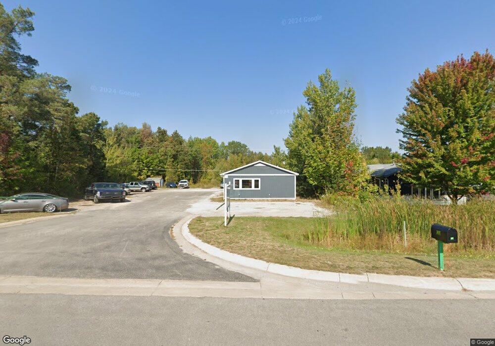
2085 N Us Highway 31 Petoskey, MI 49770
Estimated Value: $179,138
--
Bed
--
Bath
1,040
Sq Ft
$172/Sq Ft
Est. Value
About This Home
This home is located at 2085 N Us Highway 31, Petoskey, MI 49770 and is currently estimated at $179,138, approximately $172 per square foot. 2085 N Us Highway 31 is a home located in Emmet County with nearby schools including Petoskey High School, Concord Academy of Petoskey, and Petoskey Montessori Children's.
Ownership History
Date
Name
Owned For
Owner Type
Purchase Details
Closed on
Aug 8, 2024
Sold by
Mcnamara Jesian B
Bought by
Statewide Environmental Services Llc
Current Estimated Value
Purchase Details
Closed on
May 29, 2020
Sold by
Wave Investments Llc
Bought by
Mcnamara Jesian B
Home Financials for this Owner
Home Financials are based on the most recent Mortgage that was taken out on this home.
Original Mortgage
$50,000
Interest Rate
3.2%
Mortgage Type
New Conventional
Purchase Details
Closed on
Jun 6, 2005
Sold by
Rosel Thomas and Rosel Nancy
Bought by
Wave Investments Llc
Purchase Details
Closed on
Apr 1, 1990
Bought by
Rosel Cash Rps
Purchase Details
Closed on
Apr 1, 1984
Bought by
Inglehart
Purchase Details
Closed on
Jul 1, 1981
Bought by
Russell
Create a Home Valuation Report for This Property
The Home Valuation Report is an in-depth analysis detailing your home's value as well as a comparison with similar homes in the area
Home Values in the Area
Average Home Value in this Area
Purchase History
| Date | Buyer | Sale Price | Title Company |
|---|---|---|---|
| Statewide Environmental Services Llc | -- | -- | |
| Mcnamara Jesian B | $120,000 | -- | |
| Wave Investments Llc | $168,000 | -- | |
| Rosel Cash Rps | $65,000 | -- | |
| Inglehart | -- | -- | |
| Russell | -- | -- |
Source: Public Records
Mortgage History
| Date | Status | Borrower | Loan Amount |
|---|---|---|---|
| Previous Owner | Mcnamara Jesian B | $50,000 |
Source: Public Records
Tax History Compared to Growth
Tax History
| Year | Tax Paid | Tax Assessment Tax Assessment Total Assessment is a certain percentage of the fair market value that is determined by local assessors to be the total taxable value of land and additions on the property. | Land | Improvement |
|---|---|---|---|---|
| 2025 | $3,220 | $89,600 | $0 | $89,600 |
| 2024 | $3,220 | $81,000 | $0 | $81,000 |
| 2023 | $2,994 | $71,500 | $0 | $71,500 |
| 2022 | $2,994 | $69,600 | $20,000 | $49,600 |
| 2021 | $3,182 | $74,000 | $40,000 | $34,000 |
| 2020 | $2,512 | $71,200 | $40,000 | $31,200 |
| 2019 | $2,352 | $67,800 | $40,000 | $27,800 |
| 2018 | $2,320 | $56,300 | $40,000 | $16,300 |
| 2017 | -- | $55,700 | $40,000 | $15,700 |
| 2016 | -- | $54,500 | $40,000 | $14,500 |
| 2015 | -- | $57,500 | $0 | $0 |
| 2014 | -- | $70,400 | $0 | $0 |
Source: Public Records
Map
Nearby Homes
- 2070 & 2002 U S 31 N
- 2067 Bluestem Dr Unit 264
- 4742 Cypress Ct
- 4766 Cypress Ct
- 3400 Lakeside Dr S Unit 17
- 2262 Harbor-Petoskey Rd
- 1616 Pond Cir Unit 65
- 3640 Pickerel Lake Rd
- 4812 Keaton Ln
- 4838 Keaton Ln
- 4838 Keaton Ln Unit 106
- 3092 U S 31 N
- 3220 Merritt St Unit 12
- 3320 Aurora Dr
- 5012 Cook Ave
- 3412 Siebenhar Way Unit Lot 11
- 5577 Pincherry Ln Unit 39
- 3611 Country Club Rd
- 3263 Siebenhar Way Unit Lot 20
- TBD Siebenhar Way Unit 16
- 2105 N Us Highway 31
- 2115 N Us Highway 31
- 2115 N Us Highway 31
- 2065 N Us Highway 31
- 4207 Sophias Way
- 2102 N Us Highway 31
- 2165 N Us-31
- 4289 Sophias Way
- 2088 N Us Highway 31
- 2088 U S 31 Unit (Pt of W/2 of NE/4)
- 2088 U S 31
- 4289 Sophia's Way
- 2049 N Us Highway 31
- 4246 Hiawatha Trail
- 2041 N Us Highway 31
- 2070 N Us Highway 31
- 2189 Barney Rd
- 2017 N Us Highway 31
- 4250 Hiawatha Trail
- 2001 N Us Highway 31