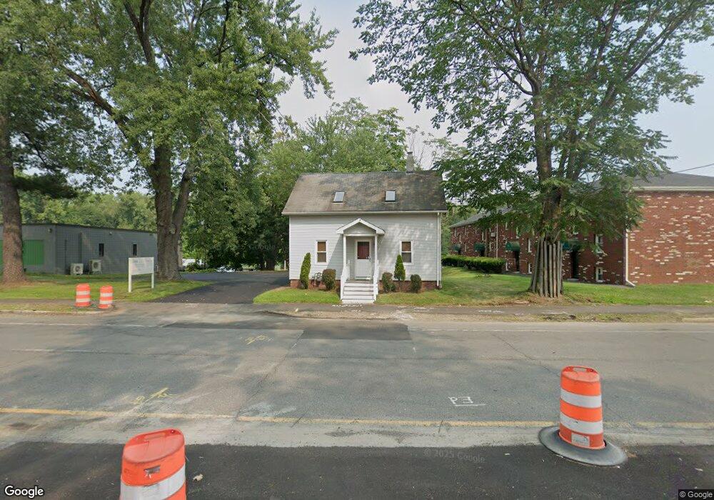
2085 Riverdale St West Springfield, MA 01089
Estimated Value: $359,827
--
Bed
1
Bath
1,222
Sq Ft
$294/Sq Ft
Est. Value
About This Home
This home is located at 2085 Riverdale St, West Springfield, MA 01089 and is currently estimated at $359,827, approximately $294 per square foot. 2085 Riverdale St is a home located in Hampden County with nearby schools including Holyoke Community Charter School, Blessed Sacrament School, and First Lutheran Christian School.
Ownership History
Date
Name
Owned For
Owner Type
Purchase Details
Closed on
Dec 7, 2012
Sold by
Vardakas Helen
Bought by
2085 Riverdale Street
Current Estimated Value
Home Financials for this Owner
Home Financials are based on the most recent Mortgage that was taken out on this home.
Original Mortgage
$136,000
Outstanding Balance
$94,624
Interest Rate
3.46%
Mortgage Type
Commercial
Estimated Equity
$265,203
Purchase Details
Closed on
Oct 28, 1999
Sold by
Jason Lee 2 Llc and Chertoff Andrew B
Bought by
Vardakas Helen
Purchase Details
Closed on
Mar 17, 1999
Sold by
Chertoff Andrew and Mckernan Bernard F
Bought by
Jason Lee 2 Llc
Purchase Details
Closed on
Jan 5, 1990
Sold by
Gaulin Marion S
Bought by
C & M Partnership
Create a Home Valuation Report for This Property
The Home Valuation Report is an in-depth analysis detailing your home's value as well as a comparison with similar homes in the area
Home Values in the Area
Average Home Value in this Area
Purchase History
| Date | Buyer | Sale Price | Title Company |
|---|---|---|---|
| 2085 Riverdale Street | $170,000 | -- | |
| Vardakas Helen | $140,000 | -- | |
| Jason Lee 2 Llc | $100,000 | -- | |
| C & M Partnership | $95,000 | -- |
Source: Public Records
Mortgage History
| Date | Status | Borrower | Loan Amount |
|---|---|---|---|
| Open | 2085 Riverdale Street | $136,000 | |
| Previous Owner | C & M Partnership | $2,950,000 | |
| Previous Owner | C & M Partnership | $175,000 |
Source: Public Records
Tax History Compared to Growth
Tax History
| Year | Tax Paid | Tax Assessment Tax Assessment Total Assessment is a certain percentage of the fair market value that is determined by local assessors to be the total taxable value of land and additions on the property. | Land | Improvement |
|---|---|---|---|---|
| 2025 | $7,491 | $247,400 | $109,700 | $137,700 |
| 2024 | $7,373 | $247,400 | $109,700 | $137,700 |
| 2023 | $7,220 | $236,100 | $109,700 | $126,400 |
| 2022 | $6,605 | $213,600 | $99,600 | $114,000 |
| 2021 | $5,528 | $170,200 | $92,700 | $77,500 |
| 2020 | $5,518 | $169,000 | $92,700 | $76,300 |
| 2019 | $5,501 | $169,000 | $92,700 | $76,300 |
| 2018 | $5,560 | $169,000 | $92,700 | $76,300 |
| 2017 | $5,601 | $169,000 | $92,700 | $76,300 |
| 2016 | $5,493 | $165,400 | $89,100 | $76,300 |
| 2015 | $5,383 | $162,200 | $87,300 | $74,900 |
| 2014 | $5,189 | $162,200 | $87,300 | $74,900 |
Source: Public Records
Map
Nearby Homes
- 89-111 Whitney Ave
- 86 Beaumont Ave
- 212 Poplar St
- 39 Bonnie Brae Dr
- 51 Beaumont Ave
- 87 Blanchwood Ave
- 50 Overlook Dr
- 81 Poplar St
- 54 Dayton St
- 59 Clayton Dr
- 66 Wayfield Ave
- 71 Florence St
- 11 Annie's Way
- 80 Brush Hill Ave Unit 28
- 80 Brush Hill Ave Unit 32
- 90 Mckinstry Ave Unit 117
- 210 Clarendon Ave
- 219 Clarendon Ave
- lot b Homestead Ave
- 39 Daley St
- 2097 Riverdale St
- 34 Elizabeth St
- 18 Elizabeth St
- 10 Elizabeth St
- 2045 Riverdale St
- 12 Marion St
- 4 Elizabeth St
- 2 Elizabeth St
- 2149 Riverdale St Unit 23
- 2149 Riverdale St Unit 20
- 2025 Riverdale St Unit 2025 Rear
- 2025 Riverdale St Unit Rear
- 2025 Riverdale St Unit L
- 2025 Riverdale St Unit R
- 2025 Riverdale St
- 2025 Riverdale St Unit 2009
- 2025 Riverdale St Unit 2003
- 2034 Riverdale St Unit 103
- 2034 Riverdale St Unit 206
- 2034 Riverdale St