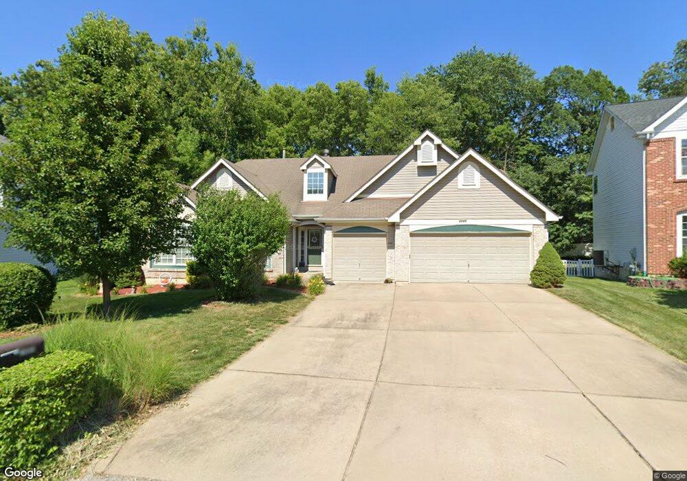
2085 Williamstown Dr Saint Peters, MO 63376
Estimated Value: $393,000 - $426,000
3
Beds
2
Baths
2,221
Sq Ft
$186/Sq Ft
Est. Value
About This Home
This home is located at 2085 Williamstown Dr, Saint Peters, MO 63376 and is currently estimated at $413,040, approximately $185 per square foot. 2085 Williamstown Dr is a home located in St. Charles County with nearby schools including Progress South Elementary School, Fort Zumwalt South Middle School, and Fort Zumwalt South High School.
Ownership History
Date
Name
Owned For
Owner Type
Purchase Details
Closed on
Oct 4, 2000
Sold by
Henderson Thomas R and Henderson Barbara A
Bought by
Henderson Thomas R and Henderson Barbara A
Current Estimated Value
Purchase Details
Closed on
Dec 3, 1999
Sold by
Mayer Custom Homes Inc
Bought by
Henderson Thomas R and Reddy Barbara A
Home Financials for this Owner
Home Financials are based on the most recent Mortgage that was taken out on this home.
Original Mortgage
$110,000
Interest Rate
8.29%
Create a Home Valuation Report for This Property
The Home Valuation Report is an in-depth analysis detailing your home's value as well as a comparison with similar homes in the area
Home Values in the Area
Average Home Value in this Area
Purchase History
| Date | Buyer | Sale Price | Title Company |
|---|---|---|---|
| Henderson Thomas R | -- | -- | |
| Henderson Thomas R | -- | -- |
Source: Public Records
Mortgage History
| Date | Status | Borrower | Loan Amount |
|---|---|---|---|
| Previous Owner | Henderson Thomas R | $110,000 |
Source: Public Records
Tax History Compared to Growth
Tax History
| Year | Tax Paid | Tax Assessment Tax Assessment Total Assessment is a certain percentage of the fair market value that is determined by local assessors to be the total taxable value of land and additions on the property. | Land | Improvement |
|---|---|---|---|---|
| 2025 | $5,008 | $78,550 | -- | -- |
| 2023 | $5,010 | $75,882 | $0 | $0 |
| 2022 | $4,235 | $59,623 | $0 | $0 |
| 2021 | $4,238 | $59,623 | $0 | $0 |
| 2020 | $4,114 | $56,041 | $0 | $0 |
| 2019 | $5,080 | $56,041 | $0 | $0 |
| 2018 | $3,795 | $49,228 | $0 | $0 |
| 2017 | $3,716 | $48,761 | $0 | $0 |
| 2016 | $3,615 | $47,247 | $0 | $0 |
| 2015 | $3,360 | $47,247 | $0 | $0 |
| 2014 | $3,087 | $42,660 | $0 | $0 |
Source: Public Records
Map
Nearby Homes
- 2068 Williamstown Dr
- 67 Oakridge West Dr
- 28 Steiert Dr
- 2 Oak Point Ct
- 114 Knaust Rd
- 42 Kingspointe Dr
- 619 Turtle Creek Ct
- 8201 Bristol Valley Dr
- Dover Plan at Birdie Hill Crossing - Cottage Collection
- Devonshire Plan at Birdie Hill Crossing - Cottage Collection
- Windsor Plan at Birdie Hill Crossing - Cottage Collection
- Fairground - Exterior Townhome Plan at Birdie Hill Crossing - Townhome Collection
- Fairground Plan at Birdie Hill Crossing - Townhome Collection
- Fairground - Interior Townhome Plan at Birdie Hill Crossing - Townhome Collection
- 523 Coldstream Ct
- 8 Soutee Dr
- 146 Huntington Crossing Dr
- 175 Blue Water Dr
- 164 Blue Water Dr
- 34 Aspen Pointe Dr
- 2089 Williamstown Dr
- 2081 Williamstown Dr
- 44 Oak Ridge West Dr
- 46 Oak Ridge West Dr
- 46 Oakridge Dr W
- 98 Lake Ridge Dr
- 2077 Williamstown Dr
- 2084 Williamstown Dr
- 48 Oak Ridge West Dr
- 48 Oakridge Dr W
- 2076 Williamstown Dr
- 2023 Lunenburg Dr
- 2073 Williamstown Dr
- 50 Oak Ridge West Dr
- 50 Oakridge Dr W
- 47 Oakridge Dr W
- 2019 Lunenburg Dr
- 40 Oakridge Dr W
- 40 Oak Ridge West Dr
- 45 Oak Ridge West Dr