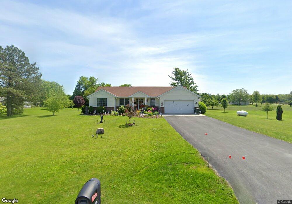
20850 Lemoyne Rd Luckey, OH 43443
Estimated Value: $203,000 - $319,970
3
Beds
2
Baths
1,533
Sq Ft
$172/Sq Ft
Est. Value
About This Home
This home is located at 20850 Lemoyne Rd, Luckey, OH 43443 and is currently estimated at $264,243, approximately $172 per square foot. 20850 Lemoyne Rd is a home located in Wood County with nearby schools including Pemberville Elementary School, Eastwood Middle School, and Eastwood High School.
Ownership History
Date
Name
Owned For
Owner Type
Purchase Details
Closed on
Apr 4, 2007
Sold by
Massey David A and Massey Rebecca J
Bought by
Haack Phillip E and Haack Dawn M
Current Estimated Value
Purchase Details
Closed on
Oct 4, 2002
Sold by
Tyner John and Tyner Rebecca L
Bought by
Massey David A and Massey Rebecca J
Home Financials for this Owner
Home Financials are based on the most recent Mortgage that was taken out on this home.
Original Mortgage
$29,110
Outstanding Balance
$12,275
Interest Rate
6.24%
Estimated Equity
$251,968
Create a Home Valuation Report for This Property
The Home Valuation Report is an in-depth analysis detailing your home's value as well as a comparison with similar homes in the area
Home Values in the Area
Average Home Value in this Area
Purchase History
| Date | Buyer | Sale Price | Title Company |
|---|---|---|---|
| Haack Phillip E | $20,500 | None Available | |
| Massey David A | $30,000 | Port Lawrence Title & Trust |
Source: Public Records
Mortgage History
| Date | Status | Borrower | Loan Amount |
|---|---|---|---|
| Open | Massey David A | $29,110 |
Source: Public Records
Tax History Compared to Growth
Tax History
| Year | Tax Paid | Tax Assessment Tax Assessment Total Assessment is a certain percentage of the fair market value that is determined by local assessors to be the total taxable value of land and additions on the property. | Land | Improvement |
|---|---|---|---|---|
| 2024 | $4,324 | $90,650 | $12,740 | $77,910 |
| 2023 | $4,324 | $90,650 | $12,740 | $77,910 |
| 2021 | $4,029 | $73,020 | $9,490 | $63,530 |
| 2020 | $4,096 | $73,020 | $9,490 | $63,530 |
| 2019 | $3,727 | $61,110 | $9,450 | $51,660 |
| 2018 | $3,758 | $61,110 | $9,450 | $51,660 |
| 2017 | $3,572 | $61,110 | $9,450 | $51,660 |
| 2016 | $3,351 | $53,480 | $9,520 | $43,960 |
| 2015 | $3,351 | $53,480 | $9,520 | $43,960 |
| 2014 | $3,658 | $53,480 | $9,520 | $43,960 |
| 2013 | $3,847 | $53,480 | $9,520 | $43,960 |
Source: Public Records
Map
Nearby Homes
- 210 School St
- 3291 Middleton Pike
- 0 Pemberville Rd
- 4396 Dowling Rd
- 19350 Luckey Rd
- 2067 Devils Hole Rd
- 151 Marshall Ave
- 150 Marshall Ave
- 420 Linden Dr
- 424 Linden Dr
- 423 Linden Dr
- 449 Linden Dr
- 425 Linden Dr
- 457 Linden Dr
- 426 Linden Dr
- 421 Linden Dr
- 451 Linden Dr
- 447 Linden Dr
- 459 Linden Dr
- 427 Linden Dr
- 20812 Lemoyne Rd
- 24060 Lemoyne Rd
- 20886 Lemoyne Rd
- 3957 Middleton Pike
- 20906 Lemoyne Rd
- 3921 Middleton Pike
- 3930 Middleton Pike
- 552 Krotzer Ave
- 551 Krotzer Ave
- 20932 Lemoyne Rd Unit 20950
- 3898 Middleton Pike
- 546 Krotzer Ave
- 20757 Lemoyne Rd
- 0 Lemoyne Parcel D Unit 5055864
- 549 Krotzer Ave Unit 4
- LOT St Rt 582 Lot 3
- LOT State Rt 582 Lot 2
- 547 Krotzer Ave Unit 3
- 540 Krotzer Ave
- 20662 Lemoyne Rd