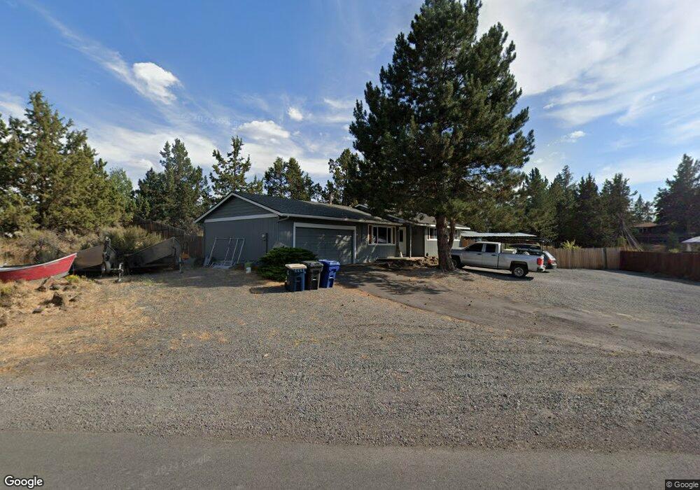
20865 Desert Wood Dr Bend, OR 97702
Old Farm District NeighborhoodEstimated Value: $553,000 - $724,000
3
Beds
1
Bath
1,024
Sq Ft
$632/Sq Ft
Est. Value
About This Home
This home is located at 20865 Desert Wood Dr, Bend, OR 97702 and is currently estimated at $647,134, approximately $631 per square foot. 20865 Desert Wood Dr is a home located in Deschutes County with nearby schools including Silver Rail Elementary School, High Desert Middle School, and Bend Senior High School.
Ownership History
Date
Name
Owned For
Owner Type
Purchase Details
Closed on
Apr 19, 2007
Sold by
Smith Robert
Bought by
Geraths Taylor
Current Estimated Value
Home Financials for this Owner
Home Financials are based on the most recent Mortgage that was taken out on this home.
Original Mortgage
$196,000
Outstanding Balance
$117,594
Interest Rate
6.1%
Mortgage Type
Negative Amortization
Estimated Equity
$529,540
Create a Home Valuation Report for This Property
The Home Valuation Report is an in-depth analysis detailing your home's value as well as a comparison with similar homes in the area
Home Values in the Area
Average Home Value in this Area
Purchase History
| Date | Buyer | Sale Price | Title Company |
|---|---|---|---|
| Geraths Taylor | $245,000 | First Amer Title Ins Co Or |
Source: Public Records
Mortgage History
| Date | Status | Borrower | Loan Amount |
|---|---|---|---|
| Open | Geraths Taylor | $196,000 |
Source: Public Records
Tax History Compared to Growth
Tax History
| Year | Tax Paid | Tax Assessment Tax Assessment Total Assessment is a certain percentage of the fair market value that is determined by local assessors to be the total taxable value of land and additions on the property. | Land | Improvement |
|---|---|---|---|---|
| 2025 | $4,567 | $270,320 | -- | -- |
| 2024 | $4,074 | $243,310 | -- | -- |
| 2023 | $2,560 | $160,130 | $0 | $0 |
| 2022 | $2,388 | $150,950 | $0 | $0 |
| 2021 | $2,392 | $146,560 | $0 | $0 |
| 2020 | $2,270 | $146,560 | $0 | $0 |
| 2019 | $2,206 | $142,300 | $0 | $0 |
| 2018 | $2,144 | $138,160 | $0 | $0 |
| 2017 | $2,081 | $134,140 | $0 | $0 |
| 2016 | $1,985 | $130,240 | $0 | $0 |
| 2015 | $1,930 | $126,450 | $0 | $0 |
| 2014 | $1,873 | $122,770 | $0 | $0 |
Source: Public Records
Map
Nearby Homes
- 20873 Greenmont Dr
- 61450 Little John Ln
- 61376 Robin Hood Ln
- 20886 King David Ave
- 20749 Canterbury Ct
- 61520 SE Admiral Way
- 61556 Twin Lakes Loop
- 20720 Will Scarlet Ln
- 61250 15th St
- 20743 Blacksmith Cir
- 61570 SE Rockway Terrace
- 61585 E Lake Dr
- 61610 SE Depot Loop
- 61536 Ascha Rose Ct
- 21062 Desert Woods Dr
- 61675 SE Depot Loop
- 20657 Couples Ln
- 61245 Crescent Ct
- 1843 SE Moorwood Ct
- 20868 Tamar Ln
- 20865 Desert Woods Dr
- 20877 Desert Woods Dr
- 20866 Desert Woods Dr
- 20856 Desert Woods Dr
- 20845 Desert Woods Dr
- 20876 Desert Woods Dr
- 20887 Desert Woods Dr
- 20846 Desert Woods Dr
- 20868 SE King Hezekiah Way
- 20886 Desert Wood Dr
- 20886 Desert Woods Dr
- 20874 King Hezekiah Way
- 20858 King Hezekiah Way
- 20837 Desert Woods Dr
- 20850 King Hezekiah Way
- 20842 SE King Hezekiah Way
- 20838 Desert Woods Dr
- 20853 Greenmont Dr
- 20868 King Hezekiah Way