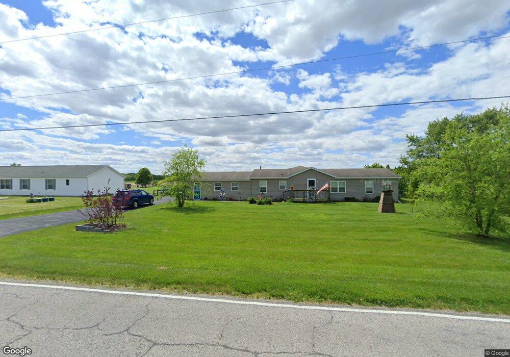
20865 Tontogany Rd Bowling Green, OH 43402
Estimated Value: $262,000 - $381,413
3
Beds
3
Baths
2,548
Sq Ft
$136/Sq Ft
Est. Value
About This Home
This home is located at 20865 Tontogany Rd, Bowling Green, OH 43402 and is currently estimated at $345,353, approximately $135 per square foot. 20865 Tontogany Rd is a home located in Wood County with nearby schools including Otsego Elementary School, Otsego Junior High School, and Otsego High School.
Ownership History
Date
Name
Owned For
Owner Type
Purchase Details
Closed on
Sep 16, 2021
Sold by
King Paul S and Smotherman Stacey M
Bought by
King Paul S and Smotherman King Stacey
Current Estimated Value
Purchase Details
Closed on
Oct 23, 2009
Sold by
Bylow Patricia M and Bylow Dennis C
Bought by
King Paul S and King Stacey M
Home Financials for this Owner
Home Financials are based on the most recent Mortgage that was taken out on this home.
Original Mortgage
$116,000
Outstanding Balance
$75,708
Interest Rate
5.07%
Mortgage Type
New Conventional
Estimated Equity
$269,645
Purchase Details
Closed on
Mar 6, 2008
Sold by
Us Bank Na
Bought by
Bylow Patricia M and Bylow Dennis C
Purchase Details
Closed on
Oct 24, 2007
Sold by
Osmond Arlene
Bought by
Us Bank Na and C Bass Mortgage Loan Asset Backed Certif
Purchase Details
Closed on
May 4, 1998
Sold by
Vollmar Dorothy J
Bought by
Osmond Gary and Osmond Arlene
Create a Home Valuation Report for This Property
The Home Valuation Report is an in-depth analysis detailing your home's value as well as a comparison with similar homes in the area
Home Values in the Area
Average Home Value in this Area
Purchase History
| Date | Buyer | Sale Price | Title Company |
|---|---|---|---|
| King Paul S | -- | None Available | |
| King Paul S | $145,000 | Attorney | |
| Bylow Patricia M | $58,000 | Federated Land Title Agency | |
| Us Bank Na | $90,000 | Public Square Title | |
| Osmond Gary | $16,500 | -- |
Source: Public Records
Mortgage History
| Date | Status | Borrower | Loan Amount |
|---|---|---|---|
| Open | King Paul S | $116,000 |
Source: Public Records
Tax History Compared to Growth
Tax History
| Year | Tax Paid | Tax Assessment Tax Assessment Total Assessment is a certain percentage of the fair market value that is determined by local assessors to be the total taxable value of land and additions on the property. | Land | Improvement |
|---|---|---|---|---|
| 2024 | $3,022 | $71,855 | $10,605 | $61,250 |
| 2023 | $3,022 | $71,860 | $10,610 | $61,250 |
| 2021 | $2,732 | $59,020 | $10,610 | $48,410 |
| 2020 | $2,746 | $59,020 | $10,610 | $48,410 |
| 2019 | $2,714 | $56,770 | $10,570 | $46,200 |
| 2018 | $2,719 | $56,770 | $10,570 | $46,200 |
| 2017 | $2,415 | $56,770 | $10,570 | $46,200 |
| 2016 | $2,064 | $45,230 | $10,260 | $34,970 |
| 2015 | $2,064 | $45,230 | $10,260 | $34,970 |
| 2014 | $2,055 | $45,230 | $10,260 | $34,970 |
| 2013 | $2,234 | $45,230 | $10,260 | $34,970 |
Source: Public Records
Map
Nearby Homes
- 109 High St
- 16890 W River Rd
- 19537 Liberty Hi Rd
- 0 River Rd W
- 0 W River Rd Unit 10000155
- 0 Scott Rd
- 18555 Crom St
- 335 S River Rd
- 18735 Main St
- 0 Wall St
- 0 Noward Rd
- 18142 Tontogany Rd
- 320 Ridgepoint Cir
- 21 Pennsylvania Ave
- 1248 Applegate St
- 35 S River Rd
- 1314 Limerick Ln
- 1324 Limerick Ln
- 1304 Limerick Ln
- 1407 Thomas Ln
- 20893 Tontogany Rd
- 20833 Tontogany Rd
- 20932 Tontogany Rd
- 20937 Tontogany Rd
- 20785 Tontogany Rd
- 20757 Tontogany Rd
- 20996 Tontogany Rd
- 20719 Tontogany Rd
- 17624 Middleton Pike
- 20760 Tontogany Rd
- 21097 Tontogany Rd
- 20675 Tontogany Rd
- 20615 Tontogany Rd
- 20605 Tontogany Rd
- 21031 Tontogany Rd
- 17285 Middleton Pike
- 21141 Tontogany Rd
- 17480 Robinson Rd
- 21217 Tontogany Rd
- 17510 Robinson Rd