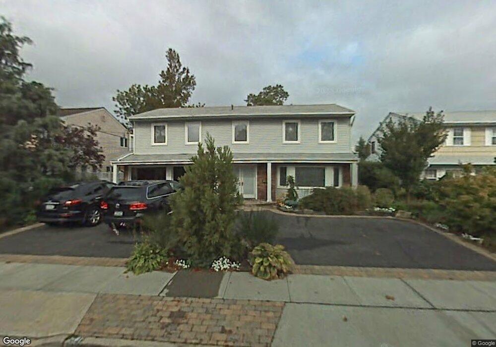
2087 Berkley Ln Merrick, NY 11566
Estimated Value: $1,161,000 - $1,199,714
--
Bed
3
Baths
2,687
Sq Ft
$439/Sq Ft
Est. Value
About This Home
This home is located at 2087 Berkley Ln, Merrick, NY 11566 and is currently estimated at $1,180,357, approximately $439 per square foot. 2087 Berkley Ln is a home located in Nassau County with nearby schools including Burcham Elementary School, Merrick Avenue Middle School, and John F. Kennedy High School.
Ownership History
Date
Name
Owned For
Owner Type
Purchase Details
Closed on
Jan 27, 2012
Sold by
Friedman Steven M and Friedman Gwen
Bought by
Stone Bryan and Stone Kathryn
Current Estimated Value
Home Financials for this Owner
Home Financials are based on the most recent Mortgage that was taken out on this home.
Original Mortgage
$499,200
Outstanding Balance
$58,274
Interest Rate
3.27%
Mortgage Type
Purchase Money Mortgage
Estimated Equity
$1,122,083
Purchase Details
Closed on
Jul 15, 1997
Sold by
Abrams Rita
Bought by
Friedman Gwen and Friedman Steven
Create a Home Valuation Report for This Property
The Home Valuation Report is an in-depth analysis detailing your home's value as well as a comparison with similar homes in the area
Home Values in the Area
Average Home Value in this Area
Purchase History
| Date | Buyer | Sale Price | Title Company |
|---|---|---|---|
| Stone Bryan | $624,000 | -- | |
| Friedman Gwen | $375,000 | -- |
Source: Public Records
Mortgage History
| Date | Status | Borrower | Loan Amount |
|---|---|---|---|
| Open | Stone Bryan | $499,200 |
Source: Public Records
Tax History Compared to Growth
Tax History
| Year | Tax Paid | Tax Assessment Tax Assessment Total Assessment is a certain percentage of the fair market value that is determined by local assessors to be the total taxable value of land and additions on the property. | Land | Improvement |
|---|---|---|---|---|
| 2025 | $25,407 | $837 | $278 | $559 |
| 2024 | $5,891 | $829 | $278 | $551 |
| 2023 | $22,460 | $783 | $260 | $523 |
| 2022 | $22,460 | $837 | $278 | $559 |
| 2021 | $33,928 | $804 | $267 | $537 |
| 2020 | $24,516 | $1,248 | $720 | $528 |
| 2019 | $23,740 | $1,248 | $720 | $528 |
| 2018 | $20,812 | $1,248 | $0 | $0 |
| 2017 | $12,934 | $1,248 | $720 | $528 |
| 2016 | $18,275 | $1,248 | $720 | $528 |
| 2015 | $4,953 | $1,248 | $565 | $683 |
| 2014 | $4,953 | $1,248 | $565 | $683 |
| 2013 | $4,686 | $1,248 | $560 | $688 |
Source: Public Records
Map
Nearby Homes