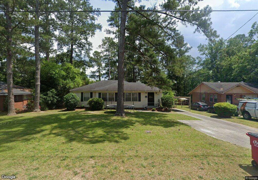
2087 Knightsbridge Rd Macon, GA 31211
Estimated Value: $92,286 - $110,000
3
Beds
1
Bath
1,290
Sq Ft
$80/Sq Ft
Est. Value
About This Home
This home is located at 2087 Knightsbridge Rd, Macon, GA 31211 and is currently estimated at $102,822, approximately $79 per square foot. 2087 Knightsbridge Rd is a home located in Bibb County with nearby schools including Martin Luther King Jr. Elementary School, Appling Middle School, and Northeast High School.
Ownership History
Date
Name
Owned For
Owner Type
Purchase Details
Closed on
Sep 15, 2005
Sold by
May Reginald D
Bought by
May Reginald D and May Antoinette F
Current Estimated Value
Home Financials for this Owner
Home Financials are based on the most recent Mortgage that was taken out on this home.
Original Mortgage
$72,000
Outstanding Balance
$43,952
Interest Rate
8.29%
Mortgage Type
Adjustable Rate Mortgage/ARM
Estimated Equity
$58,870
Purchase Details
Closed on
Sep 7, 2000
Create a Home Valuation Report for This Property
The Home Valuation Report is an in-depth analysis detailing your home's value as well as a comparison with similar homes in the area
Home Values in the Area
Average Home Value in this Area
Purchase History
| Date | Buyer | Sale Price | Title Company |
|---|---|---|---|
| May Reginald D | -- | None Avilebel | |
| -- | $60,500 | -- |
Source: Public Records
Mortgage History
| Date | Status | Borrower | Loan Amount |
|---|---|---|---|
| Open | May Reginald D | $72,000 |
Source: Public Records
Tax History Compared to Growth
Tax History
| Year | Tax Paid | Tax Assessment Tax Assessment Total Assessment is a certain percentage of the fair market value that is determined by local assessors to be the total taxable value of land and additions on the property. | Land | Improvement |
|---|---|---|---|---|
| 2025 | $697 | $35,380 | $4,160 | $31,220 |
| 2024 | $616 | $31,255 | $2,600 | $28,655 |
| 2023 | $612 | $27,650 | $1,560 | $26,090 |
| 2022 | $433 | $19,512 | $2,588 | $16,924 |
| 2021 | $294 | $14,740 | $1,650 | $13,090 |
| 2020 | $242 | $13,241 | $1,650 | $11,591 |
| 2019 | $244 | $13,241 | $1,650 | $11,591 |
| 2018 | $554 | $13,241 | $1,650 | $11,591 |
| 2017 | $234 | $13,241 | $1,650 | $11,591 |
| 2016 | $216 | $13,241 | $1,650 | $11,591 |
| 2015 | $306 | $13,241 | $1,650 | $11,591 |
| 2014 | $661 | $17,825 | $2,400 | $15,425 |
Source: Public Records
Map
Nearby Homes
- 2630 Pauladale Dr
- 2458 Tredway Dr
- 2371 Kensington Rd
- 2792 Skyline Dr
- 2557 Hyde Park Rd
- 2761 Walnut Creek Rd
- 2815 New Clinton Rd
- 240 Neptune Ct
- 2229 New Clinton Rd
- 2146 Melton Ave
- 2130 New Clinton Rd
- 131 Sun Valley Dr
- 135 Sun Valley Dr
- 2066 Melton Ave
- 3154 Bethune Ave
- 837 Artic Cir
- 1840 Kinder Kare Dr
- 1818 Kinder Kare Dr
- 3048 Bethune Ave
- 2081 Knightsbridge Rd
- 2093 Knightsbridge Rd
- 2046 Bayswater Rd
- 2103 Knightsbridge Rd
- 2071 Knightsbridge Rd
- 2054 Bayswater Rd
- 2036 Bayswater Rd
- 2090 Knightsbridge Rd
- 2084 Knightsbridge Rd
- 2063 Knightsbridge Rd
- 2064 Bayswater Rd
- 2096 Knightsbridge Rd
- 2109 Knightsbridge Rd
- 2078 Knightsbridge Rd
- 2028 Bayswater Rd
- 2106 Knightsbridge Rd
- 2072 Bayswater Rd
- 2055 Knightsbridge Rd
- 2117 Knightsbridge Rd
- 2112 Knightsbridge Rd