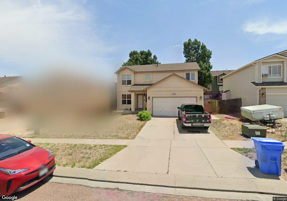
2087 Sage Grouse Ln Colorado Springs, CO 80951
Estimated Value: $433,105 - $457,000
4
Beds
4
Baths
1,480
Sq Ft
$299/Sq Ft
Est. Value
About This Home
This home is located at 2087 Sage Grouse Ln, Colorado Springs, CO 80951 and is currently estimated at $442,026, approximately $298 per square foot. 2087 Sage Grouse Ln is a home located in El Paso County with nearby schools including Evans International Elementary School, Horizon Middle School, and Sand Creek High School.
Ownership History
Date
Name
Owned For
Owner Type
Purchase Details
Closed on
Oct 31, 2016
Sold by
Forte Luciano M and Forte Srtacey A
Bought by
Owen Rachel L
Current Estimated Value
Home Financials for this Owner
Home Financials are based on the most recent Mortgage that was taken out on this home.
Original Mortgage
$256,907
Outstanding Balance
$206,771
Interest Rate
3.5%
Mortgage Type
VA
Estimated Equity
$235,255
Purchase Details
Closed on
Nov 29, 2012
Sold by
Forte Luciano M
Bought by
Forte Luciano M and Forte Stacey A
Purchase Details
Closed on
Dec 10, 2002
Sold by
Hallmark Building Company Ltd I
Bought by
Forte Luciano M
Home Financials for this Owner
Home Financials are based on the most recent Mortgage that was taken out on this home.
Original Mortgage
$172,270
Interest Rate
6.05%
Mortgage Type
FHA
Create a Home Valuation Report for This Property
The Home Valuation Report is an in-depth analysis detailing your home's value as well as a comparison with similar homes in the area
Home Values in the Area
Average Home Value in this Area
Purchase History
| Date | Buyer | Sale Price | Title Company |
|---|---|---|---|
| Owen Rachel L | $251,500 | None Available | |
| Forte Luciano M | -- | None Available | |
| Forte Luciano M | $174,975 | Security Title |
Source: Public Records
Mortgage History
| Date | Status | Borrower | Loan Amount |
|---|---|---|---|
| Open | Owen Rachel L | $256,907 | |
| Previous Owner | Forte Luciano M | $172,270 |
Source: Public Records
Tax History Compared to Growth
Tax History
| Year | Tax Paid | Tax Assessment Tax Assessment Total Assessment is a certain percentage of the fair market value that is determined by local assessors to be the total taxable value of land and additions on the property. | Land | Improvement |
|---|---|---|---|---|
| 2025 | $1,815 | $29,410 | -- | -- |
| 2024 | $1,712 | $29,780 | $5,290 | $24,490 |
| 2023 | $1,712 | $29,780 | $5,290 | $24,490 |
| 2022 | $1,456 | $21,290 | $4,170 | $17,120 |
| 2021 | $1,515 | $21,900 | $4,290 | $17,610 |
| 2020 | $1,316 | $18,950 | $3,580 | $15,370 |
| 2019 | $1,305 | $18,950 | $3,580 | $15,370 |
| 2018 | $1,121 | $16,020 | $3,560 | $12,460 |
| 2017 | $1,026 | $16,020 | $3,560 | $12,460 |
| 2016 | $1,046 | $16,110 | $3,580 | $12,530 |
| 2015 | $1,047 | $16,110 | $3,580 | $12,530 |
| 2014 | $955 | $14,430 | $3,580 | $10,850 |
Source: Public Records
Map
Nearby Homes
- 2060 Pinyon Jay Dr
- 2265 Sage Grouse Ln
- 2338 Jeanette Way
- 8809 Christy Ct
- 2210 Whale Point
- 2068 Killdeer Ct
- 2322 Zebra Point
- 2404 Obsidian Forest View
- 2575 Shannara Grove
- 1649 Reilly Grove
- 1974 Capital Dr
- 1768 Reilly Grove
- 8163 Postrock Dr
- 7820 Parsonage Ln
- 1725 Bucolo Ave
- 2034 Lillian Way
- 1925 Dewhirst Dr
- 8042 Parsonage Ln
- 2631 Gobi Dr
- 2656 Gobi Dr
- 2075 Sage Grouse Ln
- 2099 Sage Grouse Ln
- 2078 Woodpark Dr
- 2063 Sage Grouse Ln
- 2090 Woodpark Dr
- 2066 Woodpark Dr
- 2123 Sage Grouse Ln
- 2054 Woodpark Dr
- 2102 Woodpark Dr
- 2086 Sage Grouse Ln
- 2051 Sage Grouse Ln
- 2098 Sage Grouse Ln
- 2074 Sage Grouse Ln
- 2135 Sage Grouse Ln
- 2110 Sage Grouse Ln
- 2042 Woodpark Dr
- 2062 Sage Grouse Ln
- 2114 Woodpark Dr
- 2122 Sage Grouse Ln
- 2039 Sage Grouse Ln