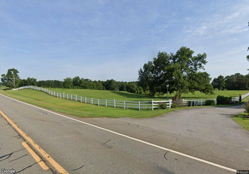
2088 Ga Highway 212 W Monticello, GA 31064
Jasper County NeighborhoodEstimated Value: $699,000 - $855,105
4
Beds
2
Baths
2,229
Sq Ft
$340/Sq Ft
Est. Value
About This Home
This home is located at 2088 Ga Highway 212 W, Monticello, GA 31064 and is currently estimated at $757,526, approximately $339 per square foot. 2088 Ga Highway 212 W is a home located in Jasper County with nearby schools including Jasper County Primary School, Washington Park Elementary School, and Jasper County Middle School.
Ownership History
Date
Name
Owned For
Owner Type
Purchase Details
Closed on
Jul 21, 2020
Sold by
Freeman Linda L
Bought by
Littleton Robert Daniel
Current Estimated Value
Home Financials for this Owner
Home Financials are based on the most recent Mortgage that was taken out on this home.
Original Mortgage
$427,500
Outstanding Balance
$379,079
Interest Rate
3.1%
Mortgage Type
New Conventional
Estimated Equity
$378,447
Purchase Details
Closed on
Aug 29, 2018
Sold by
Freeman Linda L
Bought by
Brown Henry L and Brown Mary K
Purchase Details
Closed on
Jan 20, 2005
Sold by
Freeman Linda L
Bought by
Bryant Lucinda M
Create a Home Valuation Report for This Property
The Home Valuation Report is an in-depth analysis detailing your home's value as well as a comparison with similar homes in the area
Home Values in the Area
Average Home Value in this Area
Purchase History
| Date | Buyer | Sale Price | Title Company |
|---|---|---|---|
| Littleton Robert Daniel | $450,000 | -- | |
| Brown Henry L | $140,000 | -- | |
| Bryant Lucinda M | -- | -- |
Source: Public Records
Mortgage History
| Date | Status | Borrower | Loan Amount |
|---|---|---|---|
| Open | Littleton Robert Daniel | $427,500 |
Source: Public Records
Tax History Compared to Growth
Tax History
| Year | Tax Paid | Tax Assessment Tax Assessment Total Assessment is a certain percentage of the fair market value that is determined by local assessors to be the total taxable value of land and additions on the property. | Land | Improvement |
|---|---|---|---|---|
| 2024 | $5,290 | $326,336 | $148,800 | $177,536 |
| 2023 | $4,764 | $288,016 | $131,000 | $157,016 |
| 2022 | $4,593 | $247,776 | $106,640 | $141,136 |
| 2021 | $4,305 | $195,656 | $70,440 | $125,216 |
| 2020 | $4,701 | $190,096 | $70,440 | $119,656 |
| 2019 | $5,184 | $196,904 | $68,280 | $128,624 |
| 2018 | $4,558 | $190,024 | $68,280 | $121,744 |
| 2017 | $4,723 | $186,104 | $61,200 | $124,904 |
| 2016 | $4,340 | $174,384 | $61,200 | $113,184 |
| 2015 | $4,076 | $158,384 | $0 | $0 |
| 2014 | $3,646 | $140,824 | $0 | $0 |
Source: Public Records
Map
Nearby Homes
- 1900 Ga Highway 212 W
- 1988 Ga Highway 212 W
- 14300 Ga Highway 11 N
- 0 7 Island Rd Unit 10560556
- 1037 W Washington St
- 815 Poplar St
- 1044 Clay St
- 0 Brazey Rd Unit 10570790
- 287 Poplar St
- 777 College St
- 755 College St
- 176 Marshall Dr
- 21 Tucker Cir
- 0 Cook Rd Unit 10563367
- 423 Banks St
- 253 Nancy St
- 359 Oak St
- 396 Water Oak Dr
- 0 Highway 11 N Unit 10518357
- 0 N Highway 11 Unit 10498456
- 2088 Ga Highway 212 W
- 2088 Ga Highway 212 W
- 1920 Ga Highway 212 W
- 1988 Ga Highway 212 W
- 2240 Ga Highway 212 W
- 2240 Ga Highway 212 W
- 5140 Route 212
- 2466 Ga Highway 212 W
- 0 Hwy 212 W and Malone Dr Unit 8052230
- 0 Hwy 212 W and Malone Dr Unit 7075231
- 0 Malone Dr Unit 7283076
- 0 Malone Dr Unit 8729609
- 0 Malone Dr Unit 8706328
- 0 Malone Dr Unit 8582720
- 0 Malone Dr Unit 8457678
- 0 Malone Dr Unit 7495993
- 0 Malone Dr Unit 8021995
- 440 Malone Dr
- 400 Malone Dr
- 2289 Ga Highway 212 W
