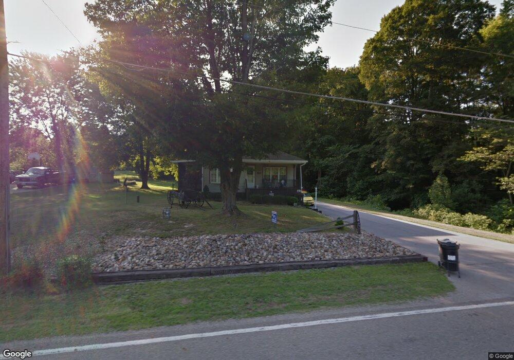
2088 Hubbard Masury Rd Hubbard, OH 44425
Estimated Value: $105,000 - $185,000
2
Beds
1
Bath
852
Sq Ft
$161/Sq Ft
Est. Value
About This Home
This home is located at 2088 Hubbard Masury Rd, Hubbard, OH 44425 and is currently estimated at $136,773, approximately $160 per square foot. 2088 Hubbard Masury Rd is a home located in Trumbull County with nearby schools including Hubbard Elementary School, Hubbard Middle School, and Hubbard High School.
Ownership History
Date
Name
Owned For
Owner Type
Purchase Details
Closed on
Nov 8, 1995
Sold by
Zock Jeanette M
Bought by
Miller Bruce E and Miller Joann M
Current Estimated Value
Home Financials for this Owner
Home Financials are based on the most recent Mortgage that was taken out on this home.
Original Mortgage
$30,000
Outstanding Balance
$424
Interest Rate
7.7%
Mortgage Type
New Conventional
Estimated Equity
$136,349
Purchase Details
Closed on
Jan 1, 1990
Sold by
Zock Vincent A
Bought by
Jeanette M Zock
Create a Home Valuation Report for This Property
The Home Valuation Report is an in-depth analysis detailing your home's value as well as a comparison with similar homes in the area
Home Values in the Area
Average Home Value in this Area
Purchase History
| Date | Buyer | Sale Price | Title Company |
|---|---|---|---|
| Miller Bruce E | $42,000 | -- | |
| Jeanette M Zock | -- | -- |
Source: Public Records
Mortgage History
| Date | Status | Borrower | Loan Amount |
|---|---|---|---|
| Open | Miller Bruce E | $30,000 |
Source: Public Records
Tax History Compared to Growth
Tax History
| Year | Tax Paid | Tax Assessment Tax Assessment Total Assessment is a certain percentage of the fair market value that is determined by local assessors to be the total taxable value of land and additions on the property. | Land | Improvement |
|---|---|---|---|---|
| 2024 | $1,087 | $28,950 | $4,480 | $24,470 |
| 2023 | $1,087 | $28,950 | $4,480 | $24,470 |
| 2022 | $970 | $23,980 | $4,130 | $19,850 |
| 2021 | $974 | $23,980 | $4,130 | $19,850 |
| 2020 | $978 | $23,980 | $4,130 | $19,850 |
| 2019 | $836 | $21,080 | $3,820 | $17,260 |
| 2018 | $811 | $21,080 | $3,820 | $17,260 |
| 2017 | $809 | $21,080 | $3,820 | $17,260 |
| 2016 | $692 | $19,820 | $3,820 | $16,000 |
| 2015 | $695 | $19,820 | $3,820 | $16,000 |
| 2014 | $681 | $19,820 | $3,820 | $16,000 |
| 2013 | $680 | $19,820 | $3,820 | $16,000 |
Source: Public Records
Map
Nearby Homes
- 1952 Hubbard Masury Rd
- 1911 Hubbard Thomas Rd
- 7111 Pine Grove Dr
- 1354 Stevenson Rd
- 7847 Chestnut St
- 7737 Elm St
- 784 Elmwood Dr
- 7822 2nd St
- 462 Elizabeth St
- 395 Elizabeth St
- 611 Moore St
- 132 Drummond Ave
- 764 Jones St
- 138 Moore St
- 430 E Park Ave
- 1017 Broadway St
- 11 Clubhouse Dr
- 248 Myron St
- 1 Grandview Dr
- 50 Walnut St
- 2070 Hubbard Masury Rd
- 2096 Hubbard Masury Rd
- 7545 Van Ness Ave
- 7537 Van Ness Ave
- 7523 Van Ness Ave
- 7523 Van Ness Ave
- 2122 Hubbard Masury Rd
- 7511 Van Ness Ave
- 7501 Van Ness Ave
- 7524 Van Ness Ave
- 7498 Van Ness Ave
- 7489 Van Ness Ave
- 2150 Hubbard Masury Rd
- 7488 Van Ness Ave
- 7481 Van Ness Ave
- 2125 Stiver St
- 2162 Hubbard Masury Rd
- 7553 Mack Dr
- 7465 Van Ness Ave
- 7573 Mack Dr