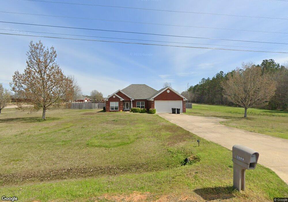
2088 Wolfe Rd Columbus, MS 39705
Estimated Value: $296,405 - $315,000
Studio
2
Baths
2,326
Sq Ft
$132/Sq Ft
Est. Value
About This Home
This home is located at 2088 Wolfe Rd, Columbus, MS 39705 and is currently estimated at $306,601, approximately $131 per square foot. 2088 Wolfe Rd is a home located in Lowndes County with nearby schools including Columbus Christian Academy.
Ownership History
Date
Name
Owned For
Owner Type
Purchase Details
Closed on
Sep 23, 2022
Sold by
Anderson Aaron Allen and Anderson Emily Michelle
Bought by
Fessenden Jon W and Fessenden Elena
Current Estimated Value
Home Financials for this Owner
Home Financials are based on the most recent Mortgage that was taken out on this home.
Original Mortgage
$180,000
Outstanding Balance
$172,292
Interest Rate
5.66%
Mortgage Type
New Conventional
Estimated Equity
$134,309
Purchase Details
Closed on
Aug 27, 2021
Sold by
Cumberland Sterling-Cumberland J and Cumberland Lyndsay D
Bought by
Anderson Emily M
Create a Home Valuation Report for This Property
The Home Valuation Report is an in-depth analysis detailing your home's value as well as a comparison with similar homes in the area
Purchase History
| Date | Buyer | Sale Price | Title Company |
|---|---|---|---|
| Fessenden Jon W | -- | -- | |
| Anderson Emily M | -- | None Available |
Source: Public Records
Mortgage History
| Date | Status | Borrower | Loan Amount |
|---|---|---|---|
| Open | Fessenden Jon W | $180,000 |
Source: Public Records
Tax History
| Year | Tax Paid | Tax Assessment Tax Assessment Total Assessment is a certain percentage of the fair market value that is determined by local assessors to be the total taxable value of land and additions on the property. | Land | Improvement |
|---|---|---|---|---|
| 2025 | $1,583 | $19,251 | $0 | $0 |
| 2024 | $1,568 | $19,251 | $0 | $0 |
| 2023 | $1,333 | $16,898 | $0 | $0 |
| 2022 | $1,634 | $16,898 | $0 | $0 |
| 2021 | $1,274 | $16,898 | $0 | $0 |
| 2020 | $1,187 | $16,898 | $0 | $0 |
| 2019 | $1,184 | $16,752 | $0 | $0 |
| 2018 | $1,184 | $16,361 | $0 | $0 |
| 2017 | $1,119 | $16,361 | $0 | $0 |
| 2016 | $1,119 | $16,361 | $0 | $0 |
| 2015 | $1,127 | $16,455 | $0 | $0 |
| 2014 | $1,127 | $16,455 | $0 | $0 |
Source: Public Records
Map
Nearby Homes
- 1097 Wolfe Rd
- 30 Military Chapel Ln
- 415 Justin Cir
- Lot 1 Jess Lyons Rd
- Lot 4 Jess Lyons Rd
- Lot 6 Jess Lyons Rd
- Lot 2 Jess Lyons Rd
- Lot 5 Jess Lyons Rd
- Lot 3 Jess Lyons Rd
- 240 Shrinewood Dr
- 29 Regent Ln
- 0 Poole Rd
- 85 Lakeview Dr
- 602 Bunker Hill Rd
- 196 South Pkwy
- 510 Bunkerhill Rd
- 360 Waring Rd
- 3816 Sand Rd
- 40 Timber Dr
- 261 Bunkerhill Rd
- 78 Red Oak Ln
- 2124 Wolfe Rd
- 73 Red Oak Ln
- 116 Red Oak Ln
- 115 Red Oak Ln
- 2160 Wolfe Rd
- 106 Taylor Raye Ln
- 161 Red Oak Ln
- 140 Taylor Raye Ln
- 132 Red Oak Ln
- 160 Red Oak Ln
- 21 Mckenzie Dr
- 20 Mckenzie Dr
- 2230 Wolfe Rd
- 188 Taylor Raye Ln
- 188 Red Oak Ln
- 218 Taylor Raye Ln
- 191 Red Oak Ln
- 177 Taylor Raye Ln
- 61 Mckenzie Dr
Your Personal Tour Guide
Ask me questions while you tour the home.