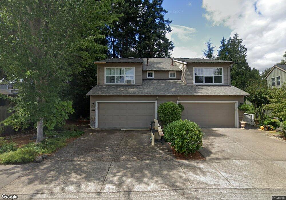
20885 NW Rockspring Ln Beaverton, OR 97006
AmberGlen NeighborhoodEstimated Value: $464,329 - $508,000
3
Beds
3
Baths
1,503
Sq Ft
$321/Sq Ft
Est. Value
About This Home
This home is located at 20885 NW Rockspring Ln, Beaverton, OR 97006 and is currently estimated at $481,832, approximately $320 per square foot. 20885 NW Rockspring Ln is a home located in Washington County with nearby schools including Lenox Elementary School, J.W. Poynter Middle School, and Liberty High School.
Ownership History
Date
Name
Owned For
Owner Type
Purchase Details
Closed on
Nov 17, 2005
Sold by
Ahmdt John H and Ahmdt Judith H
Bought by
Boone Andrew T
Current Estimated Value
Home Financials for this Owner
Home Financials are based on the most recent Mortgage that was taken out on this home.
Original Mortgage
$196,000
Outstanding Balance
$106,669
Interest Rate
5.93%
Mortgage Type
Fannie Mae Freddie Mac
Estimated Equity
$375,163
Purchase Details
Closed on
Apr 27, 1999
Sold by
Habitat Northwest Inc
Bought by
Ahrndt John H and Ahrndt Judith D
Home Financials for this Owner
Home Financials are based on the most recent Mortgage that was taken out on this home.
Original Mortgage
$136,875
Interest Rate
9.99%
Mortgage Type
Purchase Money Mortgage
Create a Home Valuation Report for This Property
The Home Valuation Report is an in-depth analysis detailing your home's value as well as a comparison with similar homes in the area
Home Values in the Area
Average Home Value in this Area
Purchase History
| Date | Buyer | Sale Price | Title Company |
|---|---|---|---|
| Boone Andrew T | $245,000 | Fidelity Natl Title Co Of Or | |
| Ahrndt John H | $182,500 | Transnation Title Insurance |
Source: Public Records
Mortgage History
| Date | Status | Borrower | Loan Amount |
|---|---|---|---|
| Open | Boone Andrew T | $196,000 | |
| Previous Owner | Ahrndt John H | $136,875 |
Source: Public Records
Tax History Compared to Growth
Tax History
| Year | Tax Paid | Tax Assessment Tax Assessment Total Assessment is a certain percentage of the fair market value that is determined by local assessors to be the total taxable value of land and additions on the property. | Land | Improvement |
|---|---|---|---|---|
| 2025 | $4,620 | $282,630 | -- | -- |
| 2024 | $4,488 | $274,400 | -- | -- |
| 2023 | $4,488 | $266,410 | $0 | $0 |
| 2022 | $4,367 | $266,410 | $0 | $0 |
| 2021 | $4,279 | $251,130 | $0 | $0 |
| 2020 | $4,187 | $243,820 | $0 | $0 |
| 2019 | $4,066 | $236,720 | $0 | $0 |
| 2018 | $3,893 | $229,830 | $0 | $0 |
| 2017 | $3,751 | $223,140 | $0 | $0 |
| 2016 | $3,649 | $216,650 | $0 | $0 |
| 2015 | $3,502 | $210,340 | $0 | $0 |
| 2014 | $3,482 | $204,220 | $0 | $0 |
Source: Public Records
Map
Nearby Homes
- 8654 NE Rockspring St
- 8599 NE Hodes St
- 2127 NE Cadbury Ave
- 2315 NE Redelfs Way
- 881 NE Wheelock Place
- 7959 NE Rockne Way
- 7915 NE Rockne Way
- 8100 NE Miriam Way
- 963 NE 73rd Ave Unit 141
- 7906 NE Miriam Way
- 7902 NE Miriam Way
- 734 NE Adwick Dr
- 645 NE Garswood Ln
- 680 NE Adwick Dr Unit 5
- 637 NE Garswood Ln
- 670 NE Adwick Dr
- 426 NE Tork Place
- 622 NE Garswood Ln
- 613 NE Garswood Ln
- 402 NE Patricia Ann Place
- 20873 NW Rockspring Ln Unit 23
- 20873 NW Rockspring Ln
- 20861 NW Rockspring Ln
- 8493 NE Windstone St
- 20903 NW Windstone Ct
- 20849 NW Rockspring Ln
- 20911 NW Windstone Ct
- 20866 NW Rockspring Ln Unit 25
- 20866 NW Rockspring Ln
- 20889 NW Windstone St
- 20919 NW Windstone Ct
- 20837 NW Rockspring Ln
- 8561 NE Rockspring St
- 20837 NE Rockspring St
- 20825 NW Rockspring Ln
- 20820 NW Rockspring Ln
- 20927 NW Windstone Ct
- 20867 NW Windstone St
- 20798 NW Rockspring Ln
- 20813 NE Rockspring St