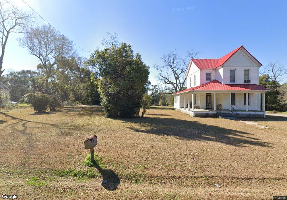
2089 Broad St Metcalf, GA 31792
Estimated Value: $143,125 - $180,000
3
Beds
1
Bath
2,345
Sq Ft
$67/Sq Ft
Est. Value
About This Home
This home is located at 2089 Broad St, Metcalf, GA 31792 and is currently estimated at $157,031, approximately $66 per square foot. 2089 Broad St is a home located in Thomas County with nearby schools including Hand in Hand Primary School, Garrison-Pilcher Elementary School, and Cross Creek Elementary School.
Ownership History
Date
Name
Owned For
Owner Type
Purchase Details
Closed on
May 3, 2023
Sold by
Thomas Harry G
Bought by
Thomas Gregory Alan and Thomas Dawn A
Current Estimated Value
Purchase Details
Closed on
Sep 12, 2011
Sold by
Thomas Harry G
Bought by
Thomas Harry G
Purchase Details
Closed on
Dec 28, 1999
Sold by
Thomas Frances H Trust
Bought by
Thomas Thomasville Family
Purchase Details
Closed on
Apr 30, 1992
Sold by
Thomas Frances H
Bought by
Thomas Frances H Trust
Purchase Details
Closed on
Apr 29, 1983
Sold by
Thomas Harry G Trust
Bought by
Thomas Frances H
Create a Home Valuation Report for This Property
The Home Valuation Report is an in-depth analysis detailing your home's value as well as a comparison with similar homes in the area
Home Values in the Area
Average Home Value in this Area
Purchase History
| Date | Buyer | Sale Price | Title Company |
|---|---|---|---|
| Thomas Gregory Alan | -- | -- | |
| Thomas Harry G | -- | -- | |
| Thomas Thomasville Family | $589,400 | -- | |
| Thomas Frances H Trust | -- | -- | |
| Thomas Frances H | -- | -- |
Source: Public Records
Tax History Compared to Growth
Tax History
| Year | Tax Paid | Tax Assessment Tax Assessment Total Assessment is a certain percentage of the fair market value that is determined by local assessors to be the total taxable value of land and additions on the property. | Land | Improvement |
|---|---|---|---|---|
| 2024 | $1,158 | $56,118 | $4,868 | $51,250 |
| 2023 | $1,079 | $53,540 | $4,868 | $48,672 |
| 2022 | $911 | $40,979 | $5,189 | $35,790 |
| 2021 | $856 | $34,954 | $4,512 | $30,442 |
| 2020 | $876 | $34,878 | $4,512 | $30,366 |
| 2019 | $885 | $34,878 | $4,512 | $30,366 |
| 2018 | $905 | $34,944 | $4,512 | $30,432 |
| 2017 | $916 | $34,827 | $4,512 | $30,315 |
| 2016 | $920 | $34,727 | $4,512 | $30,215 |
| 2015 | $1,055 | $39,204 | $4,512 | $34,692 |
| 2014 | $1,039 | $38,430 | $4,512 | $33,918 |
| 2013 | -- | $37,678 | $3,760 | $33,918 |
Source: Public Records
Map
Nearby Homes
- 2860 Stringer Rd
- 00 57 Acres Off Stringer Rd Off Metcalf-Beachton Rd
- 7500 U S 19
- 304 Bellingham Dr
- 131 Pheasant Ridge
- 104 Stratford Way
- 6908 Metcalf Rd
- 333 Shallowbrook Farms Rd
- 113 Harrogate Ln
- 396 Meander Trace
- 00 Harrogate Ln
- 122 Avalon Way
- Lot 25 A Avalon Way Unit 25-A
- 10087 Springhill Rd
- 10119 Springhill Rd
- 9700 Old Magnolia Rd
- 401 Habersham Rd
- 420 Woodlands Blvd
- 109 Elijah Hill Ln
- 115 Elijah Hill Ln
- 2057 Broad St
- 1014 S John St
- 3030 Broad St
- 000 Broad St
- 1019 Manning St
- 1058 N John St
- 1036 Manning St
- 3058 Broad St
- 1057 Manning St
- 3059 Broad St
- 1072 Stegall St
- 1048 S John St
- 3049 Hancock St
- 1106 Broad St
- 1078 Stegall St
- 2100 Hancock St
- 1075 Stegall St
- 2021 Hancock St
- 1060 N Broad St
- 2007 Magnolia St