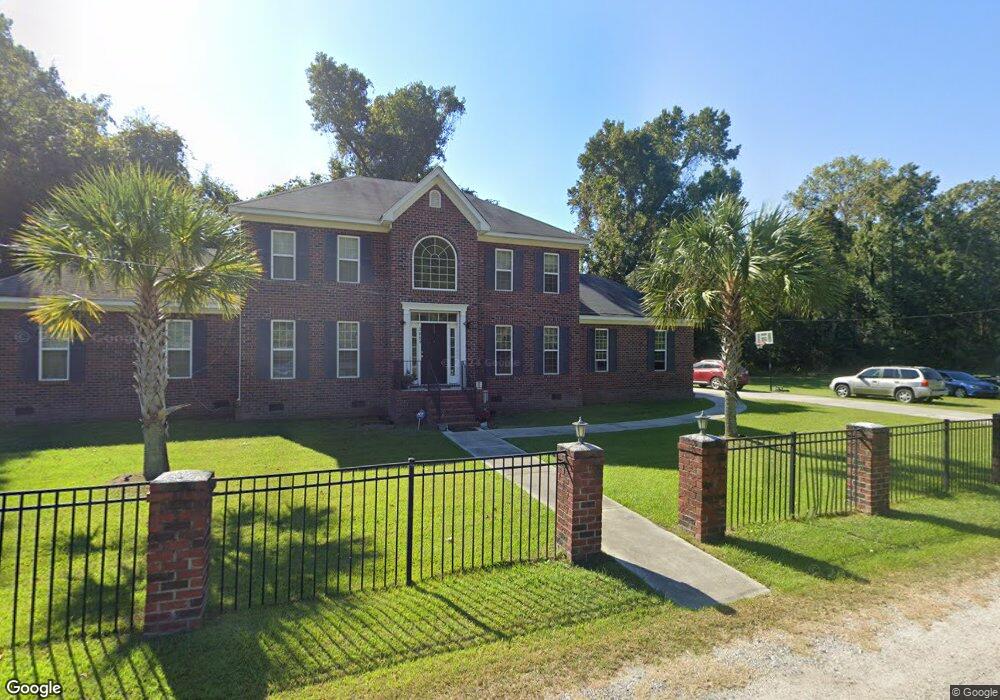
2089 Ferris and Cyrus Rd Charleston, SC 29412
James Island NeighborhoodEstimated Value: $858,079 - $1,004,000
4
Beds
3
Baths
2,840
Sq Ft
$332/Sq Ft
Est. Value
About This Home
This home is located at 2089 Ferris and Cyrus Rd, Charleston, SC 29412 and is currently estimated at $941,520, approximately $331 per square foot. 2089 Ferris and Cyrus Rd is a home with nearby schools including Murray-LaSaine Montessori School, James Island Elementary School, and Camp Road Middle.
Ownership History
Date
Name
Owned For
Owner Type
Purchase Details
Closed on
Sep 19, 2011
Sold by
Pinckney Earl
Bought by
Haskell Tomeeko P and Haskell Corey A
Current Estimated Value
Home Financials for this Owner
Home Financials are based on the most recent Mortgage that was taken out on this home.
Original Mortgage
$236,000
Interest Rate
4.09%
Mortgage Type
New Conventional
Create a Home Valuation Report for This Property
The Home Valuation Report is an in-depth analysis detailing your home's value as well as a comparison with similar homes in the area
Home Values in the Area
Average Home Value in this Area
Purchase History
| Date | Buyer | Sale Price | Title Company |
|---|---|---|---|
| Haskell Tomeeko P | -- | -- |
Source: Public Records
Mortgage History
| Date | Status | Borrower | Loan Amount |
|---|---|---|---|
| Previous Owner | Haskell Tomeeko P | $236,000 |
Source: Public Records
Tax History Compared to Growth
Tax History
| Year | Tax Paid | Tax Assessment Tax Assessment Total Assessment is a certain percentage of the fair market value that is determined by local assessors to be the total taxable value of land and additions on the property. | Land | Improvement |
|---|---|---|---|---|
| 2024 | $1,812 | $13,470 | $0 | $0 |
| 2023 | $1,812 | $13,470 | $0 | $0 |
| 2022 | $1,677 | $13,470 | $0 | $0 |
| 2021 | $1,758 | $13,470 | $0 | $0 |
| 2020 | $1,822 | $13,470 | $0 | $0 |
| 2019 | $1,625 | $11,720 | $0 | $0 |
| 2017 | $1,569 | $11,720 | $0 | $0 |
| 2016 | $1,504 | $11,720 | $0 | $0 |
| 2015 | $1,554 | $11,720 | $0 | $0 |
| 2014 | $3,989 | $0 | $0 | $0 |
| 2011 | -- | $0 | $0 | $0 |
Source: Public Records
Map
Nearby Homes
- 0 Lucky Rd Unit 24028810
- 0 Folly Beach Rd Unit 21025250
- 2134 Bradham Rd
- 2138 Terrabrook Ln
- 644 Stoneboro Ct
- 1981 Central Park Rd
- 2131 Pentland Dr
- 779 Riverland Dr
- 2152 Pentland Dr
- 1950 Bradham Rd
- 475 Woodland Shores Rd
- 586 Kell Place
- 1916 Hollings Rd
- 452 Lindberg St Unit Lot 10b
- 679 & 683 Riley Rd
- 0 Lindberg St Unit Lot 10
- 521 W Wimbledon Dr
- 340 Stefan Dr
- 748 Minton Rd
- 746 Minton Rd
- 0 Lucky Rd Unit 2714008
- 0 Lucky Rd Unit 2736408
- 0 Lucky Rd Unit 2702156
- 0 Lucky Rd Unit 2537554
- 0 Lucky Rd Unit 2415475
- 0 Lucky Rd Unit 2800991
- 0 Lucky Rd Unit 2813038
- 0 Lucky Rd Unit 2828834
- 0 Lucky Rd Unit 2830847
- 0 Lucky Rd Unit 2907246
- 0 Lucky Rd Unit 2922606
- 0 Lucky Rd Unit 1021635
- 0 Lucky Rd Unit 1301049
- 0 Lucky Rd Unit 18001615
- 2105 Ferris and Cyrus Rd
- 2072 Lucky Rd
- 0 Ferris & Cyrus Rd
- 645 Thrasher Thicket Rd
- 644 Constant Dr
- 2028 Lucky Rd