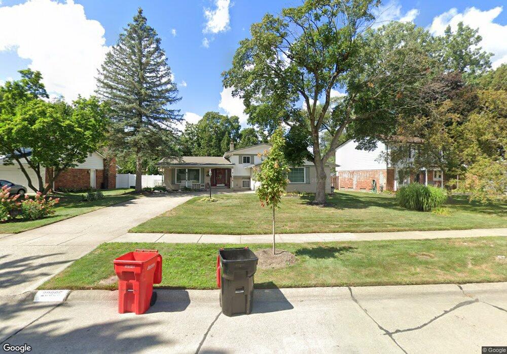
20895 Andover Rd Southfield, MI 48076
Estimated Value: $342,786 - $394,000
3
Beds
3
Baths
2,337
Sq Ft
$158/Sq Ft
Est. Value
About This Home
This home is located at 20895 Andover Rd, Southfield, MI 48076 and is currently estimated at $368,947, approximately $157 per square foot. 20895 Andover Rd is a home located in Oakland County with nearby schools including Alice M. Birney K-8 School, Faxon Academy, and Southfield Christian School.
Ownership History
Date
Name
Owned For
Owner Type
Purchase Details
Closed on
Dec 18, 2021
Sold by
Peggy A Havard Revocable Living Trust
Bought by
Havard Peggy A
Current Estimated Value
Home Financials for this Owner
Home Financials are based on the most recent Mortgage that was taken out on this home.
Original Mortgage
$106,900
Outstanding Balance
$98,320
Interest Rate
3.11%
Mortgage Type
New Conventional
Estimated Equity
$270,627
Purchase Details
Closed on
Nov 24, 2020
Sold by
Havard Peggy A
Bought by
Revocable Living Trust Of Peggy Havard
Purchase Details
Closed on
Aug 15, 2001
Sold by
Bragg Dorothy J
Bought by
Havard Peggy A
Home Financials for this Owner
Home Financials are based on the most recent Mortgage that was taken out on this home.
Original Mortgage
$172,000
Interest Rate
7.13%
Mortgage Type
Purchase Money Mortgage
Create a Home Valuation Report for This Property
The Home Valuation Report is an in-depth analysis detailing your home's value as well as a comparison with similar homes in the area
Home Values in the Area
Average Home Value in this Area
Purchase History
| Date | Buyer | Sale Price | Title Company |
|---|---|---|---|
| Havard Peggy A | -- | None Listed On Document | |
| Revocable Living Trust Of Peggy Havard | -- | None Available | |
| Havard Peggy A | $215,000 | -- |
Source: Public Records
Mortgage History
| Date | Status | Borrower | Loan Amount |
|---|---|---|---|
| Open | Havard Peggy A | $106,900 | |
| Previous Owner | Havard Peggy A | $172,000 |
Source: Public Records
Tax History Compared to Growth
Tax History
| Year | Tax Paid | Tax Assessment Tax Assessment Total Assessment is a certain percentage of the fair market value that is determined by local assessors to be the total taxable value of land and additions on the property. | Land | Improvement |
|---|---|---|---|---|
| 2022 | $3,606 | $140,010 | $21,000 | $119,010 |
| 2021 | $3,759 | $117,510 | $21,000 | $96,510 |
| 2020 | $3,273 | $111,190 | $16,800 | $94,390 |
| 2018 | $3,737 | $90,820 | $16,800 | $74,020 |
| 2015 | -- | $68,660 | $0 | $0 |
| 2014 | -- | $58,310 | $0 | $0 |
| 2011 | -- | $54,540 | $0 | $0 |
Source: Public Records
Map
Nearby Homes
- 21361 Andover Rd
- 000 Pontiac Trail
- 27249 Nantucket Dr
- 20780 Wayland St
- 21140 Winchester St
- 20345 Harbor Ln
- 27925 Arlington Dr
- 21731 Concord St
- 21330 Winchester St
- 21440 Constitution St
- 27430 Evergreen Rd Unit 36
- 21901 Concord St
- 19646 Middlesex Ave
- 20120 Covington Pkwy
- 19360 W 11 Mile Rd
- 28450 Tapert Dr
- 19400 W 11 Mile Rd Unit 12
- 5000 Town Center Unit 408
- 5000 Town Center Unit 507
- 5000 Town Center Unit 2904
- 20885 Andover Rd
- 20905 Andover Rd
- 20875 Andover Rd
- 20890 Andover Rd
- 27150 Charles Ct
- 20925 Andover Rd
- 27138 Charles Ct
- 20880 Andover Rd
- 27126 Charles Ct
- 20900 Andover Rd
- 20910 Andover Rd
- 20870 Andover Rd
- 27162 Charles Ct
- 20865 Andover Rd
- 20935 Andover Rd
- 20920 Andover Rd
- 27114 Charles Ct
- 27115 Devonshire St
- 27095 Devonshire St
- 27145 Devonshire St