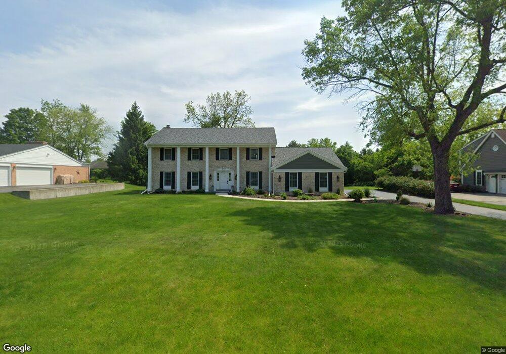
20895 Macaulay Dr Brookfield, WI 53045
Estimated Value: $671,920 - $824,000
4
Beds
3
Baths
3,060
Sq Ft
$238/Sq Ft
Est. Value
About This Home
This home is located at 20895 Macaulay Dr, Brookfield, WI 53045 and is currently estimated at $727,480, approximately $237 per square foot. 20895 Macaulay Dr is a home located in Waukesha County with nearby schools including Brookfield Elementary School, Wisconsin Hills Middle School, and Brookfield Central High School.
Ownership History
Date
Name
Owned For
Owner Type
Purchase Details
Closed on
Dec 8, 2020
Sold by
Schrieffer John C and Schrieffer Pamela L
Bought by
Pflieger Nicholas P
Current Estimated Value
Home Financials for this Owner
Home Financials are based on the most recent Mortgage that was taken out on this home.
Original Mortgage
$475,000
Outstanding Balance
$418,978
Interest Rate
2.7%
Mortgage Type
New Conventional
Estimated Equity
$308,502
Create a Home Valuation Report for This Property
The Home Valuation Report is an in-depth analysis detailing your home's value as well as a comparison with similar homes in the area
Home Values in the Area
Average Home Value in this Area
Purchase History
| Date | Buyer | Sale Price | Title Company |
|---|---|---|---|
| Pflieger Nicholas P | $500,000 | None Available |
Source: Public Records
Mortgage History
| Date | Status | Borrower | Loan Amount |
|---|---|---|---|
| Open | Pflieger Nicholas P | $475,000 |
Source: Public Records
Tax History
| Year | Tax Paid | Tax Assessment Tax Assessment Total Assessment is a certain percentage of the fair market value that is determined by local assessors to be the total taxable value of land and additions on the property. | Land | Improvement |
|---|---|---|---|---|
| 2024 | $6,388 | $568,600 | $145,000 | $423,600 |
| 2023 | $6,395 | $568,600 | $145,000 | $423,600 |
| 2022 | $6,669 | $463,400 | $140,000 | $323,400 |
| 2021 | $7,066 | $463,400 | $140,000 | $323,400 |
| 2020 | $7,356 | $463,400 | $140,000 | $323,400 |
| 2019 | $7,072 | $463,400 | $140,000 | $323,400 |
| 2018 | $6,369 | $407,200 | $140,000 | $267,200 |
| 2017 | $7,286 | $407,200 | $140,000 | $267,200 |
| 2016 | $6,457 | $407,200 | $140,000 | $267,200 |
| 2015 | $6,419 | $407,200 | $140,000 | $267,200 |
| 2014 | $6,659 | $407,200 | $140,000 | $267,200 |
| 2013 | $6,659 | $407,200 | $140,000 | $267,200 |
Source: Public Records
Map
Nearby Homes
- 20305 Downing Ct
- 2550 Harmony Cir
- 2465 Lionel Ct
- 2820 Norman Dr
- 1930 Cotton Tail Ln
- Lt118 Berwick Ct
- Lt120 Berwick Ct
- Lt116 Berwick Ct
- Lt114 Berwick Ct
- 1825 Derrin Ln
- 1775 Derrin Ln
- 2000 Kathlynn Ct
- 19775 Trilby Ct
- 19260 Brookdale Dr
- W221N3075 Greenwood Ct
- W224N2507 Ridgewood Ln
- 1040 Lansdowne Ct Unit V6
- 18860 N Hills Dr
- N32W22121 Hill n Dale Cir
- 18850 N Hills Dr
- 20935 Macaulay Dr
- 20855 Macaulay Dr
- 20880 Coventry Dr
- 20920 Coventry Dr
- 20850 Coventry Dr
- 20815 Macaulay Dr
- 20850 Macaulay Dr
- 20975 Macaulay Dr
- 2415 Shelly Ct
- 20800 Coventry Dr
- 20970 Macaulay Dr
- 20800 Tennyson Dr
- 20785 Macaulay Dr
- 2430 Shelly Ct
- 2425 Shelly Ct
- 20895 Coventry Dr
- 20865 Coventry Dr
- 20770 Coventry Dr
- 20935 Coventry Dr
- 20825 Coventry Dr
Your Personal Tour Guide
Ask me questions while you tour the home.