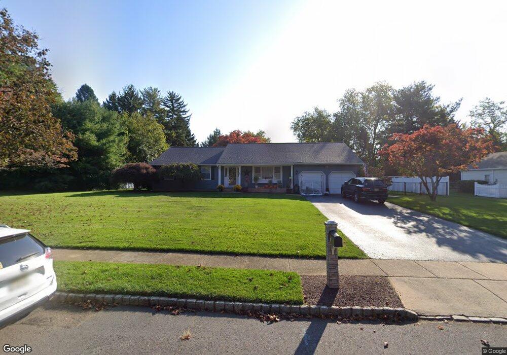
209 Cannon Rd Freehold, NJ 07728
Estimated Value: $663,000 - $802,000
3
Beds
2
Baths
1,956
Sq Ft
$374/Sq Ft
Est. Value
About This Home
This home is located at 209 Cannon Rd, Freehold, NJ 07728 and is currently estimated at $732,419, approximately $374 per square foot. 209 Cannon Rd is a home located in Monmouth County with nearby schools including C. Richard Applegate School, Dwight D. Eisenhower Middle School, and Freehold Township High School.
Ownership History
Date
Name
Owned For
Owner Type
Purchase Details
Closed on
Feb 6, 2013
Sold by
Lopardo Joseph
Bought by
Mazzacuva Aurelio
Current Estimated Value
Purchase Details
Closed on
May 15, 2007
Sold by
Raymore Ruth
Bought by
Stromick Dennis and Stromick Sandra
Home Financials for this Owner
Home Financials are based on the most recent Mortgage that was taken out on this home.
Original Mortgage
$101,000
Interest Rate
6.17%
Mortgage Type
Credit Line Revolving
Create a Home Valuation Report for This Property
The Home Valuation Report is an in-depth analysis detailing your home's value as well as a comparison with similar homes in the area
Home Values in the Area
Average Home Value in this Area
Purchase History
| Date | Buyer | Sale Price | Title Company |
|---|---|---|---|
| Mazzacuva Aurelio | $250,000 | None Available | |
| Stromick Dennis | $430,000 | None Available |
Source: Public Records
Mortgage History
| Date | Status | Borrower | Loan Amount |
|---|---|---|---|
| Previous Owner | Stromick Dennis | $101,000 | |
| Previous Owner | Stromick Dennis | $200,000 |
Source: Public Records
Tax History Compared to Growth
Tax History
| Year | Tax Paid | Tax Assessment Tax Assessment Total Assessment is a certain percentage of the fair market value that is determined by local assessors to be the total taxable value of land and additions on the property. | Land | Improvement |
|---|---|---|---|---|
| 2025 | $11,832 | $679,000 | $257,100 | $421,900 |
| 2024 | $11,037 | $653,700 | $248,300 | $405,400 |
| 2023 | $11,037 | $595,000 | $228,300 | $366,700 |
| 2022 | $10,750 | $546,800 | $198,300 | $348,500 |
| 2021 | $10,750 | $498,600 | $178,300 | $320,300 |
| 2020 | $9,251 | $427,300 | $168,300 | $259,000 |
| 2019 | $9,268 | $427,300 | $168,300 | $259,000 |
| 2018 | $9,098 | $403,800 | $158,300 | $245,500 |
| 2017 | $9,057 | $396,200 | $158,300 | $237,900 |
| 2016 | $9,396 | $403,600 | $168,300 | $235,300 |
| 2015 | $8,798 | $382,500 | $153,300 | $229,200 |
| 2014 | $8,301 | $346,900 | $128,300 | $218,600 |
Source: Public Records
Map
Nearby Homes
- 29 Schiverea Ave
- 2 Schiverea Ave
- 150 Robertsville Rd
- 16 Robertsville Rd
- 155 Robertsville Rd
- 18 Hance Blvd
- 94 Topanemus Ln
- 20 Brookwood Dr
- 28 Lockwood Ave
- 19 Edgewood Dr
- 168 Pond Rd
- 15 Edgewood Dr
- 46 Amsterdam Dr
- 7 Empress Ct
- 34 Topanemus Ln
- 17 Henry St
- 722 Zlotkin Cir Unit 4
- 92 E Main St
- 28 Roosevelt St
- 53 Wayne Ave
- 215 Cannon Rd
- 203 Cannon Rd
- 19 Terrence Terrace
- 49 Rose Ct
- 23 Terrence Terrace
- 13 Terrence Terrace
- 208 Cannon Rd
- 48 Rose Ct
- 9 Terrence Terrace
- 55 Rose Ct
- 50 Ryan Blvd
- 42 Hall Rd
- 202 Cannon Rd
- 14 Terrence Terrace
- 18 Terrence Terrace
- 10 Terrence Terrace
- 191 Cannon Rd
- 44 Ryan Blvd
- 56 Rose Ct
- 36 Hall Rd