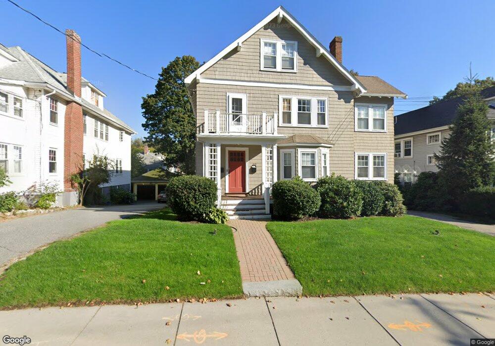
209 Common St Unit 2 Watertown, MA 02472
East Watertown NeighborhoodEstimated Value: $895,000 - $1,282,000
3
Beds
2
Baths
1,964
Sq Ft
$528/Sq Ft
Est. Value
About This Home
This home is located at 209 Common St Unit 2, Watertown, MA 02472 and is currently estimated at $1,037,783, approximately $528 per square foot. 209 Common St Unit 2 is a home located in Middlesex County with nearby schools including The Kendall School and Beacon High School.
Ownership History
Date
Name
Owned For
Owner Type
Purchase Details
Closed on
Nov 15, 2012
Sold by
Ennis Patricia C and Ennis Freeman B
Bought by
Wilson Nathan R and Wilson Emily H
Current Estimated Value
Purchase Details
Closed on
May 17, 2007
Sold by
Danzey Leslie J and Soave Leslie J
Bought by
Ennis Freeman B and Ennis Patricia C
Home Financials for this Owner
Home Financials are based on the most recent Mortgage that was taken out on this home.
Original Mortgage
$350,800
Interest Rate
6.18%
Mortgage Type
Purchase Money Mortgage
Create a Home Valuation Report for This Property
The Home Valuation Report is an in-depth analysis detailing your home's value as well as a comparison with similar homes in the area
Home Values in the Area
Average Home Value in this Area
Purchase History
| Date | Buyer | Sale Price | Title Company |
|---|---|---|---|
| Wilson Nathan R | $489,900 | -- | |
| Ennis Freeman B | $438,500 | -- |
Source: Public Records
Mortgage History
| Date | Status | Borrower | Loan Amount |
|---|---|---|---|
| Previous Owner | Ennis Freeman B | $350,800 |
Source: Public Records
Tax History Compared to Growth
Tax History
| Year | Tax Paid | Tax Assessment Tax Assessment Total Assessment is a certain percentage of the fair market value that is determined by local assessors to be the total taxable value of land and additions on the property. | Land | Improvement |
|---|---|---|---|---|
| 2025 | $9,138 | $782,400 | $0 | $782,400 |
| 2024 | $8,258 | $705,800 | $0 | $705,800 |
| 2023 | $9,438 | $695,000 | $0 | $695,000 |
| 2022 | $8,053 | $607,800 | $0 | $607,800 |
| 2021 | $7,265 | $593,100 | $0 | $593,100 |
| 2020 | $7,200 | $593,100 | $0 | $593,100 |
| 2019 | $7,173 | $556,900 | $0 | $556,900 |
| 2018 | $6,529 | $484,700 | $0 | $484,700 |
| 2017 | $6,141 | $442,100 | $0 | $442,100 |
| 2016 | $5,880 | $429,800 | $0 | $429,800 |
| 2015 | $6,460 | $429,800 | $0 | $429,800 |
| 2014 | $6,123 | $409,300 | $0 | $409,300 |
Source: Public Records
Map
Nearby Homes
- 456 Belmont St Unit 10
- 456 Belmont St Unit 21
- 43 Fuller Rd Unit 45
- 45 Fuller Rd Unit 45
- 47 Fuller Rd Unit 47
- 11 Broadway Unit 11
- 125 Trapelo Rd Unit 21
- 125 Trapelo Rd Unit 23
- 50 Carroll St Unit 50
- 71 Palfrey St Unit 71
- 235 Mount Auburn St
- 748 Belmont St
- 98 Carroll St Unit 98
- 2 Bartlett Ave Unit 1
- 214 Palfrey St
- 21 Fayette St Unit 1
- 93 Spring St Unit 29
- 91 Fayette St
- 30 Payson Rd
- 61-63 Church St
- 209 Common St Unit 1
- 207 Common St
- 217 Common St
- 217 Common St Unit 2
- 217 Common St Unit 217
- 211 Common St
- 211 Common St
- 211 Common St Unit 2
- 205 Common St Unit 207
- 142 Robbins Rd
- 178 Bellevue Rd
- 215 Common St
- 144 Robbins Rd Unit 146
- 144 Robbins Rd Unit 1
- 172 Bellevue Rd
- 184 Bellevue Rd
- 219 Common St
- 148 Robbins Rd Unit 150
- 150 Robbins Rd Unit 1
- 150 Robbins Rd Unit 150