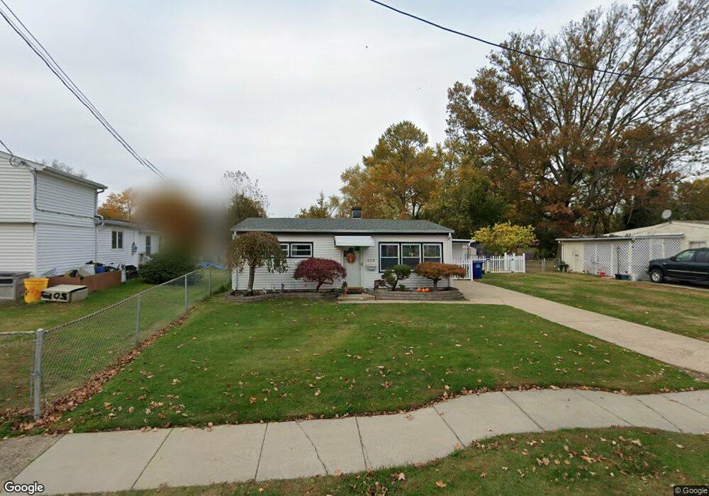
209 County Ave Maple Shade, NJ 08052
Estimated Value: $198,000 - $250,000
Studio
--
Bath
744
Sq Ft
$298/Sq Ft
Est. Value
About This Home
This home is located at 209 County Ave, Maple Shade, NJ 08052 and is currently estimated at $221,823, approximately $298 per square foot. 209 County Ave is a home located in Burlington County with nearby schools including Maude M. Wilkins Elementary School, Ralph J Steinhauer Elementary School, and Howard R Yocum School.
Ownership History
Date
Name
Owned For
Owner Type
Purchase Details
Closed on
May 28, 1999
Sold by
Dehaven Rita
Bought by
Barr Frank L
Current Estimated Value
Home Financials for this Owner
Home Financials are based on the most recent Mortgage that was taken out on this home.
Original Mortgage
$84,918
Outstanding Balance
$22,469
Interest Rate
7.09%
Mortgage Type
FHA
Estimated Equity
$199,354
Purchase Details
Closed on
Mar 11, 1994
Sold by
Est Frances Bodman
Bought by
Dehaven Rita
Create a Home Valuation Report for This Property
The Home Valuation Report is an in-depth analysis detailing your home's value as well as a comparison with similar homes in the area
Home Values in the Area
Average Home Value in this Area
Purchase History
| Date | Buyer | Sale Price | Title Company |
|---|---|---|---|
| Barr Frank L | $85,000 | Federation Title Agency Inc | |
| Dehaven Rita | $78,500 | -- |
Source: Public Records
Mortgage History
| Date | Status | Borrower | Loan Amount |
|---|---|---|---|
| Open | Barr Frank L | $84,918 |
Source: Public Records
Tax History
| Year | Tax Paid | Tax Assessment Tax Assessment Total Assessment is a certain percentage of the fair market value that is determined by local assessors to be the total taxable value of land and additions on the property. | Land | Improvement |
|---|---|---|---|---|
| 2025 | $4,217 | $111,100 | $48,100 | $63,000 |
| 2024 | $4,095 | $111,100 | $48,100 | $63,000 |
| 2023 | $4,095 | $111,100 | $48,100 | $63,000 |
| 2022 | $4,032 | $111,100 | $48,100 | $63,000 |
| 2021 | $3,779 | $111,100 | $48,100 | $63,000 |
| 2020 | $4,004 | $111,100 | $48,100 | $63,000 |
| 2019 | $3,857 | $111,100 | $48,100 | $63,000 |
| 2018 | $3,791 | $111,100 | $48,100 | $63,000 |
| 2017 | $3,746 | $111,100 | $48,100 | $63,000 |
| 2016 | $3,691 | $111,100 | $48,100 | $63,000 |
| 2015 | $3,611 | $111,100 | $48,100 | $63,000 |
| 2014 | $3,501 | $111,100 | $48,100 | $63,000 |
Source: Public Records
Map
Nearby Homes
- 452 Elm Ave
- 206 S Maple Ave
- 44 S Pine Ave
- 66 W Center Ave
- 15 S Pine Ave
- 61 S Maple Ave
- 42 Spruce Ave
- 169 Cherry Tree Ln
- 115 E Kings Hwy Unit 187
- 115 E Kings Hwy Unit 125
- 114 Weather Vane Dr
- 47 S Lippincott Ave
- 3005 Garfield Ave
- 26 Morris Ave
- 57 S Terrace Ave
- 22 Theodore Ave
- 3001 Church Rd
- 102 Kings Croft
- 126 S Lenola Rd
- 207 E Park Ave
Your Personal Tour Guide
Ask me questions while you tour the home.