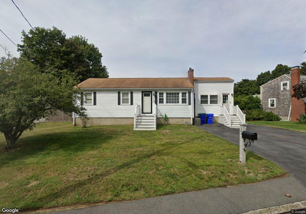
209 Durbeck Rd Rockland, MA 02370
Estimated Value: $385,000 - $502,030
2
Beds
1
Bath
928
Sq Ft
$495/Sq Ft
Est. Value
About This Home
This home is located at 209 Durbeck Rd, Rockland, MA 02370 and is currently estimated at $459,008, approximately $494 per square foot. 209 Durbeck Rd is a home located in Plymouth County with nearby schools including Rockland Senior High School, Calvary Chapel Academy, and Holy Family Elementary School.
Ownership History
Date
Name
Owned For
Owner Type
Purchase Details
Closed on
Oct 14, 2016
Sold by
Accomando Karen
Bought by
Obrien Stephen A and Obrien Nicole
Current Estimated Value
Home Financials for this Owner
Home Financials are based on the most recent Mortgage that was taken out on this home.
Original Mortgage
$212,500
Outstanding Balance
$166,841
Interest Rate
3.46%
Mortgage Type
New Conventional
Estimated Equity
$292,167
Purchase Details
Closed on
Apr 30, 2001
Sold by
Parkes Michael F and Goss Tammy M
Bought by
Accomando Karen
Home Financials for this Owner
Home Financials are based on the most recent Mortgage that was taken out on this home.
Original Mortgage
$161,500
Interest Rate
6.88%
Mortgage Type
Purchase Money Mortgage
Purchase Details
Closed on
Aug 27, 1996
Sold by
Banks Madeline C
Bought by
Parkes Michael F and Goss Tammy M
Create a Home Valuation Report for This Property
The Home Valuation Report is an in-depth analysis detailing your home's value as well as a comparison with similar homes in the area
Home Values in the Area
Average Home Value in this Area
Purchase History
| Date | Buyer | Sale Price | Title Company |
|---|---|---|---|
| Obrien Stephen A | $250,500 | -- | |
| Accomando Karen | $179,900 | -- | |
| Parkes Michael F | $125,000 | -- |
Source: Public Records
Mortgage History
| Date | Status | Borrower | Loan Amount |
|---|---|---|---|
| Open | Obrien Stephen A | $212,500 | |
| Previous Owner | Parkes Michael F | $213,000 | |
| Previous Owner | Parkes Michael F | $208,200 | |
| Previous Owner | Parkes Michael F | $198,560 | |
| Previous Owner | Parkes Michael F | $161,500 |
Source: Public Records
Tax History Compared to Growth
Tax History
| Year | Tax Paid | Tax Assessment Tax Assessment Total Assessment is a certain percentage of the fair market value that is determined by local assessors to be the total taxable value of land and additions on the property. | Land | Improvement |
|---|---|---|---|---|
| 2025 | $6,117 | $447,500 | $224,300 | $223,200 |
| 2024 | $5,978 | $425,200 | $211,600 | $213,600 |
| 2023 | $5,945 | $390,600 | $194,100 | $196,500 |
| 2022 | $5,737 | $342,500 | $168,800 | $173,700 |
| 2021 | $6,907 | $307,000 | $153,400 | $153,600 |
| 2020 | $5,124 | $292,800 | $146,200 | $146,600 |
| 2019 | $7,012 | $281,200 | $139,200 | $142,000 |
| 2018 | $4,666 | $256,100 | $139,200 | $116,900 |
| 2017 | $4,552 | $246,300 | $139,200 | $107,100 |
| 2016 | $4,292 | $232,100 | $133,900 | $98,200 |
| 2015 | $4,112 | $216,100 | $125,100 | $91,000 |
| 2014 | $3,892 | $212,200 | $122,700 | $89,500 |
Source: Public Records
Map
Nearby Homes