Estimated Value: $103,000 - $215,000
Studio
1
Bath
1,754
Sq Ft
$88/Sq Ft
Est. Value
About This Home
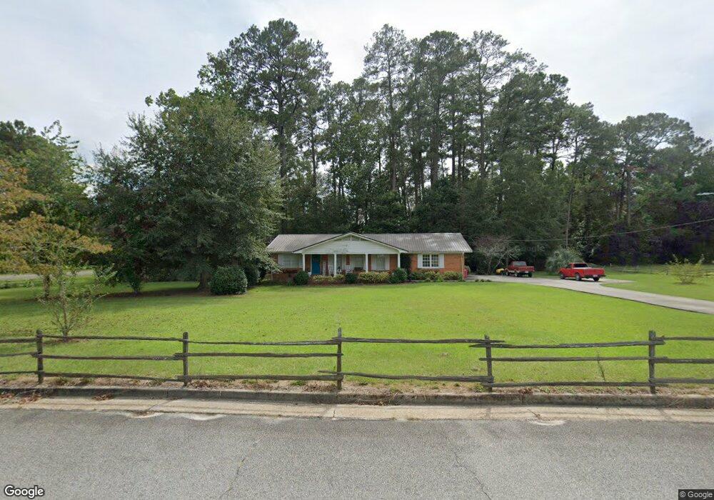
This home is located at 209 E 20th St, Alma, GA 31510 and is currently estimated at $153,797, approximately $87 per square foot. 209 E 20th St is a home located in Bacon County with nearby schools including Bacon County Primary School, Bacon County Elementary School, and Bacon County Middle School.
Ownership History
Date
Name
Owned For
Owner Type
Purchase Details
Closed on
Mar 11, 2013
Sold by
Boatright Sandra
Bought by
Southerland Leisa
Current Estimated Value
Purchase Details
Closed on
Feb 22, 2007
Sold by
Boatright Sandra L
Bought by
Southerland Leisa and Boatright Robert Dwight
Purchase Details
Closed on
Jul 18, 2002
Sold by
Kirkland Lou Nell
Bought by
Boatright Sandra
Purchase Details
Closed on
Oct 23, 2001
Sold by
Wade Beatrice M
Bought by
Kirkland Lou Nell
Create a Home Valuation Report for This Property
The Home Valuation Report is an in-depth analysis detailing your home's value as well as a comparison with similar homes in the area
Home Values in the Area
Average Home Value in this Area
Purchase History
| Date | Buyer | Sale Price | Title Company |
|---|---|---|---|
| Southerland Leisa | -- | -- | |
| Southerland Leisa | -- | -- | |
| Boatright Sandra | $55,000 | -- | |
| Kirkland Lou Nell | -- | -- |
Source: Public Records
Tax History
| Year | Tax Paid | Tax Assessment Tax Assessment Total Assessment is a certain percentage of the fair market value that is determined by local assessors to be the total taxable value of land and additions on the property. | Land | Improvement |
|---|---|---|---|---|
| 2024 | $1,937 | $53,320 | $4,680 | $48,640 |
| 2023 | $1,884 | $48,880 | $4,680 | $44,200 |
| 2022 | $1,266 | $32,840 | $4,680 | $28,160 |
| 2021 | $1,257 | $32,600 | $4,680 | $27,920 |
| 2020 | $1,205 | $29,899 | $4,712 | $25,187 |
| 2019 | $1,205 | $29,899 | $4,712 | $25,187 |
| 2018 | $1,149 | $28,555 | $4,712 | $23,843 |
| 2017 | $1,150 | $28,555 | $4,712 | $23,843 |
| 2016 | $1,150 | $28,555 | $4,712 | $23,843 |
| 2015 | $1,133 | $28,099 | $4,898 | $23,201 |
| 2014 | $913 | $28,099 | $4,898 | $23,201 |
| 2013 | $913 | $26,638 | $4,898 | $21,740 |
Source: Public Records
Map
Nearby Homes
- 403 S Ware St
- 117 Grace Loop Unit 1
- 118 Grace Loop Unit 1
- 122 Grace Loop Unit 1
- 108 Daughtry Rd
- 611 S Bead St
- 9TH E 417
- 907 N Pierce St
- 118 Morris Dr
- 113 Brite Blue Dr
- 166 Grace Loop Unit 1
- 198 Meadow Rd
- 1109 W 4th Street Extension
- 0 W 4th Street Extension Unit 10650393
- 0 Lake Lure Dr
- 1348 U S 1
- 220 Lake Shore Dr
- 220 Lakeshore Dr
- 1608 W 4th St
- 1813 W 12th St
Your Personal Tour Guide
Ask me questions while you tour the home.